
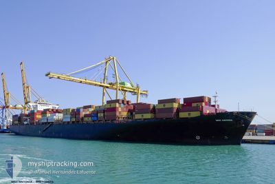
MSC ANTONIA
Container Ship
Current Trip
SAJED
| Time Travelled | --- |
|---|---|
| Remaining Time | --- |
| Distance Travelled | --- |
| Remaining Distance | --- |
| AVG Speed | --- |
| MAX Speed | --- |
| AVG Wind | --- |
| MAX Wind | --- |
| MIN Temp | --- |
| MAX Temp | --- |
| Tirant d eau | 13.5 m |
| Position reçue | 1 d depuis |
Current Position
| Longitude | 37.23235° |
|---|---|
| Latitude | 18.71311° |
| Etat | At anchor |
| Vitesse | 8.1 Noeuds |
| Parcours | 194.1° |
| Zone | Red Sea |
| Station | T-AIS |
| Position reçue | 1 d depuis |
Information
The current position of MSC ANTONIA is in Red Sea with coordinates 18.71311° / 37.23235° as reported on 2025-06-06 21:45 by AIS to our vessel tracker app. The vessel's current speed is 8.1 Noeuds
The vessel MSC ANTONIA (IMO: 9398216, MMSI: 636018660) is a Container Ship that was built in 2009 ( 16 Age ). It's sailing under the flag of [LR] Liberia.
In this page you can find informations about the vessels current position, last detected port calls, and current voyage information. If the vessels is not in coverage by AIS you will find the latest position.
The current position of MSC ANTONIA is detected by our AIS receivers and we are not responsible for the reliability of the data. The last position was recorded while the vessel was in Coverage by the Ais receivers of our vessel tracking app.
The current draught of MSC ANTONIA as reported by AIS is 13.5 meters
Weather
| Temperature | 30.4°C / 86.72°F |
|---|---|
| Wind Speed | 1 knots |
| Direction | 6° N |
| Pressure | 1008.3 hPa |
| Humidity | 17.8 % |
| Cloud Coverage | 2 % |
Featured Company
Last Port Calls
| Port | Arrival | Departure | Time In Port |
|---|---|---|---|
| 2025-06-06 18:38 | |||
| 2025-06-05 14:21 | |||
| 2025-06-04 13:01 | |||
| 2025-05-15 06:28 | |||
| 2025-05-08 05:22 | 2025-05-08 13:51 | 8 h | |
| 2025-05-03 22:43 | 2025-05-04 17:41 | 18 h | |
| 2025-05-02 05:30 | 2025-05-03 08:35 | 1 d | |
| 2025-04-29 00:39 | 2025-04-30 06:24 | 1 d | |
| 2025-04-27 15:06 | 2025-04-28 13:37 | 22 h | |
| 2025-04-25 04:31 | 2025-04-26 21:12 | 1 d |
Most Visited Ports (Last year)
| Port | Arrivals | |
|---|---|---|
| 4 | ||
| 3 | ||
| 3 | ||
| 3 | ||
| 3 | ||
| 3 |
Last Trips
| Origin | Departure | Destination | Arrival | Distance | |
|---|---|---|---|---|---|
| 2025-05-04 17:41 | 2025-05-15 06:28 | 3847.55 nm | |||
| 2025-05-04 17:41 | 2025-05-08 05:22 | 948.25 nm | |||
| 2025-05-03 08:35 | 2025-05-03 22:43 | 192.81 nm | |||
| 2025-04-30 06:24 | 2025-05-02 05:30 | 709.62 nm | |||
| 2025-04-28 13:37 | 2025-04-29 00:39 | 23.31 nm | |||
| 2025-04-26 21:12 | 2025-04-27 15:06 | 174.15 nm | |||
| 2025-04-23 22:37 | 2025-04-25 04:31 | 477.98 nm | |||
| 2025-04-12 20:12 | 2025-04-23 10:27 | 4133.99 nm | |||
| 2025-04-11 07:24 | 2025-04-12 04:43 | 147.38 nm | |||
| 2025-04-07 21:52 | 2025-04-10 09:59 | 707.81 nm |
Events
| Heure | Evenement | Détails | Position/ Destination | Info |
|---|---|---|---|---|
| 2025-06-06 21:55 | Etat Changé | Default At anchor |
18.68290 / 37.23201
SAJED
|
Vitesse: 8.1 kn Parcours: 194.1° |
| 2025-06-06 21:45 | Hors de la zone couverte |
18.71311 / 37.23235
Red Sea
|
Vitesse: 8.1 kn Parcours: 194.1° |
|
| 2025-06-06 21:45 | Dans la zone couverte |
18.71311 / 37.23235
Red Sea
|
Vitesse: 8.1 kn Parcours: 194.1° |
|
| 2025-06-06 15:38 | Port d'arrivée |
|
21.47735 / 39.15834
[SA] JEDDAH
|
Vitesse: 9.8 kn Parcours: 90° |
| 2025-06-06 11:33 | Etat Changé | Default At anchor |
19.38434 / 39.92782
SAJED
|
Vitesse: 9.8 kn Parcours: 90.2° |
| 2025-06-06 11:28 | Hors de la zone couverte |
19.38432 / 39.91219
Red Sea
|
Vitesse: 9.8 kn Parcours: 90.2° |
|
| 2025-06-06 09:46 | Etat Changé | At anchor Default |
19.38434 / 39.62278
SAJED
|
Vitesse: 9.4 kn Parcours: 90° |
| 2025-06-06 09:28 | Etat Changé | Default At anchor |
19.38434 / 39.57185
SAJED
|
Vitesse: 9.7 kn Parcours: 90.2° |
| 2025-06-06 06:57 | Dans la zone couverte |
19.38435 / 39.63250
Red Sea
|
Vitesse: 9.7 kn Parcours: 89.9° |
|
| 2025-06-06 05:51 | Hors de la zone couverte |
19.38435 / 39.43978
Red Sea
|
Vitesse: 9.5 kn Parcours: 89.6° |