

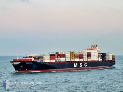
MSC ANYA
Container Ship

Current Trip
| Trip Time | 9 days |
|---|---|
| Trip Distance | 3354.75 nm |
| AVG Speed | 14 Noeuds |
| MAX Speed | 20.1 Noeuds |
| Tirant d eau | 11.3 m |
| AVG Wind | 10.8 knots |
| MAX Wind | 25.8 knots |
| MIN Temp | 6.1°C / 42.98°F |
| MAX Temp | 18.5°C / 65.3°F |
| Position reçue | 3 m depuis |
Current Position
| Longitude | -73.52458° |
|---|---|
| Latitude | 45.55192° |
| Etat | Moored |
| Vitesse | |
| Parcours | 209° |
| Zone | Gulf of St-Lawrence |
| Station | T-AIS |
| Position reçue | 3 m depuis |
Information
The current position of MSC ANYA is in Gulf of St-Lawrence with coordinates 45.55192° / -73.52458° as reported on 2025-06-01 17:12 by AIS to our vessel tracker app. The vessel's current speed is 0 Noeuds and is currently inside the port of MONTREAL.
The vessel MSC ANYA (IMO: 9297864, MMSI: 636016424) is a Container Ship that was built in 2005 ( 20 Age ). It's sailing under the flag of [LR] Liberia.
In this page you can find informations about the vessels current position, last detected port calls, and current voyage information. If the vessels is not in coverage by AIS you will find the latest position.
The current position of MSC ANYA is detected by our AIS receivers and we are not responsible for the reliability of the data. The last position was recorded while the vessel was in Coverage by the Ais receivers of our vessel tracking app.
The current draught of MSC ANYA as reported by AIS is 11.3 meters
Weather
| Temperature | 9.6°C / 49.28°F |
|---|---|
| Wind Speed | 13 knots |
| Direction | 262° W |
| Pressure | 999.5 hPa |
| Humidity | 72.1 % |
| Cloud Coverage | 100 % |


Featured Company
Last Port Calls
| Port | Arrival | Departure | Time In Port |
|---|---|---|---|
| 2025-05-31 08:42 | |||
| 2025-05-21 06:18 | 2025-05-22 05:33 | 23 h | |
| 2025-05-18 20:02 | 2025-05-19 11:57 | 15 h | |
| 2025-05-16 12:16 | 2025-05-17 08:43 | 20 h | |
| 2025-05-12 09:46 | 2025-05-14 22:49 | 2 d | |
| 2025-04-28 04:26 | 2025-05-01 18:21 | 3 d | |
| 2025-04-24 16:26 | 2025-04-25 00:11 | 7 h | |
| 2025-04-15 13:52 | 2025-04-16 13:25 | 23 h | |
| 2025-04-12 20:32 | 2025-04-14 01:15 | 1 d | |
| 2025-04-10 12:52 | 2025-04-11 13:44 | 1 d |
Last Trips
| Origin | Departure | Destination | Arrival | Distance | |
|---|---|---|---|---|---|
| 2025-05-22 05:33 | 2025-05-31 08:42 | 3354.75 nm | |||
| 2025-05-19 11:57 | 2025-05-21 06:18 | 527.26 nm | |||
| 2025-05-17 08:43 | 2025-05-18 20:02 | 513.83 nm | |||
| 2025-05-14 22:49 | 2025-05-16 12:16 | 373.71 nm | |||
| 2025-05-01 18:21 | 2025-05-12 09:46 | 3578.20 nm | |||
| 2025-04-25 00:11 | 2025-04-28 04:26 | 995.01 nm | |||
| 2025-04-16 13:25 | 2025-04-24 16:26 | 3145.29 nm | |||
| 2025-04-14 01:15 | 2025-04-15 13:52 | 528.64 nm | |||
| 2025-04-11 13:44 | 2025-04-12 20:32 | 512.61 nm | |||
| 2025-04-09 09:35 | 2025-04-10 12:52 | 373.35 nm |
Events
| Heure | Evenement | Détails | Position/ Destination | Info |
|---|---|---|---|---|
| 2025-06-01 00:03 | Changement d'ETA | 2026/05/30 15:00 2025/05/30 15:00 |
45.55197 / -73.52460
[CA] MONTREAL
|
Vitesse: Parcours: 210° |
| 2025-05-31 13:56 | Etat Changé | Moored Under way using engine |
45.55176 / -73.52471
[CA] MONTREAL
|
Vitesse: 0.1 kn Parcours: 210° |
| 2025-05-31 13:42 | Arret |
45.55256 / -73.52333
[CA] MONTREAL
|
Vitesse: 0.3 kn Parcours: 212° |
|
| 2025-05-31 12:42 | Port d'arrivée |
|
45.63040 / -73.48991
[CA] MONTREAL
|
Vitesse: 7.6 kn Parcours: 210.1° |
| 2025-05-31 11:19 | Etat Changé | Under way using engine Default |
45.79763 / -73.33409
CAMTR
|
Vitesse: 8.8 kn Parcours: 219° |
| 2025-05-31 11:12 | Etat Changé | Default Under way using engine |
45.80978 / -73.31979
CAMTR
|
Vitesse: 8.8 kn Parcours: 219.6° |
| 2025-05-31 11:11 | Etat Changé | Under way using engine Default |
45.81258 / -73.31645
CAMTR
|
Vitesse: 8.7 kn Parcours: 220° |
| 2025-05-31 10:50 | Etat Changé | Default Under way using engine |
45.85435 / -73.27012
CAMTR
|
Vitesse: 8.7 kn Parcours: 208° |
| 2025-05-31 10:46 | Etat Changé | Under way using engine Default |
45.86205 / -73.26571
CAMTR
|
Vitesse: 9.1 kn Parcours: 215° |
| 2025-05-31 10:13 | Etat Changé | Default Under way using engine |
45.93393 / -73.21345
CAMTR
|
Vitesse: 9.1 kn Parcours: 207.7° |