
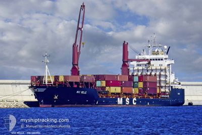
MSC BELLE
Container Ship
Current Trip
| Time Travelled | 1 day |
|---|---|
| Remaining Time | 7 h, 27 mins |
| Distance Travelled | 457.63 nm |
| Remaining Distance | 67.43 nm |
| AVG Speed | 9.6 Noeuds |
| MAX Speed | 11.1 Noeuds |
| AVG Wind | 21.2 knots |
| MAX Wind | 27 knots |
| MIN Temp | 10.2°C / 50.36°F |
| MAX Temp | 15.6°C / 60.08°F |
| Tirant d eau | 9.1 m |
| Position reçue | Maintenant |
Current Position
| Longitude | 24.08817° |
|---|---|
| Latitude | 36.92217° |
| Etat | Under way using engine |
| Vitesse | 8.7 Noeuds |
| Parcours | 343° |
| Zone | Aegean Sea |
| Station | T-AIS |
| Position reçue | Maintenant |
Info
Information
The current position of MSC BELLE is in Aegean Sea with coordinates 36.92217° / 24.08817° as reported on 2025-02-11 09:29 by AIS to our vessel tracker app. The vessel's current speed is 8.7 Noeuds and is heading at the port of PIRAEUS. The estimated time of arrival as calculated by MyShipTracking vessel tracking app is 2025-02-11 18:57 LT
The vessel MSC BELLE (IMO: 9203904, MMSI: 371743000) is a Container Ship that was built in 1998 ( 27 Age ). It's sailing under the flag of [PA] Panama.
In this page you can find informations about the vessels current position, last detected port calls, and current voyage information. If the vessels is not in coverage by AIS you will find the latest position.
The current position of MSC BELLE is detected by our AIS receivers and we are not responsible for the reliability of the data. The last position was recorded while the vessel was in Coverage by the Ais receivers of our vessel tracking app.
The current draught of MSC BELLE as reported by AIS is 9.1 meters
Weather
| Temperature | 10.2°C / 50.36°F |
|---|---|
| Wind Speed | 17 knots |
| Direction | 11° N |
| Pressure | 1027.6 hPa |
| Humidity | 54.9 % |
| Cloud Coverage | 100 % |
Featured Company
Last Port Calls
| Port | Arrival | Departure | Time In Port |
|---|---|---|---|
| 2025-02-08 15:53 | 2025-02-09 12:41 | 20 h | |
| 2025-02-04 18:00 | 2025-02-05 13:45 | 19 h | |
| 2025-02-03 14:51 | 2025-02-04 02:52 | 12 h | |
| 2025-01-31 01:35 | 2025-02-01 02:29 | 1 d | |
| 2025-01-28 06:27 | 2025-01-29 20:51 | 1 d | |
| 2025-01-26 23:51 | 2025-01-27 07:07 | 7 h | |
| 2025-01-25 08:26 | 2025-01-26 02:49 | 18 h | |
| 2025-01-22 11:17 | 2025-01-23 07:39 | 20 h | |
| 2025-01-20 02:19 | 2025-01-20 15:59 | 13 h | |
| 2025-01-19 08:55 | 2025-01-19 18:35 | 9 h |
Most Visited Ports (Last year)
| Port | Arrivals | |
|---|---|---|
| 20 | ||
| 13 | ||
| 11 | ||
| 7 | ||
| 6 | ||
| 5 |
Last Trips
| Origin | Departure | Destination | Arrival | Distance | |
|---|---|---|---|---|---|
| 2025-02-05 13:45 | 2025-02-08 15:53 | 527.10 nm | |||
| 2025-02-04 02:52 | 2025-02-04 18:00 | 82.42 nm | |||
| 2025-02-01 02:29 | 2025-02-03 14:51 | 674.45 nm | |||
| 2025-01-29 20:51 | 2025-01-31 01:35 | 284.46 nm | |||
| 2025-01-27 07:07 | 2025-01-28 06:27 | 253.08 nm | |||
| 2025-01-26 02:49 | 2025-01-26 23:51 | 218.60 nm | |||
| 2025-01-23 07:39 | 2025-01-25 08:26 | 524.71 nm | |||
| 2025-01-20 15:59 | 2025-01-22 11:17 | 309.91 nm | |||
| 2025-01-19 18:35 | 2025-01-20 02:19 | 83.35 nm | |||
| 2025-01-17 01:44 | 2025-01-19 08:55 | 676.13 nm |
Events
| Heure | Evenement | Détails | Position/ Destination | Info |
|---|---|---|---|---|
| 2025-02-10 19:19 | Changement de destination | PIREAUS ALEXANDRIA |
35.55183 / 26.18550
PIREAUS
|
Vitesse: 10.6 kn Parcours: 302° |
| 2025-02-10 19:19 | Changement d'ETA | 2025/02/11 10:00 2025/02/06 10:00 |
35.55183 / 26.18550
PIREAUS
|
Vitesse: 10.6 kn Parcours: 302° |
| 2025-02-10 17:13 | Changement de zone | Greek part of the Aegean Sea Greek part of the Mediterranean Sea - Eastern Basin |
35.31717 / 26.52217
Aegean Sea
|
Vitesse: 9.8 kn Parcours: 329° |
| 2025-02-10 12:44 | Detecté en mer | Greek part of the Mediterranean Sea - Eastern Basin |
34.70500 / 27.01750
Mediterranean Sea - Eastern Basin
|
Vitesse: 9.4 kn Parcours: 328° |
| 2025-02-10 12:44 | Etat Changé | Under way using engine Default |
34.70500 / 27.01750
ALEXANDRIA
|
Vitesse: 9.5 kn Parcours: 327° |
| 2025-02-10 12:44 | Dans la zone couverte |
34.70500 / 27.01750
Mediterranean Sea - Eastern Basin
|
Vitesse: 9.4 kn Parcours: 328° |
|
| 2025-02-09 10:41 | PORT DE DEPART |
|
31.16167 / 29.80700
ALEXANDRIA
|
Vitesse: 3.7 kn Parcours: 58° |
| 2025-02-09 10:34 | Démarrage |
31.14617 / 29.79550
[EG] EL DEKHEILA
|
Vitesse: 3.7 kn Parcours: 58° |
|
| 2025-02-08 14:25 | Arret |
31.14483 / 29.79367
[EG] EL DEKHEILA
|
Vitesse: 0.1 kn Parcours: 54° |
|
| 2025-02-08 13:53 | Port d'arrivée |
|
31.15417 / 29.80800
[EG] EL DEKHEILA
|
Vitesse: 3.1 kn Parcours: 170° |