

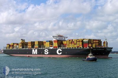
MSC CAMILLE
Container Ship
Current Trip
BSFPO
| Time Travelled | 3 days |
|---|---|
| Remaining Time | --- |
| Distance Travelled | 1358.38 nm |
| Remaining Distance | --- |
| AVG Speed | 18.2 Noeuds |
| MAX Speed | 19.6 Noeuds |
| AVG Wind | 12 knots |
| MAX Wind | 16.2 knots |
| MIN Temp | 24°C / 75.2°F |
| MAX Temp | 27.2°C / 80.96°F |
| Tirant d eau | 9.4 m |
| Position reçue | 2 d depuis |
Current Position
| Longitude | -60.87876° |
|---|---|
| Latitude | 14.25632° |
| Etat | Under way using engine |
| Vitesse | 17.6 Noeuds |
| Parcours | 89.7° |
| Zone | Caribbean Sea |
| Station | T-AIS |
| Position reçue | 2 d depuis |
Information
The current position of MSC CAMILLE is in Caribbean Sea with coordinates 14.25632° / -60.87876° as reported on 2025-04-23 18:36 by AIS to our vessel tracker app. The vessel's current speed is 17.6 Noeuds
The vessel MSC CAMILLE (IMO: 9404651, MMSI: 354625000) is a Container Ship that was built in 2009 ( 16 Age ). It's sailing under the flag of [PA] Panama.
In this page you can find informations about the vessels current position, last detected port calls, and current voyage information. If the vessels is not in coverage by AIS you will find the latest position.
The current position of MSC CAMILLE is detected by our AIS receivers and we are not responsible for the reliability of the data. The last position was recorded while the vessel was in Coverage by the Ais receivers of our vessel tracking app.
The current draught of MSC CAMILLE as reported by AIS is 9.4 meters
Weather
| Temperature | 27.2°C / 80.96°F |
|---|---|
| Wind Speed | 14 knots |
| Direction | 65° ENE |
| Pressure | 1012.5 hPa |
| Humidity | 74.6 % |
| Cloud Coverage | 100 % |
Featured Company
Last Port Calls
| Port | Arrival | Departure | Time In Port |
|---|---|---|---|
| 2025-04-20 04:49 | 2025-04-22 08:16 | 2 d | |
| 2025-04-08 06:54 | 2025-04-10 22:04 | 2 d | |
| 2025-04-03 17:26 | 2025-04-05 10:28 | 1 d | |
| 2025-04-01 01:13 | 2025-04-01 21:26 | 20 h | |
| 2025-03-28 03:42 | 2025-03-28 19:54 | 16 h | |
| 2025-03-12 14:46 | 2025-03-13 20:45 | 1 d | |
| 2025-03-09 12:37 | 2025-03-10 15:32 | 1 d | |
| 2025-03-06 16:39 | 2025-03-07 13:34 | 20 h | |
| 2025-03-04 08:14 | 2025-03-06 07:28 | 1 d | |
| 2025-02-26 18:44 | 2025-03-01 07:12 | 2 d |
Last Trips
| Origin | Departure | Destination | Arrival | Distance | |
|---|---|---|---|---|---|
| 2025-04-10 22:04 | 2025-04-20 04:49 | 1099.74 nm | |||
| 2025-04-05 10:28 | 2025-04-08 06:54 | 933.76 nm | |||
| 2025-04-01 21:26 | 2025-04-03 17:26 | 363.43 nm | |||
| 2025-03-28 19:54 | 2025-04-01 01:13 | 602.20 nm | |||
| 2025-03-13 20:45 | 2025-03-28 03:42 | 3444.53 nm | |||
| 2025-03-10 15:32 | 2025-03-12 14:46 | 308.37 nm | |||
| 2025-03-07 13:34 | 2025-03-09 12:37 | 294.98 nm | |||
| 2025-03-06 07:28 | 2025-03-06 16:39 | 117.57 nm | |||
| 2025-03-01 07:12 | 2025-03-04 08:14 | 517.40 nm | |||
| 2025-02-26 07:45 | 2025-02-26 18:44 | 127.36 nm |
Events
| Heure | Evenement | Détails | Position/ Destination | Info |
|---|---|---|---|---|
| 2025-04-23 18:36 | Hors de la zone couverte |
14.25632 / -60.87876
Caribbean Sea
|
Vitesse: 17.6 kn Parcours: 89.7° |
|
| 2025-04-23 18:30 | Changement de zone | Guadeloupe and Martinique part of the Caribbean Sea Saint Lucia part of the Caribbean Sea |
14.25648 / -60.90528
Caribbean Sea
|
Vitesse: 18.2 kn Parcours: 91.8° |
| 2025-04-23 18:17 | Etat Changé | Under way using engine Default |
14.25949 / -60.97746
BSFPO
|
Vitesse: 18.6 kn Parcours: 88° |
| 2025-04-23 18:12 | Etat Changé | Default Under way using engine |
14.25965 / -61.00030
BSFPO
|
Vitesse: 18.6 kn Parcours: 86.7° |
| 2025-04-23 18:01 | Changement de zone | Saint Lucia part of the Caribbean Sea Domican Republic part of the Caribbean Sea |
14.25676 / -61.05953
Caribbean Sea
|
Vitesse: 18.9 kn Parcours: 90.7° |
| 2025-04-23 18:01 | Dans la zone couverte |
14.25676 / -61.05953
Caribbean Sea
|
Vitesse: 18.9 kn Parcours: 90.7° |
|
| 2025-04-23 17:59 | Etat Changé | Under way using engine Default |
14.25715 / -61.07031
BSFPO
|
Vitesse: 18.5 kn Parcours: 94° |
| 2025-04-22 12:16 | PORT DE DEPART |
|
18.39366 / -69.57252
BSFPO
|
Vitesse: 2.1 kn Parcours: 39° |
| 2025-04-20 22:44 | Etat Changé | Default Moored |
18.42914 / -69.63115
[DO] BOCA CHIKA
|
Vitesse: Parcours: 349° |
| 2025-04-20 22:35 | Hors de la zone couverte |
18.42906 / -69.63118
Caribbean Sea
[DO] BOCA CHIKA
|
Vitesse: Parcours: 348.9° |