

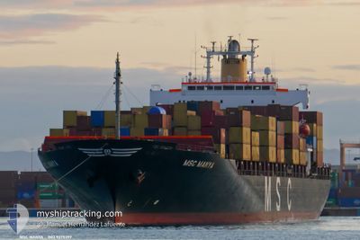
MSC MANYA
Container Ship

Current Trip
| Time Travelled | 12 h, 22 mins |
|---|---|
| Remaining Time | --- |
| Distance Travelled | 171.31 nm |
| Remaining Distance | --- |
| AVG Speed | 14.3 Noeuds |
| MAX Speed | 16.7 Noeuds |
| AVG Wind | 9.5 knots |
| MAX Wind | 15 knots |
| MIN Temp | 24°C / 75.2°F |
| MAX Temp | 27.5°C / 81.5°F |
| Tirant d eau | 8.2 m |
| Position reçue | 9 h, 25 m depuis |
Current Position
| Longitude | -61.49793° |
|---|---|
| Latitude | 10.93082° |
| Etat | Under way using engine |
| Vitesse | 15.2 Noeuds |
| Parcours | 53° |
| Zone | Caribbean Sea |
| Station | T-AIS |
| Position reçue | 9 h, 25 m depuis |
Information
The current position of MSC MANYA is in Caribbean Sea with coordinates 10.93082° / -61.49793° as reported on 2025-04-25 10:16 by AIS to our vessel tracker app. The vessel's current speed is 15.2 Noeuds and is heading at the port of MANAUS. The estimated time of arrival as calculated by MyShipTracking vessel tracking app is 2025-04-28 09:00 LT
The vessel MSC MANYA (IMO: 9275397, MMSI: 636015233) is a Container Ship that was built in 2003 ( 22 Age ). It's sailing under the flag of [LR] Liberia.
In this page you can find informations about the vessels current position, last detected port calls, and current voyage information. If the vessels is not in coverage by AIS you will find the latest position.
The current position of MSC MANYA is detected by our AIS receivers and we are not responsible for the reliability of the data. The last position was recorded while the vessel was in Coverage by the Ais receivers of our vessel tracking app.
The current draught of MSC MANYA as reported by AIS is 8.2 meters
Weather
| Temperature | 27.2°C / 80.96°F |
|---|---|
| Wind Speed | 13 knots |
| Direction | 100° E |
| Pressure | 1009.8 hPa |
| Humidity | 75.4 % |
| Cloud Coverage | 20 % |


Featured Company
Last Port Calls
| Port | Arrival | Departure | Time In Port |
|---|---|---|---|
| 2025-04-23 20:38 | 2025-04-25 03:20 | 1 d | |
| 2025-04-18 20:06 | 2025-04-19 18:08 | 22 h | |
| 2025-04-17 01:10 | 2025-04-18 18:35 | 1 d | |
| 2025-04-06 06:17 | 2025-04-07 12:29 | 1 d | |
| 2025-03-28 22:53 | 2025-04-01 08:51 | 3 d | |
| 2025-03-17 09:25 | 2025-03-18 18:50 | 1 d | |
| 2025-03-14 08:29 | 2025-03-15 05:53 | 21 h | |
| 2025-03-02 01:12 | 2025-03-02 19:45 | 18 h | |
| 2025-02-22 22:17 | 2025-02-25 12:41 | 2 d | |
| 2025-02-16 01:55 | 2025-02-16 16:23 | 14 h |
Most Visited Ports (Last year)
| Port | Arrivals | |
|---|---|---|
| 12 | ||
| 8 | ||
| 4 | ||
| 3 | ||
| 2 | ||
| 2 |
Last Trips
| Origin | Departure | Destination | Arrival | Distance | |
|---|---|---|---|---|---|
| 2025-04-19 18:08 | 2025-04-23 20:38 | 1175.53 nm | |||
| 2025-04-18 18:35 | 2025-04-18 20:06 | 7.24 nm | |||
| 2025-04-07 12:29 | 2025-04-17 01:10 | 2370.71 nm | |||
| 2025-04-01 08:51 | 2025-04-06 06:17 | 1136.34 nm | |||
| 2025-03-18 18:50 | 2025-03-28 22:53 | 3078.83 nm | |||
| 2025-03-15 05:53 | 2025-03-17 09:25 | 18.27 nm | |||
| 2025-03-02 19:45 | 2025-03-14 08:29 | 2402.81 nm | |||
| 2025-02-25 12:41 | 2025-03-02 01:12 | 1136.58 nm | |||
| 2025-02-09 08:39 | 2025-02-16 01:55 | 1203.20 nm | |||
| 2025-02-08 04:41 | 2025-02-08 08:39 | 12.64 nm |
Events
| Heure | Evenement | Détails | Position/ Destination | Info |
|---|---|---|---|---|
| 2025-04-25 10:22 | Etat Changé | Default Under way using engine |
10.94017 / -61.47413
TT POS>BR MAO
|
Vitesse: 15.2 kn Parcours: 53° |
| 2025-04-25 10:16 | Hors de la zone couverte |
10.93082 / -61.49793
Caribbean Sea
TT POS>BR MAO
|
Vitesse: 15.2 kn Parcours: 53° |
|
| 2025-04-25 09:49 | Etat Changé | Under way using engine Default |
10.86415 / -61.59093
TT POS>BR MAO
|
Vitesse: 15.5 kn Parcours: 54° |
| 2025-04-25 09:48 | Etat Changé | Default Under way using engine |
10.86080 / -61.59563
TT POS>BR MAO
|
Vitesse: 15.5 kn Parcours: 54° |
| 2025-04-25 08:55 | Etat Changé | Under way using engine Default |
10.70520 / -61.77248
TT POS>BR MAO
|
Vitesse: 16.3 kn Parcours: 6° |
| 2025-04-25 08:41 | Etat Changé | Default Under way using engine |
10.65012 / -61.77023
TT POS>BR MAO
|
Vitesse: 15.2 kn Parcours: 326° |
| 2025-04-25 08:19 | Tirant d'eau modifié | 8.2 9.3 |
10.60498 / -61.68960
TT POS>BR MAO
|
Vitesse: 13.9 kn Parcours: 285° |
| 2025-04-25 08:19 | Changement de destination | TT POS>BR MAO PA MIT>TT POS |
10.60498 / -61.68960
TT POS>BR MAO
|
Vitesse: 13.9 kn Parcours: 285° |
| 2025-04-25 08:19 | Changement d'ETA | 2025/04/28 13:00 2025/04/23 17:00 |
10.60498 / -61.68960
TT POS>BR MAO
|
Vitesse: 13.9 kn Parcours: 285° |
| 2025-04-25 08:10 | Etat Changé | Under way using engine Default |
10.59710 / -61.66015
PA MIT>TT POS
|
Vitesse: 12.7 kn Parcours: 274° |