
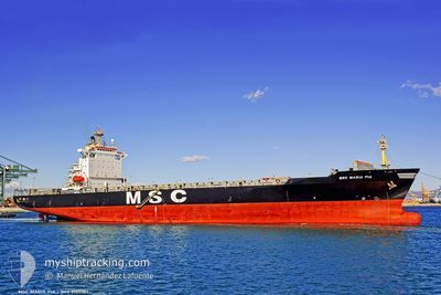
MSC MARIA PIA
Container Ship
Current Trip
| Time Travelled | 1 day |
|---|---|
| Remaining Time | 1 day |
| Distance Travelled | 475.58 nm |
| Remaining Distance | 675.07 nm |
| AVG Speed | 14.2 Noeuds |
| MAX Speed | 18.2 Noeuds |
| AVG Wind | 7.4 knots |
| MAX Wind | 19 knots |
| MIN Temp | 1.5°C / 34.7°F |
| MAX Temp | 3.7°C / 38.66°F |
| Tirant d eau | 12.2 m |
| Position reçue | Maintenant |
Current Position
| Longitude | 11.12847° |
|---|---|
| Latitude | 56.02596° |
| Etat | Under way using engine |
| Vitesse | 8 Noeuds |
| Parcours | 20.9° |
| Zone | Kattegat |
| Station | T-AIS |
| Position reçue | Maintenant |
Info
Information
The current position of MSC MARIA PIA is in Kattegat with coordinates 56.02596° / 11.12847° as reported on 2025-02-02 21:55 by AIS to our vessel tracker app. The vessel's current speed is 8 Noeuds and is heading at the port of ANTWERP. The estimated time of arrival as calculated by MyShipTracking vessel tracking app is 2025-02-04 14:06 LT
The vessel MSC MARIA PIA (IMO: 9155107, MMSI: 354711000) is a Container Ship that was built in 1997 ( 28 Age ). It's sailing under the flag of [PA] Panama.
In this page you can find informations about the vessels current position, last detected port calls, and current voyage information. If the vessels is not in coverage by AIS you will find the latest position.
The current position of MSC MARIA PIA is detected by our AIS receivers and we are not responsible for the reliability of the data. The last position was recorded while the vessel was in Coverage by the Ais receivers of our vessel tracking app.
The current draught of MSC MARIA PIA as reported by AIS is 12.2 meters
Weather
| Temperature | 3.1°C / 37.58°F |
|---|---|
| Wind Speed | 9 knots |
| Direction | 268° W |
| Pressure | 1026.2 hPa |
| Humidity | 89.5 % |
| Cloud Coverage | 100 % |
Featured Company
Last Port Calls
| Port | Arrival | Departure | Time In Port |
|---|---|---|---|
| 2025-01-31 23:38 | 2025-02-01 06:33 | 6 h | |
| 2025-01-29 14:43 | 2025-01-30 23:46 | 1 d | |
| 2025-01-27 13:00 | 2025-01-28 02:03 | 13 h | |
| 2025-01-21 19:32 | 2025-01-23 11:51 | 1 d | |
| 2025-01-17 16:29 | 2025-01-18 12:57 | 20 h | |
| 2025-01-14 15:24 | 2025-01-16 17:51 | 2 d | |
| 2025-01-11 08:08 | 2025-01-13 14:53 | 2 d | |
| 2025-01-04 02:24 | 2025-01-05 06:27 | 1 d | |
| 2024-12-30 12:04 | 2024-12-31 15:27 | 1 d | |
| 2024-12-25 17:41 | 2024-12-26 06:07 | 12 h |
Most Visited Ports (Last year)
| Port | Arrivals | |
|---|---|---|
| 25 | ||
| 24 | ||
| 24 | ||
| 10 | ||
| 7 | ||
| 6 |
Last Trips
| Origin | Departure | Destination | Arrival | Distance | |
|---|---|---|---|---|---|
| 2025-01-31 00:46 | 2025-02-01 01:38 | 367.70 nm | |||
| 2025-01-28 03:03 | 2025-01-29 15:43 | 320.17 nm | |||
| 2025-01-23 12:51 | 2025-01-27 14:00 | 1222.50 nm | |||
| 2025-01-18 14:57 | 2025-01-21 20:32 | 1159.98 nm | |||
| 2025-01-16 18:51 | 2025-01-17 18:29 | 366.67 nm | |||
| 2025-01-13 15:53 | 2025-01-14 16:24 | 279.67 nm | |||
| 2025-01-05 07:27 | 2025-01-11 09:08 | 1305.43 nm | |||
| 2024-12-31 16:27 | 2025-01-04 03:24 | 523.46 nm | |||
| 2024-12-26 08:07 | 2024-12-30 13:04 | 1301.38 nm | |||
| 2024-12-24 00:37 | 2024-12-25 19:41 | 272.76 nm |
Events
| Heure | Evenement | Détails | Position/ Destination | Info |
|---|---|---|---|---|
| 2025-02-02 16:41 | Changement de zone | Danish part of the Kattegat Danish part of the Baltic Sea |
54.74029 / 10.79231
Kattegat
BEANR
|
Vitesse: 16.6 kn Parcours: 13.4° |
| 2025-02-02 16:14 | Changement de zone | Danish part of the Baltic Sea German part of the Baltic Sea |
54.63835 / 10.88989
Baltic Sea
BEANR
|
Vitesse: 16.5 kn Parcours: 303.5° |
| 2025-02-02 15:11 | Changement de zone | German part of the Baltic Sea Danish part of the Baltic Sea |
54.54396 / 11.35916
Baltic Sea
BEANR
|
Vitesse: 16.8 kn Parcours: 296.7° |
| 2025-02-02 13:26 | Changement de zone | Danish part of the Baltic Sea German part of the Baltic Sea |
54.44358 / 12.14936
Baltic Sea
BEANR
|
Vitesse: 15.7 kn Parcours: 270° |
| 2025-02-02 13:14 | Changement de zone | German part of the Baltic Sea Danish part of the Baltic Sea |
54.48206 / 12.19985
Baltic Sea
BEANR
|
Vitesse: 16.5 kn Parcours: 194.7° |
| 2025-02-02 12:17 | Changement de zone | Danish part of the Baltic Sea German part of the Baltic Sea |
54.65151 / 12.39473
Baltic Sea
BEANR
|
Vitesse: 12.3 kn Parcours: 236.6° |
| 2025-02-02 11:29 | Changement de zone | German part of the Baltic Sea Danish part of the Baltic Sea |
54.72008 / 12.57518
Baltic Sea
BEANR
|
Vitesse: 8.8 kn Parcours: 235.4° |
| 2025-02-02 09:59 | Detecté en mer | Danish part of the Baltic Sea |
54.83239 / 12.92742
Baltic Sea
BEANR
|
Vitesse: 9.2 kn Parcours: 249° |
| 2025-02-02 06:37 | Changement de zone | German part of the Baltic Sea Swedish part of the Baltic Sea |
55.01456 / 13.79960
Baltic Sea
BEANR
|
Vitesse: 9.6 kn Parcours: 251.3° |
| 2025-02-02 02:10 | Changement de zone | Swedish part of the Baltic Sea Danish part of the Kattegat |
55.48727 / 14.72675
Baltic Sea
BEANR
|
Vitesse: 9.4 kn Parcours: 244.5° |