

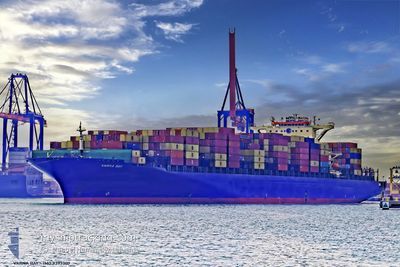
MSC RIDA VIII
Container Ship

Current Trip
KRPUS
| Time Travelled | 6 h, 53 mins |
|---|---|
| Remaining Time | --- |
| Distance Travelled | 58.48 nm |
| Remaining Distance | --- |
| AVG Speed | 9.4 Noeuds |
| MAX Speed | 11.9 Noeuds |
| AVG Wind | 4.8 knots |
| MAX Wind | 8.5 knots |
| MIN Temp | 19°C / 66.2°F |
| MAX Temp | 19.7°C / 67.46°F |
| Tirant d eau | 10.5 m |
| Position reçue | 2 d depuis |
Current Position
| Longitude | 122.92742° |
|---|---|
| Latitude | 34.12845° |
| Etat | Under way using engine |
| Vitesse | 18.7 Noeuds |
| Parcours | 325° |
| Zone | Yellow Sea |
| Station | T-AIS |
| Position reçue | 2 d depuis |
Information
The current position of MSC RIDA VIII is in Yellow Sea with coordinates 34.12845° / 122.92742° as reported on 2025-06-08 01:24 by AIS to our vessel tracker app. The vessel's current speed is 18.7 Noeuds
The vessel MSC RIDA VIII (IMO: 9393307, MMSI: 255803480) is a Container Ship that was built in 2009 ( 16 Age ). It's sailing under the flag of [PT] Portugal.
In this page you can find informations about the vessels current position, last detected port calls, and current voyage information. If the vessels is not in coverage by AIS you will find the latest position.
The current position of MSC RIDA VIII is detected by our AIS receivers and we are not responsible for the reliability of the data. The last position was recorded while the vessel was in Coverage by the Ais receivers of our vessel tracking app.
The current draught of MSC RIDA VIII as reported by AIS is 10.5 meters
Weather
| Temperature | 19.7°C / 67.46°F |
|---|---|
| Wind Speed | 9 knots |
| Direction | 358° N |
| Pressure | 1009 hPa |
| Humidity | 94.4 % |
| Cloud Coverage | 100 % |


Featured Company
Last Port Calls
| Port | Arrival | Departure | Time In Port |
|---|---|---|---|
| 2025-06-09 13:03 | 2025-06-10 03:07 | 14 h | |
| 2025-06-07 07:53 | 2025-06-07 16:22 | 8 h | |
| 2025-05-29 22:14 | 2025-05-31 03:02 | 1 d | |
| 2025-05-07 17:46 | 2025-05-07 18:52 | 1 h | |
| 2025-04-30 03:31 | 2025-05-01 19:35 | 1 d | |
| 2025-04-28 01:06 | 2025-04-29 01:33 | 1 d | |
| 2025-04-23 09:36 | 2025-04-26 15:21 | 3 d | |
| 2025-04-16 23:24 | 2025-04-18 07:28 | 1 d |
Most Visited Ports (Last year)
| Port | Arrivals | |
|---|---|---|
| 5 | ||
| 4 | ||
| 3 | ||
| 2 | ||
| 2 | ||
| 1 |
Last Trips
| Origin | Departure | Destination | Arrival | Distance | |
|---|---|---|---|---|---|
| 2025-06-07 16:22 | 2025-06-09 13:03 | 454.26 nm | |||
| 2025-05-31 03:02 | 2025-06-07 07:53 | 1035.67 nm | |||
| 2025-05-07 18:52 | 2025-05-29 22:14 | 9497.65 nm | |||
| 2025-05-01 19:35 | 2025-05-07 17:46 | 1969.87 nm | |||
| 2025-04-29 01:33 | 2025-04-30 03:31 | 193.93 nm | |||
| 2025-04-26 15:21 | 2025-04-28 01:06 | 306.14 nm | |||
| 2025-04-18 07:28 | 2025-04-23 09:36 | 2006.29 nm | |||
| 2025-03-25 10:38 | 2025-04-16 23:24 | 8461.00 nm |
Events
| Heure | Evenement | Détails | Position/ Destination | Info |
|---|---|---|---|---|
| 2025-06-09 19:07 | PORT DE DEPART |
|
36.01231 / 120.36240
KRPUS
|
Vitesse: 9.8 kn Parcours: 104° |
| 2025-06-09 18:23 | Démarrage |
36.01990 / 120.23460
[CN] QINGDAO
|
Vitesse: 4.9 kn Parcours: 52° |
|
| 2025-06-09 06:17 | Arret |
36.01447 / 120.23489
[CN] QINGDAO
|
Vitesse: Parcours: 232° |
|
| 2025-06-09 05:03 | Port d'arrivée |
|
36.02488 / 120.34323
[CN] QINGDAO
|
Vitesse: 14.7 kn Parcours: 281° |
| 2025-06-09 02:35 | Démarrage |
35.81983 / 120.98855
KRPUS
|
Vitesse: 3.1 kn Parcours: 270° |
|
| 2025-06-08 13:47 | Arret |
35.82072 / 120.99173
KRPUS
|
Vitesse: 0.3 kn Parcours: 226° |
|
| 2025-06-08 01:31 | Etat Changé | Default Under way using engine |
34.15777 / 122.90382
KRPUS
|
Vitesse: 18.7 kn Parcours: 325° |
| 2025-06-08 01:24 | Changement de zone | South Korean part of the Yellow Sea Chinese part of the South China Sea |
34.12845 / 122.92742
Yellow Sea
|
Vitesse: 18.7 kn Parcours: 325° |
| 2025-06-08 01:24 | Etat Changé | Under way using engine Default |
34.12845 / 122.92742
KRPUS
|
Vitesse: 18.7 kn Parcours: 331° |
| 2025-06-08 01:24 | Hors de la zone couverte |
34.12845 / 122.92742
Yellow Sea
|
Vitesse: 18.7 kn Parcours: 325° |