

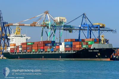
MSC ROSSELLA III
Container Ship

Current Trip
| Trip Time | 23 h, 50 mins |
|---|---|
| Trip Distance | 293.52 nm |
| AVG Speed | 12.4 Noeuds |
| MAX Speed | 14.2 Noeuds |
| Tirant d eau | 7.7 m |
| AVG Wind | 7.2 knots |
| MAX Wind | 9.8 knots |
| MIN Temp | 22.7°C / 72.86°F |
| MAX Temp | 26.9°C / 80.42°F |
| Position reçue | 2 h, 43 m depuis |
Current Position
| Longitude | 30.08265° |
|---|---|
| Latitude | 31.31443° |
| Etat | Moored |
| Vitesse | |
| Parcours | 89° |
| Zone | Mediterranean Sea - Eastern Basin |
| Station | T-AIS |
| Position reçue | 2 h, 43 m depuis |
Information
The current position of MSC ROSSELLA III is in Mediterranean Sea - Eastern Basin with coordinates 31.31443° / 30.08265° as reported on 2025-06-11 19:33 by AIS to our vessel tracker app. The vessel's current speed is 0 Noeuds and is currently inside the port of ABU QIR.
The vessel MSC ROSSELLA III (IMO: 9320025, MMSI: 255915798) is a Container Ship that was built in 2006 ( 19 Age ). It's sailing under the flag of [PT] Portugal.
In this page you can find informations about the vessels current position, last detected port calls, and current voyage information. If the vessels is not in coverage by AIS you will find the latest position.
The current position of MSC ROSSELLA III is detected by our AIS receivers and we are not responsible for the reliability of the data. The last position was recorded while the vessel was in Coverage by the Ais receivers of our vessel tracking app.
The current draught of MSC ROSSELLA III as reported by AIS is 7.7 meters
Weather
| Temperature | 24.3°C / 75.74°F |
|---|---|
| Wind Speed | 7 knots |
| Direction | 326° NW |
| Pressure | 1009.4 hPa |
| Humidity | 67.2 % |
| Cloud Coverage | 92 % |


Featured Company
Last Port Calls
| Port | Arrival | Departure | Time In Port |
|---|---|---|---|
| 2025-06-11 15:39 | |||
| 2025-06-10 06:16 | 2025-06-10 16:49 | 10 h | |
| 2025-06-08 09:51 | 2025-06-08 23:06 | 13 h | |
| 2025-06-06 23:51 | 2025-06-07 08:48 | 8 h | |
| 2025-06-05 08:52 | 2025-06-05 20:29 | 11 h | |
| 2025-05-30 09:45 | 2025-05-30 23:39 | 13 h | |
| 2025-05-28 02:24 | 2025-05-29 11:09 | 1 d | |
| 2025-05-27 00:06 | 2025-05-27 09:43 | 9 h | |
| 2025-05-26 03:02 | 2025-05-26 17:43 | 14 h | |
| 2025-05-22 08:28 | 2025-05-24 12:40 | 2 d |
Most Visited Ports (Last year)
| Port | Arrivals | |
|---|---|---|
| 6 | ||
| 6 | ||
| 5 | ||
| 5 | ||
| 5 | ||
| 4 |
Last Trips
| Origin | Departure | Destination | Arrival | Distance | |
|---|---|---|---|---|---|
| 2025-06-10 16:49 | 2025-06-11 15:39 | 293.52 nm | |||
| 2025-06-08 23:06 | 2025-06-10 06:16 | 108.34 nm | |||
| 2025-06-07 08:48 | 2025-06-08 09:51 | 349.77 nm | |||
| 2025-06-05 20:29 | 2025-06-06 23:51 | 98.76 nm | |||
| 2025-05-30 23:39 | 2025-06-05 08:52 | 855.35 nm | |||
| 2025-05-29 11:09 | 2025-05-30 09:45 | 211.46 nm | |||
| 2025-05-27 09:43 | 2025-05-28 02:24 | 106.36 nm | |||
| 2025-05-26 17:43 | 2025-05-27 00:06 | 64.63 nm | |||
| 2025-05-24 12:40 | 2025-05-26 03:02 | 270.75 nm | |||
| 2025-05-19 23:58 | 2025-05-22 08:28 | 323.96 nm |
Events
| Heure | Evenement | Détails | Position/ Destination | Info |
|---|---|---|---|---|
| 2025-06-11 19:33 | Hors de la zone couverte |
31.31443 / 30.08265
Mediterranean Sea - Eastern Basin
[EG] ABU QIR
|
Vitesse: Parcours: 327.9° |
|
| 2025-06-11 14:15 | Etat Changé | Moored Under way using engine |
31.31445 / 30.08268
[EG] ABU QIR
|
Vitesse: Parcours: 89° |
| 2025-06-11 13:54 | Arret |
31.31456 / 30.08274
[EG] ABU QIR
|
Vitesse: 0.3 kn Parcours: 89° |
|
| 2025-06-11 13:39 | Port d'arrivée |
|
31.31899 / 30.08468
[EG] ABU QIR
|
Vitesse: 6.5 kn Parcours: 156.3° |
| 2025-06-11 11:05 | Dans la zone couverte |
31.58182 / 29.99579
Mediterranean Sea - Eastern Basin
EGAKI
|
Vitesse: 6.9 kn Parcours: 159.9° |
|
| 2025-06-11 06:32 | Hors de la zone couverte |
31.81437 / 30.98858
Mediterranean Sea - Eastern Basin
EGAKI
|
Vitesse: 12.4 kn Parcours: 249° |
|
| 2025-06-10 21:42 | Detecté en mer | Egyptian part of the Mediterranean Sea - Eastern Basin |
32.65980 / 33.05178
Mediterranean Sea - Eastern Basin
EGAKI
|
Vitesse: 13.4 kn Parcours: 239.5° |
| 2025-06-10 14:02 | Changement d'ETA | 2025/06/11 14:00 2025/06/11 15:00 |
32.85542 / 35.01107
EGAKI
|
Vitesse: 10.7 kn Parcours: 307.4° |
| 2025-06-10 13:49 | PORT DE DEPART |
|
32.83207 / 35.02210
EGAKI
|
Vitesse: 5.1 kn Parcours: 355° |
| 2025-06-10 13:46 | Démarrage |
32.82775 / 35.02353
[IL] HAIFA
|
Vitesse: 3.7 kn Parcours: 343° |