
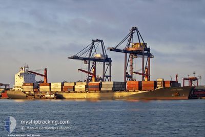
MSC SARYA III
Container Ship
Current Trip
| Time Travelled | 8 h, 11 mins |
|---|---|
| Remaining Time | --- |
| Distance Travelled | 109.15 nm |
| Remaining Distance | --- |
| AVG Speed | 14.2 Noeuds |
| MAX Speed | 14.7 Noeuds |
| AVG Wind | 7.1 knots |
| MAX Wind | 8 knots |
| MIN Temp | 28.3°C / 82.94°F |
| MAX Temp | 29.1°C / 84.38°F |
| Tirant d eau | 11.4 m |
| Position reçue | 20 d depuis |
Current Position
| Longitude | 56.96476° |
|---|---|
| Latitude | -19.63137° |
| Etat | Under way using engine |
| Vitesse | 8 Noeuds |
| Parcours | 330.7° |
| Zone | Indian Ocean |
| Station | T-AIS |
| Position reçue | 20 d depuis |
Info
Information
The current position of MSC SARYA III is in Indian Ocean with coordinates -19.63137° / 56.96476° as reported on 2025-01-18 17:52 by AIS to our vessel tracker app. The vessel's current speed is 8 Noeuds and is heading at the port of NACALA PORTO.
The vessel MSC SARYA III (IMO: 9241451, MMSI: 636021492) is a Container Ship that was built in 2003 ( 22 Age ). It's sailing under the flag of [LR] Liberia.
In this page you can find informations about the vessels current position, last detected port calls, and current voyage information. If the vessels is not in coverage by AIS you will find the latest position.
The current position of MSC SARYA III is detected by our AIS receivers and we are not responsible for the reliability of the data. The last position was recorded while the vessel was in Coverage by the Ais receivers of our vessel tracking app.
The current draught of MSC SARYA III as reported by AIS is 11.4 meters
Weather
| Temperature | 28.3°C / 82.94°F |
|---|---|
| Wind Speed | 8 knots |
| Direction | 136° SE |
| Pressure | 1012.6 hPa |
| Humidity | 79.9 % |
| Cloud Coverage | 5 % |
Featured Company
Last Port Calls
| Port | Arrival | Departure | Time In Port |
|---|---|---|---|
| 2025-02-07 05:58 | 2025-02-07 16:40 | 10 h | |
| 2025-02-03 07:54 | 2025-02-05 06:35 | 1 d | |
| 2025-01-24 00:54 | 2025-01-26 02:35 | 2 d | |
| 2025-01-14 23:09 | 2025-01-18 16:48 | 3 d | |
| 2025-01-10 10:51 | 2025-01-10 21:20 | 10 h | |
| 2025-01-03 07:09 | 2025-01-04 22:33 | 1 d | |
| 2024-12-26 06:53 | 2024-12-28 18:06 | 2 d | |
| 2024-12-19 12:20 | 2024-12-21 11:10 | 1 d | |
| 2024-12-10 14:19 | 2024-12-11 05:47 | 15 h | |
| 2024-12-05 08:58 | 2024-12-09 05:22 | 3 d |
Most Visited Ports (Last year)
| Port | Arrivals | |
|---|---|---|
| 16 | ||
| 9 | ||
| 8 | ||
| 7 | ||
| 5 | ||
| 5 |
Last Trips
| Origin | Departure | Destination | Arrival | Distance | |
|---|---|---|---|---|---|
| 2025-02-05 06:35 | 2025-02-07 05:58 | 423.39 nm | |||
| 2025-01-26 02:35 | 2025-02-03 07:54 | 719.75 nm | |||
| 2025-01-18 16:48 | 2025-01-24 00:54 | 1276.50 nm | |||
| 2025-01-10 21:20 | 2025-01-14 23:09 | 538.14 nm | |||
| 2025-01-04 22:33 | 2025-01-10 10:51 | 799.88 nm | |||
| 2024-12-28 18:06 | 2025-01-03 07:09 | 624.48 nm | |||
| 2024-12-21 11:10 | 2024-12-26 06:53 | 329.06 nm | |||
| 2024-12-11 05:47 | 2024-12-19 12:20 | 1216.25 nm | |||
| 2024-12-09 05:22 | 2024-12-10 14:19 | 476.03 nm | |||
| 2024-12-04 16:50 | 2024-12-05 08:58 | 137.83 nm |
Events
| Heure | Evenement | Détails | Position/ Destination | Info |
|---|---|---|---|---|
| 2025-02-07 13:40 | Démarrage | 0.48 nm, North of TOAMASINA |
-18.14127 / 49.42606
MZ MNC
|
Vitesse: 4.4 kn Parcours: -1° |
| 2025-02-07 13:40 | PORT DE DEPART |
|
-18.14127 / 49.42606
MZ MNC
|
Vitesse: 0.3 kn Parcours: -1° |
| 2025-02-07 03:12 | Arret |
-18.15125 / 49.42754
[MG] TOAMASINA
|
Vitesse: Parcours: 205° |
|
| 2025-02-07 02:58 | Port d'arrivée |
|
-18.14941 / 49.42690
[MG] TOAMASINA
|
Vitesse: 3.2 kn Parcours: 187° |
| 2025-02-06 21:30 | Démarrage |
-17.67422 / 49.82058
MZ MNC
|
Vitesse: 5.1 kn Parcours: 235° |
|
| 2025-02-06 13:56 | Arret |
-17.69455 / 49.90442
MZ MNC
|
Vitesse: 0.2 kn Parcours: -1° |
|
| 2025-02-05 03:47 | Démarrage | 1.35 nm, North East of ANTSIRANANA |
-12.25726 / 49.29812
MZ MNC
|
Vitesse: 5.2 kn Parcours: 51° |
| 2025-02-05 03:35 | PORT DE DEPART |
|
-12.26508 / 49.28880
MZ MNC
|
Vitesse: 1.7 kn Parcours: -1° |
| 2025-02-03 05:00 | Arret |
-12.26783 / 49.28819
[MG] ANTSIRANANA
|
Vitesse: 0.2 kn Parcours: -1° |
|
| 2025-02-03 04:54 | Port d'arrivée |
|
-12.26797 / 49.28798
[MG] ANTSIRANANA
|
Vitesse: 1.1 kn Parcours: -1° |