
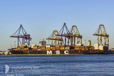
MSC SASHA
Cargo A
Current Trip
LAST UPDATE TIME
| Time Travelled | 6 days |
|---|---|
| Remaining Time | --- |
| Distance Travelled | 2577.36 nm |
| Remaining Distance | --- |
| AVG Speed | 17.6 Noeuds |
| MAX Speed | 19.5 Noeuds |
| AVG Wind | 17 knots |
| MAX Wind | 32 knots |
| MIN Temp | 20.8°C / 69.44°F |
| MAX Temp | 27.2°C / 80.96°F |
| Tirant d eau | 11 m |
| Position reçue | 3 d depuis |
Current Position
| Longitude | -61.48445° |
|---|---|
| Latitude | 16.75395° |
| Etat | Under way using engine |
| Vitesse | 17 Noeuds |
| Parcours | 65° |
| Zone | Caribbean Sea |
| Station | T-AIS |
| Position reçue | 3 d depuis |
Info
Information
The current position of MSC SASHA is in Caribbean Sea with coordinates 16.75395° / -61.48445° as reported on 2025-02-09 05:05 by AIS to our vessel tracker app. The vessel's current speed is 17 Noeuds
The vessel MSC SASHA (IMO: 9720500, MMSI: 255805897) is a Cargo A It's sailing under the flag of [PT] Portugal.
In this page you can find informations about the vessels current position, last detected port calls, and current voyage information. If the vessels is not in coverage by AIS you will find the latest position.
The current position of MSC SASHA is detected by our AIS receivers and we are not responsible for the reliability of the data. The last position was recorded while the vessel was in Coverage by the Ais receivers of our vessel tracking app.
The current draught of MSC SASHA as reported by AIS is 11 meters
Weather
| Temperature | 21°C / 69.8°F |
|---|---|
| Wind Speed | 6 knots |
| Direction | 60° ENE |
| Pressure | 1025 hPa |
| Humidity | 59.3 % |
| Cloud Coverage | 3 % |
Featured Company
Last Port Calls
| Port | Arrival | Departure | Time In Port |
|---|---|---|---|
| 2025-02-01 12:48 | 2025-02-06 10:25 | 4 d | |
| 2025-01-30 07:12 | 2025-01-31 11:33 | 1 d | |
| 2025-01-25 22:46 | 2025-01-26 20:38 | 21 h | |
| 2025-01-18 19:19 | 2025-01-20 19:21 | 2 d | |
| 2025-01-17 04:14 | 2025-01-18 03:56 | 23 h | |
| 2025-01-13 01:46 | 2025-01-13 16:05 | 14 h | |
| 2025-01-12 01:26 | 2025-01-12 13:34 | 12 h | |
| 2025-01-05 19:21 | 2025-01-07 11:46 | 1 d | |
| 2025-01-02 15:09 | 2025-01-03 18:00 | 1 d | |
| 2024-12-22 14:27 | 2024-12-23 16:52 | 1 d |
Last Trips
| Origin | Departure | Destination | Arrival | Distance | |
|---|---|---|---|---|---|
| 2025-01-31 06:33 | 2025-02-01 07:48 | 75.14 nm | |||
| 2025-01-26 15:38 | 2025-01-30 02:12 | 1358.54 nm | |||
| 2025-01-20 16:21 | 2025-01-25 17:46 | 1343.96 nm | |||
| 2025-01-18 00:56 | 2025-01-18 16:19 | 271.75 nm | |||
| 2025-01-13 11:05 | 2025-01-17 01:14 | 1523.19 nm | |||
| 2025-01-12 08:34 | 2025-01-12 20:46 | 48.97 nm | |||
| 2025-01-07 06:46 | 2025-01-11 20:26 | 1410.56 nm | |||
| 2025-01-03 14:00 | 2025-01-05 14:21 | 823.15 nm | |||
| 2024-12-23 16:52 | 2025-01-02 11:09 | 3857.50 nm | |||
| 2024-12-19 20:23 | 2024-12-22 14:27 | 1203.51 nm |
Events
| Heure | Evenement | Détails | Position/ Destination | Info |
|---|---|---|---|---|
| 2025-02-09 05:10 | Etat Changé | Default Under way using engine |
16.76472 / -61.46007
LAST UPDATE TIME
|
Vitesse: 17 kn Parcours: 65° |
| 2025-02-09 05:05 | Hors de la zone couverte |
16.75395 / -61.48445
Caribbean Sea
|
Vitesse: 17 kn Parcours: 65° |
|
| 2025-02-09 04:05 | Etat Changé | Under way using engine Default |
16.63658 / -61.76149
LAST UPDATE TIME
|
Vitesse: 17.7 kn Parcours: 66° |
| 2025-02-09 03:39 | Etat Changé | Default Under way using engine |
16.58397 / -61.88147
LAST UPDATE TIME
|
Vitesse: 17.5 kn Parcours: 66.1° |
| 2025-02-09 03:28 | Changement de zone | Guadeloupe and Martinique part of the Caribbean Sea Montserrat part of the Caribbean Sea |
16.56128 / -61.93359
Caribbean Sea
|
Vitesse: 17.5 kn Parcours: 66.1° |
| 2025-02-09 01:59 | Etat Changé | Under way using engine Default |
16.38689 / -62.34506
LAST UPDATE TIME
|
Vitesse: 17.5 kn Parcours: 66° |
| 2025-02-09 01:54 | Etat Changé | Default Under way using engine |
16.37706 / -62.36780
LAST UPDATE TIME
|
Vitesse: 17.7 kn Parcours: 65.2° |
| 2025-02-09 01:43 | Detecté en mer | Montserrat part of the Caribbean Sea |
16.35364 / -62.42056
Caribbean Sea
|
Vitesse: 17.7 kn Parcours: 65.2° |
| 2025-02-09 01:41 | Etat Changé | Under way using engine Default |
16.35052 / -62.42751
LAST UPDATE TIME
|
Vitesse: 17.8 kn Parcours: 64° |
| 2025-02-09 01:41 | Dans la zone couverte |
16.35364 / -62.42056
Caribbean Sea
|
Vitesse: 17.7 kn Parcours: 65.2° |