
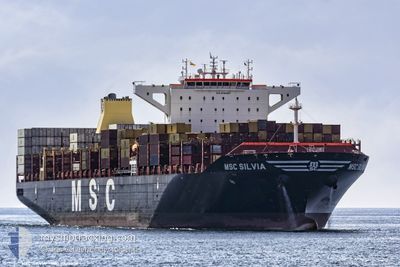
MSC SILVIA
Cargo A
Current Trip
| Time Travelled | 2 days |
|---|---|
| Remaining Time | --- |
| Distance Travelled | 1128.72 nm |
| Remaining Distance | --- |
| AVG Speed | 14.8 Noeuds |
| MAX Speed | 20.4 Noeuds |
| AVG Wind | 21.2 knots |
| MAX Wind | 26.5 knots |
| MIN Temp | -4.4°C / 24.08°F |
| MAX Temp | 22.6°C / 72.68°F |
| Tirant d eau | 14.8 m |
| Position reçue | 2 d depuis |
Current Position
| Longitude | -73.80996° |
|---|---|
| Latitude | 39.67559° |
| Etat | Under way using engine |
| Vitesse | 14.2 Noeuds |
| Parcours | 159.9° |
| Zone | North Atlantic Ocean |
| Station | T-AIS |
| Position reçue | 2 d depuis |
Info
Information
The current position of MSC SILVIA is in North Atlantic Ocean with coordinates 39.67559° / -73.80996° as reported on 2025-02-18 11:33 by AIS to our vessel tracker app. The vessel's current speed is 14.2 Noeuds and is heading at the port of NHAVA SHEVA. The estimated time of arrival as calculated by MyShipTracking vessel tracking app is 2025-03-16 06:00 LT
The vessel MSC SILVIA (IMO: 9720457, MMSI: 255806506) is a Cargo A It's sailing under the flag of [PT] Portugal.
In this page you can find informations about the vessels current position, last detected port calls, and current voyage information. If the vessels is not in coverage by AIS you will find the latest position.
The current position of MSC SILVIA is detected by our AIS receivers and we are not responsible for the reliability of the data. The last position was recorded while the vessel was in Coverage by the Ais receivers of our vessel tracking app.
The current draught of MSC SILVIA as reported by AIS is 14.8 meters
Weather
| Temperature | 22.5°C / 72.5°F |
|---|---|
| Wind Speed | 19 knots |
| Direction | 197° SSW |
| Pressure | 1020.8 hPa |
| Humidity | 80.7 % |
| Cloud Coverage | 100 % |
Featured Company
Last Port Calls
| Port | Arrival | Departure | Time In Port |
|---|---|---|---|
| 2025-02-15 19:48 | 2025-02-18 01:07 | 2 d | |
| 2025-02-13 21:17 | 2025-02-14 15:55 | 18 h | |
| 2025-02-11 11:03 | 2025-02-12 19:16 | 1 d | |
| 2025-02-08 09:09 | 2025-02-09 16:00 | 1 d | |
| 2025-02-04 12:24 | 2025-02-06 15:28 | 2 d | |
| 2025-01-27 09:14 | 2025-01-28 16:25 | 1 d | |
| 2025-01-24 17:34 | 2025-01-25 20:57 | 1 d | |
| 2025-01-12 15:09 | 2025-01-13 10:29 | 19 h | |
| 2024-12-21 21:31 | 2024-12-23 21:07 | 1 d | |
| 2024-12-13 23:49 | 2024-12-15 03:40 | 1 d |
Most Visited Ports (Last year)
| Port | Arrivals | |
|---|---|---|
| 5 | ||
| 5 | ||
| 4 | ||
| 4 | ||
| 4 | ||
| 3 |
Last Trips
| Origin | Departure | Destination | Arrival | Distance | |
|---|---|---|---|---|---|
| 2025-02-14 15:55 | 2025-02-15 19:48 | 318.50 nm | |||
| 2025-02-12 19:16 | 2025-02-13 21:17 | 224.47 nm | |||
| 2025-02-09 16:00 | 2025-02-11 11:03 | 602.60 nm | |||
| 2025-02-06 15:28 | 2025-02-08 09:09 | 172.38 nm | |||
| 2025-01-28 16:25 | 2025-02-04 12:24 | 932.21 nm | |||
| 2025-01-25 20:57 | 2025-01-27 09:14 | 596.31 nm | |||
| 2025-01-13 10:29 | 2025-01-24 17:34 | 4524.74 nm | |||
| 2024-12-23 21:07 | 2025-01-12 15:09 | 7111.84 nm | |||
| 2024-12-15 03:40 | 2024-12-21 21:31 | 1292.85 nm | |||
| 2024-12-12 07:42 | 2024-12-13 23:49 | 427.69 nm |
Events
| Heure | Evenement | Détails | Position/ Destination | Info |
|---|---|---|---|---|
| 2025-02-18 11:47 | Etat Changé | Default Under way using engine |
39.62305 / -73.78378
INNSA
|
Vitesse: 14.2 kn Parcours: 159.9° |
| 2025-02-18 11:33 | Hors de la zone couverte |
39.67559 / -73.80996
North Atlantic Ocean
INNSA
|
Vitesse: 14.2 kn Parcours: 159.9° |
|
| 2025-02-18 06:07 | PORT DE DEPART |
|
40.57692 / -74.03352
INNSA
|
Vitesse: 12.7 kn Parcours: 172° |
| 2025-02-18 04:43 | Démarrage |
40.67173 / -74.13576
[US] NEW YORK
|
Vitesse: 3.2 kn Parcours: 207° |
|
| 2025-02-18 03:26 | Etat Changé | Under way using engine Moored |
40.68187 / -74.14788
[US] NEW YORK
|
Vitesse: Parcours: 311° |
| 2025-02-18 02:30 | Etat Changé | Moored Default |
40.68192 / -74.14778
[US] NEW YORK
|
Vitesse: Parcours: 311° |
| 2025-02-18 02:22 | Etat Changé | Default Moored |
40.68190 / -74.14789
[US] NEW YORK
|
Vitesse: Parcours: 311° |
| 2025-02-17 19:47 | Tirant d'eau modifié | 14.8 11.7 |
40.68192 / -74.14786
[US] NEW YORK
|
Vitesse: Parcours: 311° |
| 2025-02-17 19:47 | Changement de destination | INNSA USNYC |
40.68192 / -74.14786
[US] NEW YORK
|
Vitesse: Parcours: 311° |
| 2025-02-17 19:47 | Changement d'ETA | 2025/03/16 00:30 2025/02/15 23:00 |
40.68192 / -74.14786
[US] NEW YORK
|
Vitesse: Parcours: 311° |