
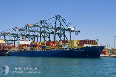
MSC VANCOUVER
Container Ship
Current Trip
| Trip Time | 1 day |
|---|---|
| Trip Distance | 133.84 nm |
| AVG Speed | 5.5 Noeuds |
| MAX Speed | 5.5 Noeuds |
| Tirant d eau | 10.1 m |
| AVG Wind | 11 knots |
| MAX Wind | 23.6 knots |
| MIN Temp | 21.9°C / 71.42°F |
| MAX Temp | 28.1°C / 82.58°F |
| Position reçue | 4 h, 33 m depuis |
Current Position
| Longitude | -48.62343° |
|---|---|
| Latitude | -26.91282° |
| Etat | Under way using engine |
| Vitesse | 9.6 Noeuds |
| Parcours | 265.5° |
| Zone | South Atlantic Ocean |
| Station | T-AIS |
| Position reçue | 4 h, 33 m depuis |
Info
Information
The current position of MSC VANCOUVER is in South Atlantic Ocean with coordinates -26.91282° / -48.62343° as reported on 2025-02-14 00:38 by AIS to our vessel tracker app. The vessel's current speed is 9.6 Noeuds and is currently inside the port of NAVEGANTES.
The vessel MSC VANCOUVER (IMO: 9285691, MMSI: 636020499) is a Container Ship that was built in 2004 ( 21 Age ). It's sailing under the flag of [LR] Liberia.
In this page you can find informations about the vessels current position, last detected port calls, and current voyage information. If the vessels is not in coverage by AIS you will find the latest position.
The current position of MSC VANCOUVER is detected by our AIS receivers and we are not responsible for the reliability of the data. The last position was recorded while the vessel was in Coverage by the Ais receivers of our vessel tracking app.
The current draught of MSC VANCOUVER as reported by AIS is 10.1 meters
Weather
| Temperature | 21.9°C / 71.42°F |
|---|---|
| Wind Speed | 2 knots |
| Direction | 196° SSW |
| Pressure | 1014 hPa |
| Humidity | 99 % |
| Cloud Coverage | 100 % |
Featured Company
Last Port Calls
| Port | Arrival | Departure | Time In Port |
|---|---|---|---|
| 2025-02-13 22:14 | |||
| 2025-02-10 15:58 | 2025-02-12 01:47 | 1 d | |
| 2025-01-25 12:23 | 2025-01-25 20:20 | 7 h | |
| 2025-01-24 18:24 | 2025-01-25 12:05 | 17 h | |
| 2025-01-15 14:48 | 2025-01-18 07:54 | 2 d | |
| 2025-01-11 14:25 | 2025-01-12 06:44 | 16 h | |
| 2025-01-03 13:21 | 2025-01-04 06:17 | 16 h | |
| 2024-12-23 10:30 | 2024-12-23 10:38 | 7 m | |
| 2024-12-15 08:04 | 2024-12-15 09:00 | 56 m | |
| 2024-12-12 22:02 | 2024-12-13 14:46 | 16 h |
Last Trips
| Origin | Departure | Destination | Arrival | Distance | |
|---|---|---|---|---|---|
| 2025-02-12 01:47 | 2025-02-13 22:14 | 133.84 nm | |||
| 2025-01-25 20:20 | 2025-02-10 15:58 | 4566.53 nm | |||
| 2025-01-25 12:05 | 2025-01-25 12:23 | 1.71 nm | |||
| 2025-01-18 07:54 | 2025-01-24 18:24 | 1735.43 nm | |||
| 2025-01-12 06:44 | 2025-01-15 14:48 | 556.36 nm | |||
| 2025-01-04 06:17 | 2025-01-11 14:25 | 1984.91 nm | |||
| 2024-12-23 10:38 | 2025-01-03 13:21 | 4119.74 nm | |||
| 2024-12-15 09:00 | 2024-12-23 10:30 | 565.23 nm | |||
| 2024-12-13 14:46 | 2024-12-15 08:04 | 228.56 nm | |||
| 2024-12-12 12:28 | 2024-12-12 22:02 | 83.84 nm |
Events
| Heure | Evenement | Détails | Position/ Destination | Info |
|---|---|---|---|---|
| 2025-02-14 01:14 | Arret |
-26.89775 / -48.66477
[BR] NAVEGANTES
|
Vitesse: 0.3 kn Parcours: 282° |
|
| 2025-02-14 01:14 | Port d'arrivée |
|
-26.89775 / -48.66477
[BR] NAVEGANTES
|
Vitesse: 1.9 kn Parcours: 283° |
| 2025-02-14 00:46 | Etat Changé | Default Under way using engine |
-26.91298 / -48.64253
BRNVT
|
Vitesse: 9.6 kn Parcours: 265.5° |
| 2025-02-14 00:38 | Hors de la zone couverte |
-26.91282 / -48.62343
South Atlantic Ocean
[BR] NAVEGANTES
|
Vitesse: 9.6 kn Parcours: 265.5° |
|
| 2025-02-13 16:20 | Démarrage | 17.39 nm, North East of CAMBORIU |
-26.82945 / -48.34260
BRNVT
|
Vitesse: 3.1 kn Parcours: 226° |
| 2025-02-13 13:54 | Arret | 15.98 nm, North East of CAMBORIU |
-26.84566 / -48.36177
BRNVT
|
Vitesse: 0.3 kn Parcours: 192° |
| 2025-02-13 12:59 | Démarrage | 15.87 nm, East of NAVEGANTES |
-26.81918 / -48.37850
BRNVT
|
Vitesse: 3.4 kn Parcours: 166° |
| 2025-02-13 11:05 | Tirant d'eau modifié | 10.1 10.3 |
-26.82317 / -48.39003
BRNVT
|
Vitesse: 0.1 kn Parcours: 191° |
| 2025-02-13 10:59 | Tirant d'eau modifié | 10.3 10.1 |
-26.82342 / -48.39068
BRNVT
|
Vitesse: 0.1 kn Parcours: 194° |
| 2025-02-13 06:29 | Arret | 14.09 nm, East of NAVEGANTES |
-26.82203 / -48.41236
BRNVT
|
Vitesse: 0.3 kn Parcours: 235° |