
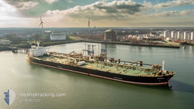
MT SAMURAI
Crude Oil Tanker
Current Trip
| Time Travelled | 4 days |
|---|---|
| Remaining Time | --- |
| Distance Travelled | 1160.22 nm |
| Remaining Distance | --- |
| AVG Speed | 12.2 Noeuds |
| MAX Speed | 14.1 Noeuds |
| AVG Wind | 11.1 knots |
| MAX Wind | 23 knots |
| MIN Temp | 25.9°C / 78.62°F |
| MAX Temp | 31.1°C / 87.98°F |
| Tirant d eau | 8.2 m |
| Position reçue | 14 h, 30 m depuis |
Current Position
| Longitude | 76.72230° |
|---|---|
| Latitude | 6.97130° |
| Etat | Under way using engine |
| Vitesse | 13.5 Noeuds |
| Parcours | 298° |
| Zone | Laccadive Sea |
| Station | T-AIS |
| Position reçue | 14 h, 30 m depuis |
Info
Information
The current position of MT SAMURAI is in Laccadive Sea with coordinates 6.97130° / 76.72230° as reported on 2025-02-08 02:21 by AIS to our vessel tracker app. The vessel's current speed is 13.5 Noeuds and is heading at the port of FUJAIRAH. The estimated time of arrival as calculated by MyShipTracking vessel tracking app is 2025-02-14 17:00 LT
The vessel MT SAMURAI (IMO: 9378876, MMSI: 636013852) is a Crude Oil Tanker that was built in 2009 ( 16 Age ). It's sailing under the flag of [LR] Liberia.
In this page you can find informations about the vessels current position, last detected port calls, and current voyage information. If the vessels is not in coverage by AIS you will find the latest position.
The current position of MT SAMURAI is detected by our AIS receivers and we are not responsible for the reliability of the data. The last position was recorded while the vessel was in Coverage by the Ais receivers of our vessel tracking app.
The current draught of MT SAMURAI as reported by AIS is 8.2 meters
Weather
| Temperature | 27.5°C / 81.5°F |
|---|---|
| Wind Speed | 4 knots |
| Direction | 311° NW |
| Pressure | 1011.6 hPa |
| Humidity | 57.8 % |
| Cloud Coverage | 2 % |
Featured Company
Last Port Calls
| Port | Arrival | Departure | Time In Port |
|---|---|---|---|
| 2025-02-02 18:05 | 2025-02-04 07:36 | 1 d |
Most Visited Ports (Last year)
| Port | Arrivals | |
|---|---|---|
| 2 | ||
| 1 | ||
| 1 |
Last Trips
| Origin | Departure | Destination | Arrival | Distance |
|---|
Events
| Heure | Evenement | Détails | Position/ Destination | Info |
|---|---|---|---|---|
| 2025-02-08 02:29 | Etat Changé | Default Under way using engine |
6.98622 / 76.69508
AEFJR
|
Vitesse: 13.5 kn Parcours: 298° |
| 2025-02-08 02:21 | Hors de la zone couverte |
6.97130 / 76.72230
Laccadive Sea
AEFJR
|
Vitesse: 13.5 kn Parcours: 298° |
|
| 2025-02-08 00:40 | Etat Changé | Under way using engine Default |
6.79763 / 77.04953
AEFJR
|
Vitesse: 12.6 kn Parcours: 298° |
| 2025-02-08 00:17 | Etat Changé | Default Under way using engine |
6.75863 / 77.11968
AEFJR
|
Vitesse: 12.6 kn Parcours: 298° |
| 2025-02-07 21:26 | Tirant d'eau modifié | 8.2 14.3 |
6.45792 / 77.66810
AEFJR
|
Vitesse: 13.1 kn Parcours: 297° |
| 2025-02-07 21:26 | Changement de destination | AEFJR INVTZ |
6.45792 / 77.66810
AEFJR
|
Vitesse: 13.1 kn Parcours: 297° |
| 2025-02-07 21:26 | Changement d'ETA | 2025/02/14 17:00 2025/02/03 07:00 |
6.45792 / 77.66810
AEFJR
|
Vitesse: 13.1 kn Parcours: 297° |
| 2025-02-07 21:17 | Etat Changé | Under way using engine Default |
6.44387 / 77.69535
INVTZ
|
Vitesse: 13 kn Parcours: 300° |
| 2025-02-07 20:42 | Etat Changé | Default Under way using engine |
6.38093 / 77.80683
INVTZ
|
Vitesse: 12.9 kn Parcours: 299° |
| 2025-02-07 20:33 | Etat Changé | Under way using engine Default |
6.36448 / 77.83537
INVTZ
|
Vitesse: 12.9 kn Parcours: 300° |