
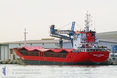
MUSTAFA HARMANDA
General Cargo
Current Trip
| Time Travelled | 8 days |
|---|---|
| Remaining Time | 20 h, 25 mins |
| Distance Travelled | 1096.22 nm |
| Remaining Distance | 156.71 nm |
| AVG Speed | 8.4 Noeuds |
| MAX Speed | 11.8 Noeuds |
| AVG Wind | 10.6 knots |
| MAX Wind | 28 knots |
| MIN Temp | 5.6°C / 42.08°F |
| MAX Temp | 16°C / 60.8°F |
| Tirant d eau | 5.5 m |
| Position reçue | 1 h, 10 m depuis |
Current Position
| Longitude | 14.77576° |
|---|---|
| Latitude | 43.37856° |
| Etat | Under way using engine |
| Vitesse | 7.5 Noeuds |
| Parcours | 315.8° |
| Zone | Adriatic Sea |
| Station | T-AIS |
| Position reçue | 1 h, 10 m depuis |
Info
Information
The current position of MUSTAFA HARMANDA is in Adriatic Sea with coordinates 43.37856° / 14.77576° as reported on 2025-03-09 23:27 by AIS to our vessel tracker app. The vessel's current speed is 7.5 Noeuds and is heading at the port of CHIOGGIA. The estimated time of arrival as calculated by MyShipTracking vessel tracking app is 2025-03-10 21:02 LT
The vessel MUSTAFA HARMANDA (IMO: 9280225, MMSI: 371020000) is a General Cargo that was built in 2003 ( 22 Age ). It's sailing under the flag of [PA] Panama.
In this page you can find informations about the vessels current position, last detected port calls, and current voyage information. If the vessels is not in coverage by AIS you will find the latest position.
The current position of MUSTAFA HARMANDA is detected by our AIS receivers and we are not responsible for the reliability of the data. The last position was recorded while the vessel was in Coverage by the Ais receivers of our vessel tracking app.
The current draught of MUSTAFA HARMANDA as reported by AIS is 5.5 meters
Weather
| Temperature | 14.7°C / 58.46°F |
|---|---|
| Wind Speed | 19 knots |
| Direction | 129° SE |
| Pressure | 1009.4 hPa |
| Humidity | 84.5 % |
| Cloud Coverage | 100 % |
Featured Company
Last Port Calls
| Port | Arrival | Departure | Time In Port |
|---|---|---|---|
| 2025-02-27 21:53 | 2025-03-01 17:51 | 1 d | |
| 2025-02-24 03:26 | 2025-02-26 05:44 | 2 d | |
| 2025-02-20 06:21 | 2025-02-21 15:08 | 1 d | |
| 2025-02-11 06:37 | 2025-02-14 07:27 | 3 d | |
| 2025-02-07 06:24 | 2025-02-10 14:26 | 3 d | |
| 2025-01-27 13:33 | 2025-01-29 02:21 | 1 d | |
| 2025-01-21 14:51 | 2025-01-24 18:57 | 3 d | |
| 2025-01-15 15:26 |
Most Visited Ports (Last year)
| Port | Arrivals | |
|---|---|---|
| 6 | ||
| 5 | ||
| 5 | ||
| 5 | ||
| 3 | ||
| 2 |
Last Trips
| Origin | Departure | Destination | Arrival | Distance | |
|---|---|---|---|---|---|
| 2025-02-26 07:44 | 2025-02-28 00:53 | 336.25 nm | |||
| 2025-02-21 17:08 | 2025-02-24 05:26 | 269.67 nm | |||
| 2025-02-14 08:27 | 2025-02-20 08:21 | 868.71 nm | |||
| 2025-02-10 15:26 | 2025-02-11 07:37 | 102.05 nm | |||
| 2025-01-29 04:21 | 2025-02-07 07:24 | 1378.14 nm | |||
| 2025-01-24 20:57 | 2025-01-27 15:33 | 547.19 nm | |||
| 2025-01-15 17:26 | 2025-01-21 16:51 | 612.70 nm |
Events
| Heure | Evenement | Détails | Position/ Destination | Info |
|---|---|---|---|---|
| 2025-03-09 23:34 | Etat Changé | Default Under way using engine |
43.39003 / 14.76003
ITCHI
|
Vitesse: 7.5 kn Parcours: 315.8° |
| 2025-03-09 23:27 | Hors de la zone couverte |
43.37856 / 14.77576
Adriatic Sea
ITCHI
|
Vitesse: 7.5 kn Parcours: 315.8° |
|
| 2025-03-09 23:12 | Etat Changé | Under way using engine Default |
43.35738 / 14.80487
ITCHI
|
Vitesse: 7.6 kn Parcours: 316° |
| 2025-03-09 23:08 | Etat Changé | Default Under way using engine |
43.35118 / 14.81352
ITCHI
|
Vitesse: 7.7 kn Parcours: 315.3° |
| 2025-03-09 10:50 | Changement de zone | Croatian part of the Adriatic Sea Italian part of the Adriatic Sea |
42.17313 / 16.33818
Adriatic Sea
ITCHI
|
Vitesse: 7.9 kn Parcours: 311.5° |
| 2025-03-09 06:52 | Etat Changé | Under way using engine Default |
41.80004 / 16.83308
ITCHI
|
Vitesse: 7.5 kn Parcours: 315° |
| 2025-03-09 06:39 | Dans la zone couverte |
41.80052 / 16.83247
Adriatic Sea
ITCHI
|
Vitesse: 7.6 kn Parcours: 316.7° |
|
| 2025-03-09 05:03 | Etat Changé | Default Under way using engine |
41.63060 / 17.05405
ITCHI
|
Vitesse: 8.4 kn Parcours: 319.5° |
| 2025-03-09 04:45 | Hors de la zone couverte |
41.59908 / 17.09039
Adriatic Sea
ITCHI
|
Vitesse: 8.4 kn Parcours: 319.5° |
|
| 2025-03-09 01:20 | Etat Changé | Under way using engine Default |
41.27959 / 17.50634
ITCHI
|
Vitesse: 7.9 kn Parcours: 320° |