
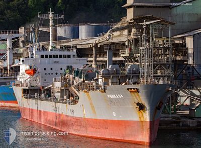
MV PERKASA
Cement Carrier
Current Trip
BIRINGKASI
| Time Travelled | 23 h, 19 mins |
|---|---|
| Remaining Time | --- |
| Distance Travelled | 1.25 nm |
| Remaining Distance | --- |
| AVG Speed | --- |
| MAX Speed | --- |
| AVG Wind | 7.3 knots |
| MAX Wind | 9 knots |
| MIN Temp | 25.4°C / 77.72°F |
| MAX Temp | 28.4°C / 83.12°F |
| Tirant d eau | 7.1 m |
| Position reçue | 58 m depuis |
Current Position
| Longitude | 119.47003° |
|---|---|
| Latitude | -4.81403° |
| Etat | At anchor |
| Vitesse | |
| Parcours | 49° |
| Zone | Makassar Strait |
| Station | T-AIS |
| Position reçue | 58 m depuis |
Info
Information
The current position of MV PERKASA is in Makassar Strait with coordinates -4.81403° / 119.47003° as reported on 2025-02-10 05:42 by AIS to our vessel tracker app. The vessel's current speed is 0 Noeuds
The vessel MV PERKASA (IMO: 8109204, MMSI: 525019095) is a Cement Carrier that was built in 1981 ( 44 Age ). It's sailing under the flag of [ID] Indonesia.
In this page you can find informations about the vessels current position, last detected port calls, and current voyage information. If the vessels is not in coverage by AIS you will find the latest position.
The current position of MV PERKASA is detected by our AIS receivers and we are not responsible for the reliability of the data. The last position was recorded while the vessel was in Coverage by the Ais receivers of our vessel tracking app.
The current draught of MV PERKASA as reported by AIS is 7.1 meters
Weather
| Temperature | 28.9°C / 84.02°F |
|---|---|
| Wind Speed | 11 knots |
| Direction | 287° WNW |
| Pressure | 1008.2 hPa |
| Humidity | 75.6 % |
| Cloud Coverage | 81 % |
Featured Company
Last Port Calls
| Port | Arrival | Departure | Time In Port |
|---|---|---|---|
| 2025-02-08 10:32 | 2025-02-09 07:22 | 20 h | |
| 2025-01-08 05:08 | 2025-01-09 12:52 | 1 d | |
| 2024-12-20 01:16 | 2024-12-21 02:46 | 1 d | |
| 2024-12-14 22:03 | 2024-12-16 14:01 | 1 d | |
| 2024-12-10 07:59 | 2024-12-11 09:14 | 1 d |
Most Visited Ports (Last year)
| Port | Arrivals | |
|---|---|---|
| 9 | ||
| 8 | ||
| 6 | ||
| 4 | ||
| 4 | ||
| 1 |
Last Trips
| Origin | Departure | Destination | Arrival | Distance | |
|---|---|---|---|---|---|
| 2025-01-09 20:52 | 2025-02-08 18:32 | 649.30 nm | |||
| 2024-12-21 10:46 | 2025-01-08 13:08 | 599.62 nm | |||
| 2024-12-16 22:01 | 2024-12-20 09:16 | 692.98 nm | |||
| 2024-12-11 17:14 | 2024-12-15 06:03 | 687.53 nm | |||
| 2024-11-23 05:35 | 2024-12-10 15:59 | 649.71 nm |
Events
| Heure | Evenement | Détails | Position/ Destination | Info |
|---|---|---|---|---|
| 2025-02-10 05:48 | Etat Changé | Default At anchor |
-4.81400 / 119.47001
BIRINGKASI
|
Vitesse: Parcours: 49° |
| 2025-02-10 05:42 | Etat Changé | At anchor Default |
-4.81403 / 119.47003
BIRINGKASI
|
Vitesse: Parcours: 39° |
| 2025-02-10 05:30 | Etat Changé | Default At anchor |
-4.81393 / 119.47004
BIRINGKASI
|
Vitesse: Parcours: 37° |
| 2025-02-10 05:16 | Changement de destination | BIRINGKASI BLKPPN |
-4.81392 / 119.47006
BIRINGKASI
|
Vitesse: Parcours: 33° |
| 2025-02-10 05:16 | Changement d'ETA | 2025/08/25 15:00 2025/01/24 15:30 |
-4.81392 / 119.47006
BIRINGKASI
|
Vitesse: Parcours: 33° |
| 2025-02-10 05:09 | Etat Changé | At anchor Default |
-4.81396 / 119.47003
BLKPPN
|
Vitesse: Parcours: 42° |
| 2025-02-10 05:01 | Dans la zone couverte |
-4.81396 / 119.47003
Makassar Strait
|
Vitesse: Parcours: 43° |
|
| 2025-02-09 07:43 | Arret | 0.83 nm, West of BIRINGKASSI |
-4.81485 / 119.46963
BLKPPN
|
Vitesse: 0.2 kn Parcours: 107° |
| 2025-02-09 07:28 | Démarrage | 0.52 nm, West of BIRINGKASSI |
-4.81573 / 119.47473
BLKPPN
|
Vitesse: 3.4 kn Parcours: 46° |
| 2025-02-09 07:22 | PORT DE DEPART |
|
-4.81573 / 119.47473
BLKPPN
|
Vitesse: 1.7 kn Parcours: 344° |