
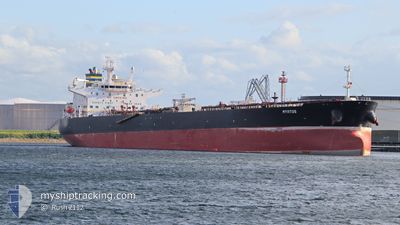
MYRTOS
Crude Oil Tanker
Current Trip
| Time Travelled | 1 day |
|---|---|
| Remaining Time | --- |
| Distance Travelled | 48.34 nm |
| Remaining Distance | --- |
| AVG Speed | 6.8 Noeuds |
| MAX Speed | 12 Noeuds |
| AVG Wind | 11.1 knots |
| MAX Wind | 14 knots |
| MIN Temp | 26.1°C / 78.98°F |
| MAX Temp | 29°C / 84.2°F |
| Tirant d eau | 8.5 m |
| Position reçue | 3 m depuis |
Current Position
| Longitude | 103.89984° |
|---|---|
| Latitude | 1.24997° |
| Etat | At anchor |
| Vitesse | |
| Parcours | 45° |
| Zone | Singapore Strait |
| Station | T-AIS |
| Position reçue | 3 m depuis |
Info
Information
The current position of MYRTOS is in Singapore Strait with coordinates 1.24997° / 103.89984° as reported on 2025-02-14 20:38 by AIS to our vessel tracker app. The vessel's current speed is 0 Noeuds
The vessel MYRTOS (IMO: 9389100, MMSI: 249592000) is a Crude Oil Tanker that was built in 2009 ( 16 Age ). It's sailing under the flag of [MT] Malta.
In this page you can find informations about the vessels current position, last detected port calls, and current voyage information. If the vessels is not in coverage by AIS you will find the latest position.
The current position of MYRTOS is detected by our AIS receivers and we are not responsible for the reliability of the data. The last position was recorded while the vessel was in Coverage by the Ais receivers of our vessel tracking app.
The current draught of MYRTOS as reported by AIS is 8.5 meters
Weather
| Temperature | 26.1°C / 78.98°F |
|---|---|
| Wind Speed | 11 knots |
| Direction | 21° NNE |
| Pressure | 1009.1 hPa |
| Humidity | 85.3 % |
| Cloud Coverage | 56 % |
Featured Company
Last Port Calls
| Port | Arrival | Departure | Time In Port |
|---|---|---|---|
| 2025-02-09 11:33 | 2025-02-13 12:49 | 4 d | |
| 2024-12-27 05:33 | 2024-12-30 04:04 | 2 d |
Most Visited Ports (Last year)
| Port | Arrivals | |
|---|---|---|
| 3 | ||
| 2 | ||
| 2 | ||
| 1 | ||
| 1 | ||
| 1 |
Last Trips
| Origin | Departure | Destination | Arrival | Distance | |
|---|---|---|---|---|---|
| 2024-12-30 04:04 | 2025-02-09 11:33 | 9070.30 nm | |||
| 2024-11-21 18:41 | 2024-12-27 05:33 | 8857.66 nm |
Events
| Heure | Evenement | Détails | Position/ Destination | Info |
|---|---|---|---|---|
| 2025-02-14 08:47 | Etat Changé | At anchor Default |
1.25342 / 103.90270
PEBGC
|
Vitesse: 0.2 kn Parcours: 194° |
| 2025-02-14 08:44 | Etat Changé | Default At anchor |
1.25340 / 103.90258
PEBGC
|
Vitesse: 0.2 kn Parcours: 190° |
| 2025-02-14 06:35 | Etat Changé | At anchor Default |
1.25337 / 103.90024
PEBGC
|
Vitesse: Parcours: 158° |
| 2025-02-14 06:30 | Etat Changé | Default At anchor |
1.25329 / 103.90022
PEBGC
|
Vitesse: Parcours: 158° |
| 2025-02-13 11:47 | Etat Changé | At anchor Default |
1.25291 / 103.90026
PEBGC
|
Vitesse: Parcours: 136° |
| 2025-02-13 11:44 | Etat Changé | Default At anchor |
1.25298 / 103.90028
PEBGC
|
Vitesse: Parcours: 136° |
| 2025-02-13 10:29 | Arret | 2.84 nm, East of SINGAPORE |
1.25339 / 103.90166
PEBGC
|
Vitesse: 0.2 kn Parcours: 193° |
| 2025-02-13 10:20 | Etat Changé | At anchor Under way using engine |
1.25266 / 103.90292
PEBGC
|
Vitesse: 0.8 kn Parcours: 246° |
| 2025-02-13 09:28 | Etat Changé | Under way using engine Moored |
1.24781 / 103.95803
PEBGC
|
Vitesse: 3.7 kn Parcours: 319° |
| 2025-02-13 09:22 | Changement de zone | Singaporean part of the Singapore Strait Indonesian part of the Singapore Strait |
1.24104 / 103.96063
Singapore Strait
PEBGC
|
Vitesse: 5 kn Parcours: 345.1° |