
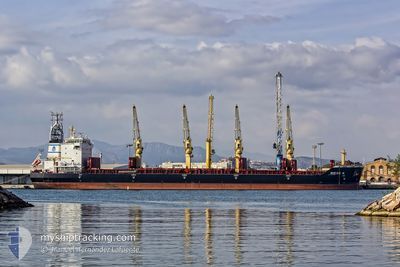
NIKOS N
Bulk Carrier
Current Trip
| Time Travelled | 31 days |
|---|---|
| Remaining Time | 4 h, 20 mins |
| Distance Travelled | 5954.62 nm |
| Remaining Distance | 56.93 nm |
| AVG Speed | 10.1 Noeuds |
| MAX Speed | 22.3 Noeuds |
| AVG Wind | 10.8 knots |
| MAX Wind | 31 knots |
| MIN Temp | 6.6°C / 43.88°F |
| MAX Temp | 19.8°C / 67.64°F |
| Tirant d eau | 12.3 m |
| Position reçue | 2 h, 7 m depuis |
Current Position
| Longitude | -76.16425° |
|---|---|
| Latitude | 37.88717° |
| Etat | Under way using engine |
| Vitesse | 12.6 Noeuds |
| Parcours | 344.6° |
| Zone | North Atlantic Ocean |
| Station | T-AIS |
| Position reçue | 2 h, 7 m depuis |
Info
Information
The current position of NIKOS N is in North Atlantic Ocean with coordinates 37.88717° / -76.16425° as reported on 2025-02-07 00:19 by AIS to our vessel tracker app. The vessel's current speed is 12.6 Noeuds and is heading at the port of BALTIMORE. The estimated time of arrival as calculated by MyShipTracking vessel tracking app is 2025-02-07 06:46 LT
The vessel NIKOS N (IMO: 9412646, MMSI: 538007185) is a Bulk Carrier that was built in 2011 ( 14 Age ). It's sailing under the flag of [MH] Marshall Is.
In this page you can find informations about the vessels current position, last detected port calls, and current voyage information. If the vessels is not in coverage by AIS you will find the latest position.
The current position of NIKOS N is detected by our AIS receivers and we are not responsible for the reliability of the data. The last position was recorded while the vessel was in Coverage by the Ais receivers of our vessel tracking app.
The current draught of NIKOS N as reported by AIS is 12.3 meters
Weather
| Temperature | 6.7°C / 44.06°F |
|---|---|
| Wind Speed | 7 knots |
| Direction | 231° SW |
| Pressure | 1012.8 hPa |
| Humidity | 97.4 % |
| Cloud Coverage | 4 % |
Featured Company
Last Port Calls
| Port | Arrival | Departure | Time In Port |
|---|---|---|---|
| 2025-01-03 02:17 | 2025-01-06 17:39 | 3 d | |
| 2024-12-20 10:02 | 2024-12-23 19:49 | 3 d | |
| 2024-12-17 02:02 | 2024-12-19 16:06 | 2 d | |
| 2024-12-02 06:24 | 2024-12-11 09:41 | 9 d |
Most Visited Ports (Last year)
| Port | Arrivals | |
|---|---|---|
| 2 | ||
| 2 | ||
| 1 | ||
| 1 | ||
| 1 | ||
| 1 |
Last Trips
| Origin | Departure | Destination | Arrival | Distance | |
|---|---|---|---|---|---|
| 2024-12-23 20:49 | 2025-01-03 05:17 | 2767.88 nm | |||
| 2024-12-19 17:06 | 2024-12-20 11:02 | 166.84 nm | |||
| 2024-12-11 10:41 | 2024-12-17 03:02 | 1515.03 nm | |||
| 2024-11-14 10:56 | 2024-12-02 07:24 | 2383.69 nm |
Events
| Heure | Evenement | Détails | Position/ Destination | Info |
|---|---|---|---|---|
| 2025-02-07 00:29 | Etat Changé | Default Under way using engine |
37.92189 / -76.17743
US BAL
|
Vitesse: 12.6 kn Parcours: 344.6° |
| 2025-02-07 00:19 | Etat Changé | Under way using engine Default |
37.88717 / -76.16425
US BAL
|
Vitesse: 12.8 kn Parcours: 5° |
| 2025-02-07 00:19 | Hors de la zone couverte |
37.88717 / -76.16425
North Atlantic Ocean
|
Vitesse: 12.6 kn Parcours: 344.6° |
|
| 2025-02-06 23:33 | Etat Changé | Default Under way using engine |
37.72614 / -76.18063
US BAL
|
Vitesse: 12.7 kn Parcours: 334.4° |
| 2025-02-06 23:19 | Etat Changé | Under way using engine Default |
37.68232 / -76.16188
US BAL
|
Vitesse: 12.2 kn Parcours: 317° |
| 2025-02-06 22:54 | Etat Changé | Default Under way using engine |
37.61603 / -76.09441
US BAL
|
Vitesse: 12.5 kn Parcours: 319.6° |
| 2025-02-06 22:48 | Etat Changé | Under way using engine Default |
37.59905 / -76.07698
US BAL
|
Vitesse: 12.4 kn Parcours: 319° |
| 2025-02-06 22:48 | Dans la zone couverte |
37.60264 / -76.08081
North Atlantic Ocean
US BAL
|
Vitesse: 12.5 kn Parcours: 319.6° |
|
| 2025-02-06 21:07 | Etat Changé | Default Under way using engine |
37.26720 / -76.12318
US BAL
|
Vitesse: 12.6 kn Parcours: 18° |
| 2025-02-06 20:59 | Hors de la zone couverte |
37.24072 / -76.13380
North Atlantic Ocean
US BAL
|
Vitesse: 12.6 kn Parcours: 18° |