
OCEANOGRAF
Other Type
Current Trip
SUR/RESEARCH OPER.
| Time Travelled | 7 h, 42 mins |
|---|---|
| Remaining Time | --- |
| Distance Travelled | 19.54 nm |
| Remaining Distance | --- |
| AVG Speed | 7.5 Noeuds |
| MAX Speed | 9.7 Noeuds |
| AVG Wind | 12 knots |
| MAX Wind | 15 knots |
| MIN Temp | -1.6°C / 29.12°F |
| MAX Temp | 0.5°C / 32.9°F |
| Tirant d eau | 2 m |
| Position reçue | 1 m depuis |
Current Position
| Longitude | 18.85709° |
|---|---|
| Latitude | 54.61829° |
| Etat | Restricted manoeuverability |
| Vitesse | 0.1 Noeuds |
| Parcours | 315° |
| Zone | Baltic Sea |
| Station | T-AIS |
| Position reçue | 1 m depuis |
Info
Information
The current position of OCEANOGRAF is in Baltic Sea with coordinates 54.61829° / 18.85709° as reported on 2025-02-15 19:01 by AIS to our vessel tracker app. The vessel's current speed is 0.1 Noeuds
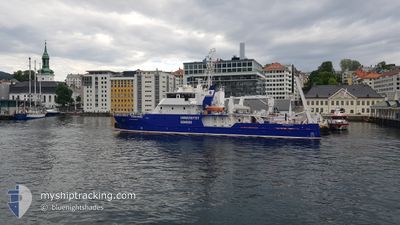
The vessel OCEANOGRAF (IMO: 9776951, MMSI: 261036120) is a Other Type It's sailing under the flag of [PL] Poland.
In this page you can find informations about the vessels current position, last detected port calls, and current voyage information. If the vessels is not in coverage by AIS you will find the latest position.
The current position of OCEANOGRAF is detected by our AIS receivers and we are not responsible for the reliability of the data. The last position was recorded while the vessel was in Coverage by the Ais receivers of our vessel tracking app.
The current draught of OCEANOGRAF as reported by AIS is 2 meters
Weather
| Temperature | -0.1°C / 31.82°F |
|---|---|
| Wind Speed | 13 knots |
| Direction | 304° NW |
| Pressure | 1020.6 hPa |
| Humidity | 62.1 % |
| Cloud Coverage | 98 % |
Featured Company
Last Port Calls
| Port | Arrival | Departure | Time In Port |
|---|---|---|---|
| 2025-02-13 17:23 | 2025-02-15 12:20 | 1 d | |
| 2025-02-10 07:36 | 2025-02-13 08:57 | 3 d | |
| 2025-02-07 19:52 | 2025-02-07 22:20 | 2 h | |
| 2025-02-03 22:48 | 2025-02-04 07:38 | 8 h | |
| 2024-12-12 19:19 | 2025-02-03 11:06 | ||
| 2024-12-11 15:18 | 2024-12-12 07:24 | 16 h | |
| 2024-12-09 07:23 | 2024-12-09 18:06 | 10 h | |
| 2024-12-07 18:56 | 2024-12-07 19:37 | 40 m | |
| 2024-12-07 07:29 | 2024-12-07 12:56 | 5 h | |
| 2024-12-02 14:35 | 2024-12-07 06:22 | 4 d |
Last Trips
| Origin | Departure | Destination | Arrival | Distance | |
|---|---|---|---|---|---|
| 2025-02-13 08:57 | 2025-02-13 17:23 | 32.85 nm | |||
| 2025-02-07 22:20 | 2025-02-10 07:36 | 78.00 nm | |||
| 2025-02-04 07:38 | 2025-02-07 19:52 | 482.84 nm | |||
| 2025-02-03 11:06 | 2025-02-03 22:48 | 52.95 nm | |||
| 2024-12-12 07:24 | 2024-12-12 19:19 | 80.14 nm | |||
| 2024-12-09 18:06 | 2024-12-11 15:18 | 142.70 nm | |||
| 2024-12-07 19:37 | 2024-12-09 07:23 | 105.88 nm | |||
| 2024-12-07 12:56 | 2024-12-07 18:56 | 9.33 nm | |||
| 2024-12-07 06:22 | 2024-12-07 07:29 | 10.20 nm | |||
| 2024-12-02 10:50 | 2024-12-02 14:35 | 2.32 nm |
Events
| Heure | Evenement | Détails | Position/ Destination | Info |
|---|---|---|---|---|
| 2025-02-15 18:49 | Etat Changé | Restricted manoeuverability Under way using engine |
54.61826 / 18.85728
SUR/RESEARCH OPER.
|
Vitesse: Parcours: 316° |
| 2025-02-15 18:39 | Arret | 2.26 nm, North East of HEL |
54.61842 / 18.85741
SUR/RESEARCH OPER.
|
Vitesse: 0.2 kn Parcours: 294° |
| 2025-02-15 17:32 | Etat Changé | Under way using engine Restricted manoeuverability |
54.57517 / 18.63096
SUR/RESEARCH OPER.
|
Vitesse: 9.6 kn Parcours: 85.7° |
| 2025-02-15 17:29 | Démarrage | 3.58 nm, North East of GDYNIA |
54.57422 / 18.61640
SUR/RESEARCH OPER.
|
Vitesse: 3.1 kn Parcours: 63° |
| 2025-02-15 16:40 | Arret | 3.8 nm, North East of GDYNIA |
54.56914 / 18.63066
SUR/RESEARCH OPER.
|
Vitesse: 0.3 kn Parcours: 242° |
| 2025-02-15 15:27 | Démarrage | 3.48 nm, North East of GDYNIA |
54.57045 / 18.61771
SUR/RESEARCH OPER.
|
Vitesse: 5.5 kn Parcours: 285.3° |
| 2025-02-15 12:12 | Etat Changé | Restricted manoeuverability Under way using engine |
54.56992 / 18.62048
SUR/RESEARCH OPER.
|
Vitesse: 0.1 kn Parcours: 318° |
| 2025-02-15 12:04 | Arret | 3.54 nm, North East of GDYNIA |
54.56983 / 18.62075
SUR/RESEARCH OPER.
|
Vitesse: 0.2 kn Parcours: 318° |
| 2025-02-15 11:20 | PORT DE DEPART |
|
54.51600 / 18.56323
SUR/RESEARCH OPER.
|
Vitesse: 5.8 kn Parcours: 101° |
| 2025-02-15 11:16 | Démarrage |
54.52120 / 18.55725
[PL] GDYNIA
|
Vitesse: 3.5 kn Parcours: 104° |