
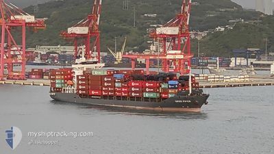
OKEE AURELIA
Cargo
Current Trip
CNSGH
| Time Travelled | 1 day |
|---|---|
| Remaining Time | --- |
| Distance Travelled | 347.41 nm |
| Remaining Distance | --- |
| AVG Speed | 15 Noeuds |
| MAX Speed | 17.2 Noeuds |
| AVG Wind | 11.8 knots |
| MAX Wind | 18.2 knots |
| MIN Temp | 10.9°C / 51.62°F |
| MAX Temp | 16.6°C / 61.88°F |
| Tirant d eau | 5.8 m |
| Position reçue | 17 d depuis |
Current Position
| Longitude | 104.34711° |
|---|---|
| Latitude | 1.29331° |
| Etat | Not under command |
| Vitesse | 4 Noeuds |
| Parcours | 28° |
| Zone | Singapore Strait |
| Station | T-AIS |
| Position reçue | 17 d depuis |
Info
Information
The current position of OKEE AURELIA is in Singapore Strait with coordinates 1.29331° / 104.34711° as reported on 2025-11-29 01:14 by AIS to our vessel tracker app. The vessel's current speed is 4 Noeuds
The vessel OKEE AURELIA (IMO: 934366300, MMSI: 305002000) is a Cargo It's sailing under the flag of [AG] Antigua Barbuda.
In this page you can find informations about the vessels current position, last detected port calls, and current voyage information. If the vessels is not in coverage by AIS you will find the latest position.
The current position of OKEE AURELIA is detected by our AIS receivers and we are not responsible for the reliability of the data. The last position was recorded while the vessel was in Coverage by the Ais receivers of our vessel tracking app.
The current draught of OKEE AURELIA as reported by AIS is 5.8 meters
Weather
| Temperature | 16.7°C / 62.06°F |
|---|---|
| Wind Speed | --- |
| Direction | 223° SW |
| Pressure | 1022.3 hPa |
| Humidity | 53 % |
| Cloud Coverage | 78 % |
Featured Company
Last Port Calls
| Port | Arrival | Departure | Time In Port |
|---|---|---|---|
| 2025-12-15 11:26 | 2025-12-15 20:19 | 8 h | |
| 2025-11-20 15:32 | 2025-11-20 21:28 | 5 h | |
| 2025-11-07 11:31 | 2025-11-08 11:53 | 1 d | |
| 2025-11-06 10:19 | 2025-11-06 18:45 | 8 h | |
| 2025-11-04 21:25 | 2025-11-05 11:04 | 13 h | |
| 2025-11-02 14:51 | 2025-11-03 14:46 | 23 h | |
| 2025-10-29 18:46 | 2025-10-31 12:16 | 1 d | |
| 2025-10-28 06:30 | 2025-10-28 19:47 | 13 h | |
| 2025-10-26 21:48 | 2025-10-27 19:06 | 21 h | |
| 2025-10-25 14:35 | 2025-10-26 12:21 | 21 h |
Last Trips
| Origin | Departure | Destination | Arrival | Distance | |
|---|---|---|---|---|---|
| 2025-11-20 21:28 | 2025-12-15 11:26 | 2511.26 nm | |||
| 2025-11-08 11:53 | 2025-11-20 15:32 | 3356.79 nm | |||
| 2025-11-06 18:45 | 2025-11-07 11:31 | 76.14 nm | |||
| 2025-11-05 11:04 | 2025-11-06 10:19 | 285.73 nm | |||
| 2025-11-03 14:46 | 2025-11-04 21:25 | 286.29 nm | |||
| 2025-10-31 12:16 | 2025-11-02 14:51 | 53.74 nm | |||
| 2025-10-28 19:47 | 2025-10-29 18:46 | 32.39 nm | |||
| 2025-10-27 19:06 | 2025-10-28 06:30 | 35.20 nm | |||
| 2025-10-26 12:21 | 2025-10-26 21:48 | 47.63 nm | |||
| 2025-10-24 11:29 | 2025-10-25 14:35 | 85.21 nm |
Events
| Heure | Evenement | Détails | Position/ Destination | Info |
|---|---|---|---|---|
| 2025-12-15 12:22 | Démarrage | 4.33 nm, South East of SHANGHAI |
31.33005 / 121.67837
CNSGH
|
Vitesse: 6.9 kn Parcours: 106° |
| 2025-12-15 12:19 | PORT DE DEPART |
|
31.33005 / 121.67837
CNSGH
|
Vitesse: Parcours: 306° |
| 2025-12-15 04:04 | Arret |
31.32807 / 121.67233
[CN] SHANGHAI
|
Vitesse: Parcours: 306° |
|
| 2025-12-15 03:26 | Port d'arrivée |
|
31.32903 / 121.67437
[CN] SHANGHAI
|
Vitesse: 3.5 kn Parcours: 275° |
| 2025-12-08 10:46 | Démarrage |
2.04947 / 104.75174
CNSGH
|
Vitesse: 9 kn Parcours: 23° |