
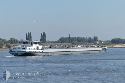
OLGA CAROLINE
Tanker
Current Trip
SCLESSIN ESSO
| Time Travelled | 1 day |
|---|---|
| Remaining Time | --- |
| Distance Travelled | 53.86 nm |
| Remaining Distance | --- |
| AVG Speed | 7.1 Noeuds |
| MAX Speed | 9.5 Noeuds |
| AVG Wind | 6.4 knots |
| MAX Wind | 13.7 knots |
| MIN Temp | 2.3°C / 36.14°F |
| MAX Temp | 3.5°C / 38.3°F |
| Tirant d eau | 2.9 m |
| Position reçue | 46 m depuis |
Current Position
| Longitude | 5.68748° |
|---|---|
| Latitude | 50.79464° |
| Etat | Under way using engine |
| Vitesse | 9 Noeuds |
| Parcours | 340.1° |
| Zone | North Sea |
| Station | T-AIS |
| Position reçue | 46 m depuis |
Info
Information
The current position of OLGA CAROLINE is in North Sea with coordinates 50.79464° / 5.68748° as reported on 2025-02-07 16:22 by AIS to our vessel tracker app. The vessel's current speed is 9 Noeuds
The vessel OLGA CAROLINE (MMSI: 211741810) is a Tanker It's sailing under the flag of [DE] Germany.
In this page you can find informations about the vessels current position, last detected port calls, and current voyage information. If the vessels is not in coverage by AIS you will find the latest position.
The current position of OLGA CAROLINE is detected by our AIS receivers and we are not responsible for the reliability of the data. The last position was recorded while the vessel was in Coverage by the Ais receivers of our vessel tracking app.
The current draught of OLGA CAROLINE as reported by AIS is 2.9 meters
Weather
| Temperature | 3.6°C / 38.48°F |
|---|---|
| Wind Speed | 14 knots |
| Direction | 99° E |
| Pressure | 1022.1 hPa |
| Humidity | 70.9 % |
| Cloud Coverage | 100 % |
Featured Company
Last Port Calls
| Port | Arrival | Departure | Time In Port |
|---|---|---|---|
| 2025-02-05 17:08 | 2025-02-06 06:45 | 13 h | |
| 2025-02-01 09:30 | 2025-02-01 11:35 | 2 h | |
| 2025-01-31 09:11 | 2025-02-01 01:55 | 16 h | |
| 2025-01-31 03:00 | 2025-01-31 08:48 | 5 h | |
| 2025-01-25 17:19 | 2025-01-28 19:09 | 3 d | |
| 2025-01-24 19:14 | 2025-01-25 10:36 | 15 h | |
| 2025-01-23 18:52 | 2025-01-24 11:17 | 16 h | |
| 2025-01-21 04:50 | 2025-01-22 10:20 | 1 d | |
| 2025-01-15 23:51 | 2025-01-17 08:50 | 1 d | |
| 2025-01-15 11:45 | 2025-01-15 16:34 | 4 h |
Most Visited Ports (Last year)
| Port | Arrivals | |
|---|---|---|
| 80 | ||
| 23 | ||
| 17 | ||
| 11 | ||
| 7 | ||
| 3 |
Last Trips
| Origin | Departure | Destination | Arrival | Distance | |
|---|---|---|---|---|---|
| 2025-02-01 12:35 | 2025-02-05 18:08 | 109.47 nm | |||
| 2025-02-01 02:55 | 2025-02-01 10:30 | 55.12 nm | |||
| 2025-01-31 09:48 | 2025-01-31 10:11 | 2.52 nm | |||
| 2025-01-28 20:09 | 2025-01-31 04:00 | 175.73 nm | |||
| 2025-01-25 11:36 | 2025-01-25 18:19 | 50.20 nm | |||
| 2025-01-24 12:17 | 2025-01-24 20:14 | 53.04 nm | |||
| 2025-01-22 11:20 | 2025-01-23 19:52 | 23.75 nm | |||
| 2025-01-17 09:50 | 2025-01-21 05:50 | 107.64 nm | |||
| 2025-01-15 17:34 | 2025-01-16 00:51 | 51.46 nm | |||
| 2025-01-15 09:50 | 2025-01-15 12:45 | 20.76 nm |
Events
| Heure | Evenement | Détails | Position/ Destination | Info |
|---|---|---|---|---|
| 2025-02-07 16:20 | Dans la zone couverte |
50.79464 / 5.68748
North Sea
|
Vitesse: 9 kn Parcours: 340.1° |
|
| 2025-02-06 18:51 | Hors de la zone couverte |
50.78902 / 5.68869
North Sea
SCLESSIN ESSO
|
Vitesse: 7.5 kn Parcours: 177.1° |
|
| 2025-02-06 18:48 | Dans la zone couverte |
50.79252 / 5.68790
North Sea
SCLESSIN ESSO
|
Vitesse: 8.3 kn Parcours: 167.3° |
|
| 2025-02-06 09:02 | Hors de la zone couverte |
51.17825 / 4.77144
North Sea
SCLESSIN ESSO
|
Vitesse: 7.5 kn Parcours: 96.1° |
|
| 2025-02-06 07:38 | Démarrage | 1.11 nm, South East of WIJNEGEM |
51.22624 / 4.53830
SCLESSIN ESSO
|
Vitesse: 3.7 kn Parcours: 118.3° |
| 2025-02-06 07:36 | Etat Changé | Under way using engine Moored |
51.22696 / 4.53595
SCLESSIN ESSO
|
Vitesse: Parcours: 511° |
| 2025-02-06 07:34 | Etat Changé | Moored Under way using engine |
51.22706 / 4.53556
SCLESSIN ESSO
|
Vitesse: Parcours: 511° |
| 2025-02-06 07:13 | Arret | 0.99 nm, South East of WIJNEGEM |
51.22711 / 4.53537
SCLESSIN ESSO
|
Vitesse: Parcours: 511° |
| 2025-02-06 06:45 | PORT DE DEPART |
|
51.24042 / 4.48677
SCLESSIN ESSO
|
Vitesse: 4.9 kn Parcours: 88.4° |
| 2025-02-06 05:50 | Démarrage |
51.24842 / 4.37403
[BE] ANTWERP
|
Vitesse: 4.5 kn Parcours: 97.7° |