
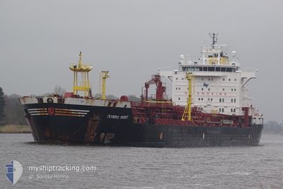
OLYMPIC SPIRIT
Oil/Chemical Tanker
Current Trip
| Time Travelled | 12 h, 52 mins |
|---|---|
| Remaining Time | --- |
| Distance Travelled | 118.96 nm |
| Remaining Distance | --- |
| AVG Speed | 11.5 Noeuds |
| MAX Speed | 12.6 Noeuds |
| AVG Wind | 5.3 knots |
| MAX Wind | 11 knots |
| MIN Temp | 10.6°C / 51.08°F |
| MAX Temp | 13.5°C / 56.3°F |
| Tirant d eau | 6.8 m |
| Position reçue | 2 h, 21 m depuis |
Current Position
| Longitude | 7.74458° |
|---|---|
| Latitude | 42.43632° |
| Etat | Under way using engine |
| Vitesse | 11.1 Noeuds |
| Parcours | 198.9° |
| Zone | Mediterranean Sea - Western Basin |
| Station | T-AIS |
| Position reçue | 2 h, 21 m depuis |
Info
Information
The current position of OLYMPIC SPIRIT is in Mediterranean Sea - Western Basin with coordinates 42.43632° / 7.74458° as reported on 2025-02-11 20:47 by AIS to our vessel tracker app. The vessel's current speed is 11.1 Noeuds and is heading at the port of BEJAIA. The estimated time of arrival as calculated by MyShipTracking vessel tracking app is 2025-02-13 07:00 LT
The vessel OLYMPIC SPIRIT (IMO: 9327097, MMSI: 636022387) is a Oil/Chemical Tanker that was built in 2005 ( 20 Age ). It's sailing under the flag of [LR] Liberia.
In this page you can find informations about the vessels current position, last detected port calls, and current voyage information. If the vessels is not in coverage by AIS you will find the latest position.
The current position of OLYMPIC SPIRIT is detected by our AIS receivers and we are not responsible for the reliability of the data. The last position was recorded while the vessel was in Coverage by the Ais receivers of our vessel tracking app.
The current draught of OLYMPIC SPIRIT as reported by AIS is 6.8 meters
Weather
| Temperature | 13.4°C / 56.12°F |
|---|---|
| Wind Speed | 11 knots |
| Direction | 158° SSE |
| Pressure | 1021.4 hPa |
| Humidity | 84.1 % |
| Cloud Coverage | 100 % |
Featured Company
Last Port Calls
| Port | Arrival | Departure | Time In Port |
|---|---|---|---|
| 2025-02-10 13:00 | 2025-02-11 11:17 | 22 h | |
| 2025-02-06 07:25 | 2025-02-10 04:37 | 3 d | |
| 2025-01-27 08:35 | 2025-01-27 17:52 | 9 h | |
| 2025-01-01 21:21 | 2025-01-03 08:25 | 1 d | |
| 2024-12-28 22:33 | 2024-12-30 19:37 | 1 d | |
| 2024-12-14 23:21 | 2024-12-18 16:07 | 3 d | |
| 2024-12-02 20:16 |
Most Visited Ports (Last year)
| Port | Arrivals | |
|---|---|---|
| 2 | ||
| 2 | ||
| 2 | ||
| 1 | ||
| 1 | ||
| 1 |
Last Trips
| Origin | Departure | Destination | Arrival | Distance | |
|---|---|---|---|---|---|
| 2025-02-10 04:37 | 2025-02-10 13:00 | 92.80 nm | |||
| 2025-01-03 08:25 | 2025-02-06 07:25 | 7015.67 nm | |||
| 2025-01-03 08:25 | 2025-01-27 08:35 | 5430.94 nm | |||
| 2024-12-30 19:37 | 2025-01-01 21:21 | 402.57 nm | |||
| 2024-12-18 16:07 | 2024-12-28 22:33 | 2514.16 nm | |||
| 2024-12-02 20:16 | 2024-12-14 23:21 | 2412.82 nm |
Events
| Heure | Evenement | Détails | Position/ Destination | Info |
|---|---|---|---|---|
| 2025-02-11 20:47 | Hors de la zone couverte |
42.43632 / 7.74458
Mediterranean Sea - Western Basin
DZ BJA
|
Vitesse: 11.1 kn Parcours: 198.9° |
|
| 2025-02-11 19:34 | Etat Changé | Under way using engine Default |
42.65077 / 7.84496
DZ BJA
|
Vitesse: 11.3 kn Parcours: 203° |
| 2025-02-11 19:34 | Dans la zone couverte |
42.64547 / 7.84225
Mediterranean Sea - Western Basin
DZ BJA
|
Vitesse: 11.1 kn Parcours: 200.8° |
|
| 2025-02-11 18:18 | Etat Changé | Default Under way using engine |
42.87485 / 7.96019
DZ BJA
|
Vitesse: 11.1 kn Parcours: 199.4° |
| 2025-02-11 18:16 | Hors de la zone couverte |
42.88069 / 7.96302
Mediterranean Sea - Western Basin
DZ BJA
|
Vitesse: 11.1 kn Parcours: 199.4° |
|
| 2025-02-11 16:58 | Detecté en mer | French part of the Mediterranean Sea - Western Basin |
43.11335 / 8.07043
Mediterranean Sea - Western Basin
DZ BJA
|
Vitesse: 11.4 kn Parcours: 200.1° |
| 2025-02-11 16:16 | Changement d'ETA | 2025/02/13 06:00 2025/02/13 00:02 |
43.23618 / 8.13351
DZ BJA
|
Vitesse: 10.9 kn Parcours: 200.4° |
| 2025-02-11 14:52 | Changement de zone | Italian part of the Mediterranean Sea - Western Basin Italian part of the Ligurian Sea |
43.48247 / 8.25189
Mediterranean Sea - Western Basin
DZ BJA
|
Vitesse: 11 kn Parcours: 200° |
| 2025-02-11 14:52 | Etat Changé | Under way using engine Default |
43.48247 / 8.25189
DZ BJA
|
Vitesse: 11.4 kn Parcours: 200° |
| 2025-02-11 14:44 | Etat Changé | Default Under way using engine |
43.50557 / 8.26329
DZ BJA
|
Vitesse: 11.2 kn Parcours: 199.3° |