

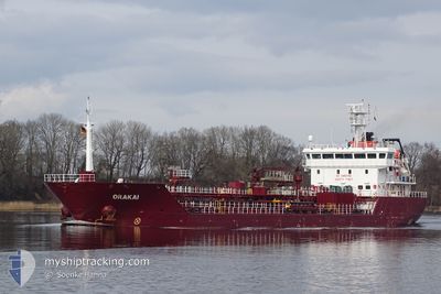
ORAKAI
Oil/Chemical Tanker

Current Trip
| Time Travelled | 3 days |
|---|---|
| Remaining Time | 17 h, 32 mins |
| Distance Travelled | 729.01 nm |
| Remaining Distance | 187.98 nm |
| AVG Speed | 10.2 Noeuds |
| MAX Speed | 11.9 Noeuds |
| AVG Wind | 13 knots |
| MAX Wind | 21 knots |
| MIN Temp | 18.2°C / 64.76°F |
| MAX Temp | 22.3°C / 72.14°F |
| Tirant d eau | 7.3 m |
| Position reçue | 2 m depuis |
Current Position
| Longitude | 0.24588° |
|---|---|
| Latitude | 36.82590° |
| Etat | Under way using engine |
| Vitesse | 10.7 Noeuds |
| Parcours | 258.8° |
| Zone | Mediterranean Sea - Western Basin |
| Station | T-AIS |
| Position reçue | 2 m depuis |
Information
The current position of ORAKAI is in Mediterranean Sea - Western Basin with coordinates 36.82590° / 0.24588° as reported on 2025-05-25 22:44 by AIS to our vessel tracker app. The vessel's current speed is 10.7 Noeuds and is heading at the port of MOTRIL. The estimated time of arrival as calculated by MyShipTracking vessel tracking app is 2025-05-26 18:19 LT
The vessel ORAKAI (IMO: 9402689, MMSI: 255806225) is a Oil/Chemical Tanker that was built in 2008 ( 17 Age ). It's sailing under the flag of [PT] Portugal.
In this page you can find informations about the vessels current position, last detected port calls, and current voyage information. If the vessels is not in coverage by AIS you will find the latest position.
The current position of ORAKAI is detected by our AIS receivers and we are not responsible for the reliability of the data. The last position was recorded while the vessel was in Coverage by the Ais receivers of our vessel tracking app.
The current draught of ORAKAI as reported by AIS is 7.3 meters
Weather
| Temperature | 20.8°C / 69.44°F |
|---|---|
| Wind Speed | 11 knots |
| Direction | 100° E |
| Pressure | 1018.8 hPa |
| Humidity | 67.6 % |
| Cloud Coverage | --- |


Featured Company
Last Port Calls
| Port | Arrival | Departure | Time In Port |
|---|---|---|---|
| 2025-05-22 18:42 | 2025-05-22 23:45 | 5 h | |
| 2025-05-17 09:34 | 2025-05-19 05:38 | 1 d | |
| 2025-05-11 10:09 | 2025-05-12 21:50 | 1 d | |
| 2025-05-07 22:41 | 2025-05-07 23:57 | 1 h | |
| 2025-05-05 18:26 | 2025-05-07 04:57 | 1 d | |
| 2025-04-29 19:43 | 2025-05-01 01:22 | 1 d | |
| 2025-04-28 11:18 | 2025-04-29 06:09 | 18 h | |
| 2025-04-24 04:04 | 2025-04-26 05:35 | 2 d | |
| 2025-04-20 23:56 | 2025-04-21 23:38 | 23 h | |
| 2025-04-20 09:43 | 2025-04-20 23:26 | 13 h |
Last Trips
| Origin | Departure | Destination | Arrival | Distance | |
|---|---|---|---|---|---|
| 2025-05-19 05:38 | 2025-05-22 18:42 | 910.28 nm | |||
| 2025-05-12 21:50 | 2025-05-17 09:34 | 162.75 nm | |||
| 2025-05-07 23:57 | 2025-05-11 10:09 | 745.80 nm | |||
| 2025-05-07 04:57 | 2025-05-07 22:41 | 142.93 nm | |||
| 2025-05-01 01:22 | 2025-05-05 18:26 | 1161.37 nm | |||
| 2025-04-29 06:09 | 2025-04-29 19:43 | 104.79 nm | |||
| 2025-04-26 05:35 | 2025-04-28 11:18 | 633.31 nm | |||
| 2025-04-21 23:38 | 2025-04-24 04:04 | 592.09 nm | |||
| 2025-04-20 23:26 | 2025-04-20 23:56 | 3.38 nm | |||
| 2025-04-06 16:10 | 2025-04-20 09:43 | 1206.95 nm |
Events
| Heure | Evenement | Détails | Position/ Destination | Info |
|---|---|---|---|---|
| 2025-05-25 16:13 | Changement d'ETA | 2025/05/26 20:00 2025/05/26 13:00 |
37.05106 / 1.68709
ESMOT
|
Vitesse: 10.7 kn Parcours: 259.5° |
| 2025-05-25 15:48 | Etat Changé | Under way using engine Default |
37.06346 / 1.78181
ESMOT
|
Vitesse: 11 kn Parcours: 260° |
| 2025-05-25 15:30 | Etat Changé | Default Under way using engine |
37.07209 / 1.84772
ESMOT
|
Vitesse: 11 kn Parcours: 262.3° |
| 2025-05-25 15:16 | Etat Changé | Under way using engine Default |
37.07858 / 1.90244
ESMOT
|
Vitesse: 11.1 kn Parcours: 262° |
| 2025-05-25 15:02 | Dans la zone couverte |
37.07858 / 1.90244
Mediterranean Sea - Western Basin
ESMOT
|
Vitesse: 11.1 kn Parcours: 262° |
|
| 2025-05-25 11:12 | Etat Changé | Default Under way using engine |
37.21184 / 2.86718
ESMOT
|
Vitesse: 11.9 kn Parcours: 265.2° |
| 2025-05-25 11:08 | Hors de la zone couverte |
37.21399 / 2.88220
Mediterranean Sea - Western Basin
ESMOT
|
Vitesse: 11.9 kn Parcours: 265.2° |
|
| 2025-05-25 10:52 | Etat Changé | Under way using engine Default |
37.22292 / 2.94598
ESMOT
|
Vitesse: 11.8 kn Parcours: 266° |
| 2025-05-25 10:30 | Etat Changé | Default Under way using engine |
37.22995 / 3.03763
ESMOT
|
Vitesse: 11.7 kn Parcours: 266.1° |
| 2025-05-25 10:25 | Changement de zone | Algerian part of the Mediterranean Sea - Western Basin Italian part of the Mediterranean Sea - Eastern Basin |
37.23098 / 3.05605
Mediterranean Sea - Western Basin
ESMOT
|
Vitesse: 11.7 kn Parcours: 265.7° |