
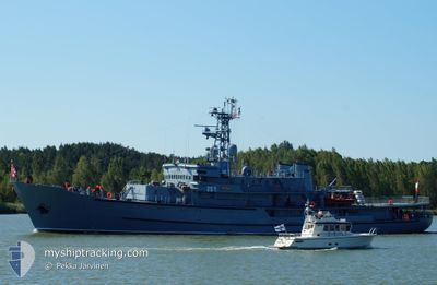
ORP WODNIK
Military ops
Current Trip
| Time Travelled | 17 h, 9 mins |
|---|---|
| Remaining Time | 12 h, 26 mins |
| Distance Travelled | 163.00 nm |
| Remaining Distance | 138.94 nm |
| AVG Speed | 11 Noeuds |
| MAX Speed | 12.3 Noeuds |
| AVG Wind | 22 knots |
| MAX Wind | 24.1 knots |
| MIN Temp | 2.5°C / 36.5°F |
| MAX Temp | 3.5°C / 38.3°F |
| Tirant d eau | 4.2 m |
| Position reçue | 1 m depuis |
Current Position
| Longitude | 15.62836° |
|---|---|
| Latitude | 55.62500° |
| Etat | Under way using engine |
| Vitesse | 11.3 Noeuds |
| Parcours | 74.9° |
| Zone | Baltic Sea |
| Station | T-AIS |
| Position reçue | 1 m depuis |
Info
Information
The current position of ORP WODNIK is in Baltic Sea with coordinates 55.62500° / 15.62836° as reported on 2025-02-11 06:06 by AIS to our vessel tracker app. The vessel's current speed is 11.3 Noeuds and is heading at the port of HEL. The estimated time of arrival as calculated by MyShipTracking vessel tracking app is 2025-02-11 18:34 LT
The vessel ORP WODNIK (IMO: 8642828, MMSI: 261213000) is a Military ops It's sailing under the flag of [PL] Poland.
In this page you can find informations about the vessels current position, last detected port calls, and current voyage information. If the vessels is not in coverage by AIS you will find the latest position.
The current position of ORP WODNIK is detected by our AIS receivers and we are not responsible for the reliability of the data. The last position was recorded while the vessel was in Coverage by the Ais receivers of our vessel tracking app.
The current draught of ORP WODNIK as reported by AIS is 4.2 meters
Weather
| Temperature | 2.3°C / 36.14°F |
|---|---|
| Wind Speed | 19 knots |
| Direction | 92° E |
| Pressure | 1037.9 hPa |
| Humidity | 72.9 % |
| Cloud Coverage | 7 % |
Featured Company
Last Port Calls
| Port | Arrival | Departure | Time In Port |
|---|---|---|---|
| 2025-02-08 07:45 | 2025-02-10 12:59 | 2 d |
Most Visited Ports (Last year)
| Port | Arrivals | |
|---|---|---|
| 2 | ||
| 1 | ||
| 1 | ||
| 1 | ||
| 1 | ||
| 1 |
Last Trips
| Origin | Departure | Destination | Arrival | Distance |
|---|
Events
| Heure | Evenement | Détails | Position/ Destination | Info |
|---|---|---|---|---|
| 2025-02-11 05:34 | Changement de zone | Swedish part of the Baltic Sea Danish part of the Kattegat |
55.59776 / 15.46280
Baltic Sea
HEL
|
Vitesse: 10.8 kn Parcours: 74.1° |
| 2025-02-10 23:26 | Changement de zone | Danish part of the Kattegat German part of the Baltic Sea |
54.92778 / 14.04961
Kattegat
HEL
|
Vitesse: 10.4 kn Parcours: 24.8° |
| 2025-02-10 20:50 | Detecté en mer | German part of the Baltic Sea |
54.64051 / 14.43078
Baltic Sea
HEL
|
Vitesse: 11.5 kn Parcours: 269.4° |
| 2025-02-10 20:01 | Changement de destination | HEL SWINOUJSCIE |
54.64439 / 14.70195
HEL
|
Vitesse: 11.6 kn Parcours: 270.5° |
| 2025-02-10 20:01 | Changement d'ETA | 2025/02/12 08:00 2025/02/08 08:00 |
54.64439 / 14.70195
HEL
|
Vitesse: 11.6 kn Parcours: 270.5° |
| 2025-02-10 19:44 | Changement de zone | Danish part of the Kattegat Polish part of the Baltic Sea |
54.64678 / 14.79722
Kattegat
|
Vitesse: 11.3 kn Parcours: 273.8° |
| 2025-02-10 19:43 | Dans la zone couverte |
54.64678 / 14.79722
Kattegat
|
Vitesse: 11.3 kn Parcours: 273.8° |
|
| 2025-02-10 14:02 | Etat Changé | Default Under way using engine |
54.04837 / 14.40500
SWINOUJSCIE
|
Vitesse: 11 kn Parcours: 61.9° |
| 2025-02-10 13:42 | Hors de la zone couverte |
54.02031 / 14.31291
Baltic Sea
|
Vitesse: 11 kn Parcours: 61.9° |
|
| 2025-02-10 13:25 | Changement de zone | Polish part of the Baltic Sea Swedish part of the Baltic Sea |
53.98801 / 14.25858
Baltic Sea
|
Vitesse: 11.3 kn Parcours: 348.6° |