

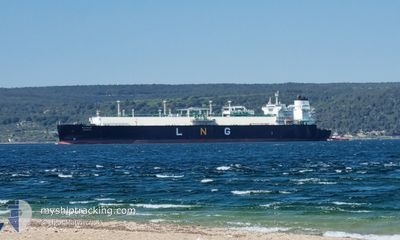
OUGARTA
Tanker D

Current Trip
KUMKALE
| Time Travelled | 2 days |
|---|---|
| Remaining Time | --- |
| Distance Travelled | 1047.78 nm |
| Remaining Distance | --- |
| AVG Speed | 16.1 Noeuds |
| MAX Speed | 18.1 Noeuds |
| AVG Wind | 7.9 knots |
| MAX Wind | 13.9 knots |
| MIN Temp | 19.3°C / 66.74°F |
| MAX Temp | 30.6°C / 87.08°F |
| Tirant d eau | 11.6 m |
| Position reçue | 20 m depuis |
Current Position
| Longitude | 20.46975° |
|---|---|
| Latitude | 36.15387° |
| Etat | Under way using engine |
| Vitesse | 10.9 Noeuds |
| Parcours | 92.6° |
| Zone | Mediterranean Sea - Eastern Basin |
| Station | T-AIS |
| Position reçue | 20 m depuis |
Information
The current position of OUGARTA is in Mediterranean Sea - Eastern Basin with coordinates 36.15387° / 20.46975° as reported on 2025-06-01 05:54 by AIS to our vessel tracker app. The vessel's current speed is 10.9 Noeuds
The vessel OUGARTA (IMO: 9761267, MMSI: 605076070) is a Tanker D It's sailing under the flag of [DZ] Algeria.
In this page you can find informations about the vessels current position, last detected port calls, and current voyage information. If the vessels is not in coverage by AIS you will find the latest position.
The current position of OUGARTA is detected by our AIS receivers and we are not responsible for the reliability of the data. The last position was recorded while the vessel was in Coverage by the Ais receivers of our vessel tracking app.
The current draught of OUGARTA as reported by AIS is 11.6 meters
Weather
| Temperature | 20.8°C / 69.44°F |
|---|---|
| Wind Speed | 10 knots |
| Direction | 343° NNW |
| Pressure | 1019.2 hPa |
| Humidity | 75.6 % |
| Cloud Coverage | 2 % |


Featured Company
Last Port Calls
| Port | Arrival | Departure | Time In Port |
|---|---|---|---|
| 2025-05-28 08:32 | 2025-05-29 10:59 | 1 d | |
| 2025-05-28 05:55 | 2025-05-28 07:23 | 1 h | |
| 2025-05-24 06:38 | 2025-05-25 09:43 | 1 d | |
| 2025-05-21 05:45 | 2025-05-22 14:12 | 1 d | |
| 2025-05-11 21:42 | 2025-05-12 23:09 | 1 d | |
| 2025-05-04 10:09 | 2025-05-05 17:03 | 1 d | |
| 2025-04-25 06:07 | 2025-04-26 07:27 | 1 d | |
| 2025-04-18 10:08 | 2025-04-19 17:53 | 1 d | |
| 2025-04-11 11:14 | 2025-04-12 18:57 | 1 d | |
| 2025-04-08 10:20 | 2025-04-10 10:56 | 2 d |
Last Trips
| Origin | Departure | Destination | Arrival | Distance | |
|---|---|---|---|---|---|
| 2025-05-28 08:23 | 2025-05-28 09:32 | 2.98 nm | |||
| 2025-05-25 11:43 | 2025-05-28 06:55 | 573.81 nm | |||
| 2025-05-22 15:12 | 2025-05-24 08:38 | 609.79 nm | |||
| 2025-05-13 00:09 | 2025-05-21 06:45 | 1893.95 nm | |||
| 2025-05-05 18:03 | 2025-05-11 22:42 | 1671.12 nm | |||
| 2025-04-26 09:27 | 2025-05-04 11:09 | 1831.31 nm | |||
| 2025-04-19 18:53 | 2025-04-25 08:07 | 1765.69 nm | |||
| 2025-04-12 20:57 | 2025-04-18 11:08 | 1194.05 nm | |||
| 2025-04-10 11:56 | 2025-04-11 13:14 | 351.57 nm | |||
| 2025-03-25 23:24 | 2025-04-08 11:20 | 2350.79 nm |
Events
| Heure | Evenement | Détails | Position/ Destination | Info |
|---|---|---|---|---|
| 2025-06-01 05:55 | Etat Changé | Default Under way using engine |
36.15373 / 20.47345
KUMKALE
|
Vitesse: 10.9 kn Parcours: 92.6° |
| 2025-06-01 05:34 | Etat Changé | Under way using engine Default |
36.15678 / 20.39450
KUMKALE
|
Vitesse: 10.9 kn Parcours: 93° |
| 2025-06-01 05:14 | Etat Changé | Default Under way using engine |
36.16036 / 20.32056
KUMKALE
|
Vitesse: 11 kn Parcours: 92.1° |
| 2025-06-01 04:57 | Etat Changé | Under way using engine Default |
36.16318 / 20.25571
KUMKALE
|
Vitesse: 11 kn Parcours: 93° |
| 2025-06-01 04:12 | Etat Changé | Default Under way using engine |
36.17014 / 20.08723
KUMKALE
|
Vitesse: 11 kn Parcours: 93.2° |
| 2025-06-01 04:04 | Etat Changé | Under way using engine Default |
36.17150 / 20.05576
KUMKALE
|
Vitesse: 11 kn Parcours: 93° |
| 2025-06-01 03:17 | Etat Changé | Default Under way using engine |
36.18267 / 19.87588
KUMKALE
|
Vitesse: 11 kn Parcours: 95° |
| 2025-06-01 03:15 | Etat Changé | Under way using engine Default |
36.18295 / 19.87216
KUMKALE
|
Vitesse: 11 kn Parcours: 95° |
| 2025-06-01 03:11 | Dans la zone couverte |
36.18295 / 19.87216
Mediterranean Sea - Eastern Basin
KUMKALE
|
Vitesse: 11 kn Parcours: 95° |
|
| 2025-06-01 00:05 | Hors de la zone couverte |
36.20978 / 19.18037
Mediterranean Sea - Eastern Basin
KUMKALE
|
Vitesse: 10.3 kn Parcours: 94.1° |