
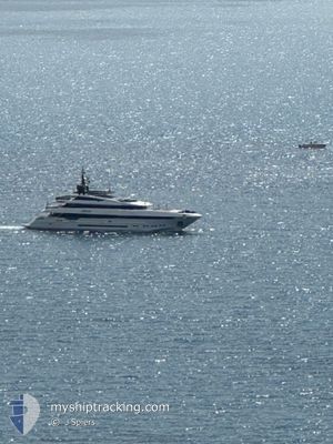
PARAMJAMUNA IV
Pleasure Craft
Current Trip
| Trip Time | 4 h, 15 mins |
|---|---|
| Trip Distance | 63.50 nm |
| AVG Speed | 13.3 Noeuds |
| MAX Speed | 19.6 Noeuds |
| Tirant d eau | 3 m |
| AVG Wind | 4.4 knots |
| MAX Wind | 9 knots |
| MIN Temp | 9.9°C / 49.82°F |
| MAX Temp | 12.9°C / 55.22°F |
| Position reçue | 21 h, 30 m depuis |
Current Position
| Longitude | 5.90459° |
|---|---|
| Latitude | 43.10335° |
| Etat | Moored |
| Vitesse | 0.2 Noeuds |
| Parcours | 33° |
| Zone | Mediterranean Sea - Western Basin |
| Station | T-AIS |
| Position reçue | 21 h, 30 m depuis |
Info
Information
The current position of PARAMJAMUNA IV is in Mediterranean Sea - Western Basin with coordinates 43.10335° / 5.90459° as reported on 2025-02-28 08:07 by AIS to our vessel tracker app. The vessel's current speed is 0.2 Noeuds and is currently inside the port of LA SEYNE-SUR-MER.
The vessel PARAMJAMUNA IV (MMSI: 229886000) is a Pleasure Craft It's sailing under the flag of [MT] Malta.
In this page you can find informations about the vessels current position, last detected port calls, and current voyage information. If the vessels is not in coverage by AIS you will find the latest position.
The current position of PARAMJAMUNA IV is detected by our AIS receivers and we are not responsible for the reliability of the data. The last position was recorded while the vessel was in Coverage by the Ais receivers of our vessel tracking app.
The current draught of PARAMJAMUNA IV as reported by AIS is 3 meters
Weather
| Temperature | 12.1°C / 53.78°F |
|---|---|
| Wind Speed | 6 knots |
| Direction | 68° ENE |
| Pressure | 1017.9 hPa |
| Humidity | 66.5 % |
| Cloud Coverage | 24 % |
Featured Company
Last Port Calls
| Port | Arrival | Departure | Time In Port |
|---|---|---|---|
| 2025-01-18 11:31 | |||
| 2025-01-18 07:16 |
Most Visited Ports (Last year)
| Port | Arrivals | |
|---|---|---|
| 32 | ||
| 10 | ||
| 3 | ||
| 2 | ||
| 1 |
Last Trips
| Origin | Departure | Destination | Arrival | Distance | |
|---|---|---|---|---|---|
| 2025-01-18 08:16 | 2025-01-18 12:31 | 63.50 nm |
Events
| Heure | Evenement | Détails | Position/ Destination | Info |
|---|---|---|---|---|
| 2025-02-28 08:07 | Hors de la zone couverte |
43.10335 / 5.90459
Mediterranean Sea - Western Basin
[FR] LA SEYNE-SUR-MER
|
Vitesse: 0.2 kn Parcours: 202° |
|
| 2025-02-28 06:25 | Dans la zone couverte |
43.10355 / 5.90451
Mediterranean Sea - Western Basin
[FR] LA SEYNE-SUR-MER
|
Vitesse: Parcours: 285° |
|
| 2025-02-27 14:07 | Hors de la zone couverte |
43.10354 / 5.90450
Mediterranean Sea - Western Basin
[FR] LA SEYNE-SUR-MER
|
Vitesse: Parcours: 159° |
|
| 2025-02-27 13:52 | Etat Changé | Moored Under way using engine |
43.10354 / 5.90451
[FR] LA SEYNE-SUR-MER
|
Vitesse: 0.1 kn Parcours: 213° |
| 2025-02-27 13:35 | Etat Changé | Under way using engine Moored |
43.10355 / 5.90451
[FR] LA SEYNE-SUR-MER
|
Vitesse: 0.3 kn Parcours: 211° |
| 2025-02-27 12:35 | Changement d'ETA | 2025/02/27 18:00 2025/02/27 17:40 |
43.10354 / 5.90451
[FR] LA SEYNE-SUR-MER
|
Vitesse: Parcours: 213° |
| 2025-02-27 11:15 | Dans la zone couverte |
43.10359 / 5.90449
Mediterranean Sea - Western Basin
[FR] LA SEYNE-SUR-MER
|
Vitesse: Parcours: 41.9° |
|
| 2025-02-27 11:08 | Changement de destination | CANNES TOULON |
43.10357 / 5.90453
[FR] LA SEYNE-SUR-MER
|
Vitesse: Parcours: 214° |
| 2025-02-27 11:08 | Changement d'ETA | 2025/02/27 17:40 2026/01/18 12:10 |
43.10357 / 5.90453
[FR] LA SEYNE-SUR-MER
|
Vitesse: Parcours: 214° |
| 2025-02-24 07:44 | Changement d'ETA | 2026/01/18 12:10 2025/01/18 12:10 |
43.10357 / 5.90453
[FR] LA SEYNE-SUR-MER
|
Vitesse: Parcours: 214° |