
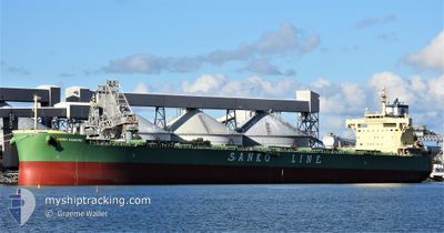
PEAK HAKU
Cargo
Current Trip
| Trip Time | 54 days |
|---|---|
| Trip Distance | 6707.06 nm |
| AVG Speed | 9.9 Noeuds |
| MAX Speed | 16 Noeuds |
| Tirant d eau | 14.6 m |
| AVG Wind | 14.6 knots |
| MAX Wind | 32.8 knots |
| MIN Temp | 1.6°C / 34.88°F |
| MAX Temp | 30.8°C / 87.44°F |
| Position reçue | 7 d depuis |
Current Position
| Longitude | 103.43320° |
|---|---|
| Latitude | 1.23587° |
| Etat | Under way using engine |
| Vitesse | 12 Noeuds |
| Parcours | 290.1° |
| Zone | Malacca Strait |
| Station | T-AIS |
| Position reçue | 7 d depuis |
Info
Information
The current position of PEAK HAKU is in Malacca Strait with coordinates 1.23587° / 103.43320° as reported on 2025-02-06 04:01 by AIS to our vessel tracker app. The vessel's current speed is 12 Noeuds and is currently inside the port of KRISHNAPATNAM.
The vessel PEAK HAKU (IMO: 9888467, MMSI: 636019190) is a Cargo It's sailing under the flag of [LR] Liberia.
In this page you can find informations about the vessels current position, last detected port calls, and current voyage information. If the vessels is not in coverage by AIS you will find the latest position.
The current position of PEAK HAKU is detected by our AIS receivers and we are not responsible for the reliability of the data. The last position was recorded while the vessel was in Coverage by the Ais receivers of our vessel tracking app.
The current draught of PEAK HAKU as reported by AIS is 14.6 meters
Weather
| Temperature | 26.5°C / 79.7°F |
|---|---|
| Wind Speed | 10 knots |
| Direction | 141° SE |
| Pressure | 1011.6 hPa |
| Humidity | 61.1 % |
| Cloud Coverage | 50 % |
Featured Company
Last Port Calls
| Port | Arrival | Departure | Time In Port |
|---|---|---|---|
| 2025-02-12 21:11 | |||
| 2024-12-16 16:08 | 2024-12-20 07:00 | 3 d |
Most Visited Ports (Last year)
| Port | Arrivals | |
|---|---|---|
| 2 | ||
| 2 | ||
| 1 | ||
| 1 | ||
| 1 | ||
| 1 |
Last Trips
| Origin | Departure | Destination | Arrival | Distance | |
|---|---|---|---|---|---|
| 2024-12-20 07:00 | 2025-02-12 21:11 | 6707.06 nm | |||
| 2024-11-16 15:38 | 2024-12-16 16:08 | 4144.57 nm |
Events
| Heure | Evenement | Détails | Position/ Destination | Info |
|---|---|---|---|---|
| 2025-02-12 16:25 | Arret |
14.25321 / 80.12907
[IN] KRISHNAPATNAM
|
Vitesse: Parcours: 33° |
|
| 2025-02-12 15:41 | Port d'arrivée |
|
14.24817 / 80.14415
[IN] KRISHNAPATNAM
|
Vitesse: 5.8 kn Parcours: 265° |
| 2025-02-12 14:01 | Démarrage | 7.03 nm, East of KRISHNAPATNAM |
14.23941 / 80.26240
SGSIN-INKRI
|
Vitesse: 3.3 kn Parcours: 25° |
| 2025-02-12 02:57 | Arret | 6.91 nm, East of KRISHNAPATNAM |
14.23317 / 80.25966
SGSIN-INKRI
|
Vitesse: 0.1 kn Parcours: 347° |
| 2025-02-06 04:01 | Etat Changé | Default Under way using engine |
1.23666 / 103.43100
SGSIN-INKRI
|
Vitesse: 12 kn Parcours: 290.1° |
| 2025-02-06 04:01 | Hors de la zone couverte |
1.23587 / 103.43320
Malacca Strait
SGSIN-INKRI
|
Vitesse: 12 kn Parcours: 290.1° |
|
| 2025-02-06 03:53 | Changement de zone | Malaysian part of the Malacca Strait Malaysian part of the Singapore Strait |
1.22708 / 103.45561
Malacca Strait
SGSIN-INKRI
|
Vitesse: 11.9 kn Parcours: 290.5° |
| 2025-02-06 03:13 | Changement de zone | Malaysian part of the Singapore Strait Indonesian part of the Singapore Strait |
1.19449 / 103.58164
Singapore Strait
SGSIN-INKRI
|
Vitesse: 11 kn Parcours: 277° |
| 2025-02-06 02:29 | Changement de zone | Indonesian part of the Singapore Strait Singaporean part of the Singapore Strait |
1.15183 / 103.70718
Singapore Strait
SGSIN-INKRI
|
Vitesse: 10.2 kn Parcours: 300.8° |
| 2025-02-06 00:10 | Démarrage | 2.4 nm, South West of TANAH MERAH |
1.28466 / 103.98886
SGSIN-INKRI
|
Vitesse: 4.5 kn Parcours: 210° |