
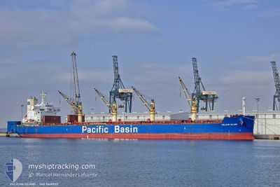
PELICAN ISLAND
Bulk Carrier
Current Trip
AR SPD
| Time Travelled | 3 days |
|---|---|
| Remaining Time | --- |
| Distance Travelled | 547.09 nm |
| Remaining Distance | --- |
| AVG Speed | 10.8 Noeuds |
| MAX Speed | 14.5 Noeuds |
| AVG Wind | 10.8 knots |
| MAX Wind | 17.8 knots |
| MIN Temp | 14.2°C / 57.56°F |
| MAX Temp | 26.9°C / 80.42°F |
| Tirant d eau | 6.6 m |
| Position reçue | 10 d depuis |
Current Position
| Longitude | -56.48582° |
|---|---|
| Latitude | -35.16442° |
| Etat | Under way using engine |
| Vitesse | 9.8 Noeuds |
| Parcours | 267° |
| Zone | Rio de La Plata |
| Station | T-AIS |
| Position reçue | 10 d depuis |
Info
Information
The current position of PELICAN ISLAND is in Rio de La Plata with coordinates -35.16442° / -56.48582° as reported on 2025-03-04 20:18 by AIS to our vessel tracker app. The vessel's current speed is 9.8 Noeuds
The vessel PELICAN ISLAND (IMO: 9668922, MMSI: 477121800) is a Bulk Carrier that was built in 2014 ( 11 Age ). It's sailing under the flag of [HK] Hong Kong.
In this page you can find informations about the vessels current position, last detected port calls, and current voyage information. If the vessels is not in coverage by AIS you will find the latest position.
The current position of PELICAN ISLAND is detected by our AIS receivers and we are not responsible for the reliability of the data. The last position was recorded while the vessel was in Coverage by the Ais receivers of our vessel tracking app.
The current draught of PELICAN ISLAND as reported by AIS is 6.6 meters
Weather
| Temperature | 18°C / 64.4°F |
|---|---|
| Wind Speed | 14 knots |
| Direction | 74° ENE |
| Pressure | 1019.5 hPa |
| Humidity | 76.1 % |
| Cloud Coverage | 64 % |
Featured Company
Last Port Calls
| Port | Arrival | Departure | Time In Port |
|---|---|---|---|
| 2025-03-06 19:39 | 2025-03-11 14:21 | 4 d | |
| 2025-02-24 14:30 | 2025-02-28 03:05 | 3 d | |
| 2025-02-20 01:09 | 2025-02-23 07:39 | 3 d | |
| 2025-02-02 00:17 | 2025-02-07 13:59 | 5 d | |
| 2025-01-20 12:06 | 2025-01-23 19:50 | 3 d | |
| 2025-01-12 21:37 | 2025-01-18 01:36 | 5 d |
Last Trips
| Origin | Departure | Destination | Arrival | Distance | |
|---|---|---|---|---|---|
| 2025-02-28 03:05 | 2025-03-06 19:39 | 1030.42 nm | |||
| 2025-02-23 07:39 | 2025-02-24 14:30 | 9.59 nm | |||
| 2025-02-07 13:59 | 2025-02-20 01:09 | 1042.24 nm | |||
| 2025-01-23 19:50 | 2025-02-02 00:17 | 567.20 nm | |||
| 2025-01-18 01:36 | 2025-01-20 12:06 | 520.86 nm | |||
| 2024-11-29 16:04 | 2025-01-12 21:37 | 3725.26 nm |
Events
| Heure | Evenement | Détails | Position/ Destination | Info |
|---|---|---|---|---|
| 2025-03-13 19:46 | Arret | 6.36 nm, South East of NECOCHEA |
-38.66611 / -58.64321
AR SPD
|
Vitesse: 0.1 kn Parcours: 129° |
| 2025-03-11 17:21 | Démarrage | 1.64 nm, South East of SAN PEDRO (AR) |
-33.69094 / -59.62706
AR SPD
|
Vitesse: 4.2 kn Parcours: 131° |
| 2025-03-11 17:21 | PORT DE DEPART |
|
-33.69094 / -59.62706
AR SPD
|
Vitesse: 2.5 kn Parcours: 115° |
| 2025-03-06 23:00 | Arret |
-33.68642 / -59.63816
[AR] SAN PEDRO (AR)
|
Vitesse: 0.1 kn Parcours: 10° |
|
| 2025-03-06 22:39 | Port d'arrivée |
|
-33.68628 / -59.63620
[AR] SAN PEDRO (AR)
|
Vitesse: 3.6 kn Parcours: 301° |
| 2025-03-06 22:21 | Démarrage | 2.06 nm, South East of SAN PEDRO (AR) |
-33.69447 / -59.61955
AR SPD
|
Vitesse: 3.6 kn Parcours: 290° |
| 2025-03-05 18:17 | Arret | 2.17 nm, South East of SAN PEDRO (AR) |
-33.69060 / -59.61326
AR SPD
|
Vitesse: 0.1 kn Parcours: 319° |