

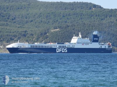
PERGAMON SEAWAYS
Ro-Ro Cargo

Current Trip
| Time Travelled | 2 days |
|---|---|
| Remaining Time | 14 h, 30 mins |
| Distance Travelled | 1011.48 nm |
| Remaining Distance | 271.82 nm |
| AVG Speed | 16.9 Noeuds |
| MAX Speed | 20.1 Noeuds |
| AVG Wind | 7.2 knots |
| MAX Wind | 21.8 knots |
| MIN Temp | 20.9°C / 69.62°F |
| MAX Temp | 32.1°C / 89.78°F |
| Tirant d eau | 6.8 m |
| Position reçue | 2 m depuis |
Current Position
| Longitude | 9.05560° |
|---|---|
| Latitude | 41.30984° |
| Etat | Under way using engine |
| Vitesse | 18.7 Noeuds |
| Parcours | 277° |
| Zone | Tyrrhenian Sea |
| Station | T-AIS |
| Position reçue | 2 m depuis |
Information
The current position of PERGAMON SEAWAYS is in Tyrrhenian Sea with coordinates 41.30984° / 9.05560° as reported on 2025-06-11 22:24 by AIS to our vessel tracker app. The vessel's current speed is 18.7 Noeuds and is heading at the port of SETE. The estimated time of arrival as calculated by MyShipTracking vessel tracking app is 2025-06-12 14:57 LT
The vessel PERGAMON SEAWAYS (IMO: 9506277, MMSI: 271043303) is a Ro-Ro Cargo that was built in 2013 ( 12 Age ). It's sailing under the flag of [TR] Turkey.
In this page you can find informations about the vessels current position, last detected port calls, and current voyage information. If the vessels is not in coverage by AIS you will find the latest position.
The current position of PERGAMON SEAWAYS is detected by our AIS receivers and we are not responsible for the reliability of the data. The last position was recorded while the vessel was in Coverage by the Ais receivers of our vessel tracking app.
The current draught of PERGAMON SEAWAYS as reported by AIS is 6.8 meters
Weather
| Temperature | 22.7°C / 72.86°F |
|---|---|
| Wind Speed | 5 knots |
| Direction | 79° E |
| Pressure | 1015.3 hPa |
| Humidity | 64.6 % |
| Cloud Coverage | 20 % |


Featured Company
Last Port Calls
| Port | Arrival | Departure | Time In Port |
|---|---|---|---|
| 2025-06-09 06:14 | 2025-06-09 11:08 | 4 h | |
| 2025-06-08 03:23 | 2025-06-08 12:16 | 8 h | |
| 2025-06-04 07:22 | 2025-06-04 16:26 | 9 h | |
| 2025-05-31 08:01 | 2025-05-31 19:30 | 11 h | |
| 2025-05-27 10:48 | 2025-05-27 21:34 | 10 h | |
| 2025-05-23 17:20 | 2025-05-24 04:21 | 11 h | |
| 2025-05-22 11:59 | 2025-05-23 12:00 | 1 d | |
| 2025-05-19 21:41 | 2025-05-22 10:24 | 2 d | |
| 2025-05-17 13:46 | 2025-05-17 17:50 | 4 h | |
| 2025-05-17 13:34 | 2025-05-17 13:38 | 3 m |
Last Trips
| Origin | Departure | Destination | Arrival | Distance | |
|---|---|---|---|---|---|
| 2025-06-08 12:16 | 2025-06-09 06:14 | 306.46 nm | |||
| 2025-06-04 16:26 | 2025-06-08 03:23 | 1464.62 nm | |||
| 2025-05-31 19:30 | 2025-06-04 07:22 | 1462.28 nm | |||
| 2025-05-27 21:34 | 2025-05-31 08:01 | 1460.90 nm | |||
| 2025-05-24 04:21 | 2025-05-27 10:48 | 1399.52 nm | |||
| 2025-05-23 12:00 | 2025-05-23 17:20 | 71.19 nm | |||
| 2025-05-22 10:24 | 2025-05-22 11:59 | 16.66 nm | |||
| 2025-05-17 17:50 | 2025-05-19 21:41 | 861.72 nm | |||
| 2025-05-17 13:38 | 2025-05-17 13:46 | 1.14 nm | |||
| 2025-05-16 19:09 | 2025-05-17 13:34 | 342.84 nm |
Events
| Heure | Evenement | Détails | Position/ Destination | Info |
|---|---|---|---|---|
| 2025-06-11 22:21 | Changement de zone | French part of the Mediterranean Sea - Western Basin Italian part of the Mediterranean Sea - Western Basin |
41.30799 / 9.07562
Mediterranean Sea - Western Basin
FRSET
|
Vitesse: 18.8 kn Parcours: 277° |
| 2025-06-11 22:10 | Changement de zone | Italian part of the Mediterranean Sea - Western Basin Italian part of the Tyrrhenian Sea |
41.30108 / 9.15276
Mediterranean Sea - Western Basin
FRSET
|
Vitesse: 18.8 kn Parcours: 277.6° |
| 2025-06-11 22:08 | Etat Changé | Under way using engine Default |
41.29957 / 9.16798
FRSET
|
Vitesse: 19.1 kn Parcours: 277° |
| 2025-06-11 22:07 | Etat Changé | Default Under way using engine |
41.29873 / 9.17705
FRSET
|
Vitesse: 18 kn Parcours: 276° |
| 2025-06-11 21:57 | Changement de zone | Italian part of the Tyrrhenian Sea French part of the Tyrrhenian Sea |
41.29377 / 9.24182
Tyrrhenian Sea
FRSET
|
Vitesse: 18 kn Parcours: 266° |
| 2025-06-11 21:51 | Changement de zone | French part of the Tyrrhenian Sea Italian part of the Tyrrhenian Sea |
41.30747 / 9.28372
Tyrrhenian Sea
FRSET
|
Vitesse: 19 kn Parcours: 229° |
| 2025-06-11 19:33 | Etat Changé | Under way using engine Default |
41.07205 / 10.06834
FRSET
|
Vitesse: 17.9 kn Parcours: 301° |
| 2025-06-11 19:30 | Etat Changé | Default Under way using engine |
41.06485 / 10.08339
FRSET
|
Vitesse: 18.1 kn Parcours: 300.3° |
| 2025-06-11 14:58 | Etat Changé | Under way using engine Default |
40.33613 / 11.65385
FRSET
|
Vitesse: 18.5 kn Parcours: 301° |
| 2025-06-11 14:48 | Dans la zone couverte |
40.33613 / 11.65385
Tyrrhenian Sea
FRSET
|
Vitesse: 18 kn Parcours: 300° |