
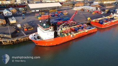
PUTFORD DEFENDER
Cargo
Current Trip
GAS FIELD
| Time Travelled | 1 day |
|---|---|
| Remaining Time | --- |
| Distance Travelled | 114.93 nm |
| Remaining Distance | --- |
| AVG Speed | 7.9 Noeuds |
| MAX Speed | 10.2 Noeuds |
| AVG Wind | 15.1 knots |
| MAX Wind | 25 knots |
| MIN Temp | 5.4°C / 41.72°F |
| MAX Temp | 6.6°C / 43.88°F |
| Tirant d eau | 4.5 m |
| Position reçue | 7 h, 40 m depuis |
Current Position
| Longitude | 0.81998° |
|---|---|
| Latitude | 54.02476° |
| Etat | Under way using engine |
| Vitesse | 0.5 Noeuds |
| Parcours | 93° |
| Zone | North Sea |
| Station | T-AIS |
| Position reçue | 7 h, 40 m depuis |
Info
Information
The current position of PUTFORD DEFENDER is in North Sea with coordinates 54.02476° / 0.81998° as reported on 2025-02-09 18:26 by AIS to our vessel tracker app. The vessel's current speed is 0.5 Noeuds
The vessel PUTFORD DEFENDER (IMO: 9298985, MMSI: 232017303) is a Cargo It's sailing under the flag of [GB] United Kingdom.
In this page you can find informations about the vessels current position, last detected port calls, and current voyage information. If the vessels is not in coverage by AIS you will find the latest position.
The current position of PUTFORD DEFENDER is detected by our AIS receivers and we are not responsible for the reliability of the data. The last position was recorded while the vessel was in Coverage by the Ais receivers of our vessel tracking app.
The current draught of PUTFORD DEFENDER as reported by AIS is 4.5 meters
Weather
| Temperature | 5.4°C / 41.72°F |
|---|---|
| Wind Speed | 25 knots |
| Direction | 64° ENE |
| Pressure | 1034.7 hPa |
| Humidity | 80.5 % |
| Cloud Coverage | 100 % |
Featured Company
Last Port Calls
| Port | Arrival | Departure | Time In Port |
|---|---|---|---|
| 2025-02-08 07:50 | 2025-02-08 19:20 | 11 h | |
| 2025-01-27 07:18 | 2025-01-27 22:55 | 15 h | |
| 2025-01-11 06:38 | 2025-01-11 14:54 | 8 h | |
| 2024-12-30 06:17 | 2024-12-30 16:02 | 9 h | |
| 2024-12-14 11:30 | 2024-12-14 19:33 | 8 h | |
| 2024-12-02 06:49 | 2024-12-02 21:52 | 15 h |
Most Visited Ports (Last year)
| Port | Arrivals | |
|---|---|---|
| 16 | ||
| 12 | ||
| 1 |
Last Trips
| Origin | Departure | Destination | Arrival | Distance | |
|---|---|---|---|---|---|
| 2025-01-27 22:55 | 2025-02-08 07:50 | 596.33 nm | |||
| 2025-01-11 14:54 | 2025-01-27 07:18 | 918.27 nm | |||
| 2024-12-30 16:02 | 2025-01-11 06:38 | 335.05 nm | |||
| 2024-12-14 19:33 | 2024-12-30 06:17 | 546.40 nm | |||
| 2024-12-02 21:52 | 2024-12-14 11:30 | 348.09 nm | |||
| 2024-11-17 17:37 | 2024-12-02 06:49 | 433.11 nm |
Events
| Heure | Evenement | Détails | Position/ Destination | Info |
|---|---|---|---|---|
| 2025-02-09 18:26 | Hors de la zone couverte |
54.02476 / .81998
North Sea
|
Vitesse: 0.5 kn Parcours: 181.6° |
|
| 2025-02-09 16:37 | Démarrage |
54.02763 / 1.03791
GAS FIELD
|
Vitesse: 3.9 kn Parcours: 54° |
|
| 2025-02-09 11:19 | Arret |
54.04086 / 1.02794
GAS FIELD
|
Vitesse: 0.3 kn Parcours: 61° |
|
| 2025-02-09 10:17 | Démarrage |
54.03115 / 1.09784
GAS FIELD
|
Vitesse: 3.8 kn Parcours: 279° |
|
| 2025-02-09 07:37 | Arret |
54.03361 / 1.08406
GAS FIELD
|
Vitesse: 0.2 kn Parcours: 89° |
|
| 2025-02-08 19:26 | Changement de destination | GAS FIELD GBLOW |
52.47751 / 1.77022
GAS FIELD
|
Vitesse: 4.7 kn Parcours: 35° |
| 2025-02-08 19:26 | Changement d'ETA | 2025/02/09 07:00 2025/02/08 07:00 |
52.47751 / 1.77022
GAS FIELD
|
Vitesse: 4.7 kn Parcours: 35° |
| 2025-02-08 19:20 | PORT DE DEPART |
|
52.47167 / 1.75967
GBLOW
|
Vitesse: 4.8 kn Parcours: 59° |
| 2025-02-08 19:12 | Démarrage |
52.47282 / 1.74936
[GB] LOWESTOFT
|
Vitesse: 3.3 kn Parcours: 274° |
|
| 2025-02-08 08:18 | Arret |
52.47297 / 1.74555
[GB] LOWESTOFT
|
Vitesse: 0.2 kn Parcours: 273° |