

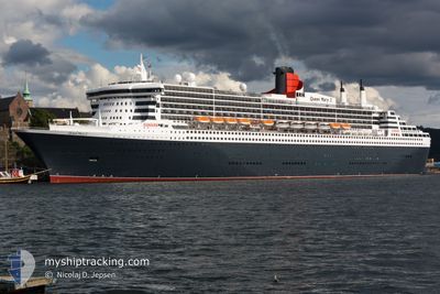
QUEEN MARY 2
Passengers Ship

Current Trip
| Time Travelled | 2 days |
|---|---|
| Remaining Time | 3 days |
| Distance Travelled | 1249.44 nm |
| Remaining Distance | 1986.36 nm |
| AVG Speed | 16.5 Noeuds |
| MAX Speed | 23.1 Noeuds |
| AVG Wind | 16.9 knots |
| MAX Wind | 21.6 knots |
| MIN Temp | 12.4°C / 54.32°F |
| MAX Temp | 16°C / 60.8°F |
| Tirant d eau | 10.4 m |
| Position reçue | 2 d depuis |
Current Position
| Longitude | -5.69548° |
|---|---|
| Latitude | 49.80829° |
| Etat | Under way using engine |
| Vitesse | 22.1 Noeuds |
| Parcours | 255.8° |
| Zone | Celtic Sea |
| Station | T-AIS |
| Position reçue | 2 d depuis |
Information
The current position of QUEEN MARY 2 is in Celtic Sea with coordinates 49.80829° / -5.69548° as reported on 2025-06-07 03:04 by AIS to our vessel tracker app. The vessel's current speed is 22.1 Noeuds and is heading at the port of NEW YORK. The estimated time of arrival as calculated by MyShipTracking vessel tracking app is 2025-06-12 15:26 LT
The vessel QUEEN MARY 2 (IMO: 9241061, MMSI: 310627000) is a Passengers Ship that was built in 2003 ( 22 Age ). It's sailing under the flag of [BM] Bermuda.
In this page you can find informations about the vessels current position, last detected port calls, and current voyage information. If the vessels is not in coverage by AIS you will find the latest position.
The current position of QUEEN MARY 2 is detected by our AIS receivers and we are not responsible for the reliability of the data. The last position was recorded while the vessel was in Coverage by the Ais receivers of our vessel tracking app.
The current draught of QUEEN MARY 2 as reported by AIS is 10.4 meters
Weather
| Temperature | 15°C / 59°F |
|---|---|
| Wind Speed | 11 knots |
| Direction | 254° WSW |
| Pressure | 1023.6 hPa |
| Humidity | 92.1 % |
| Cloud Coverage | 81 % |


Featured Company
Last Port Calls
| Port | Arrival | Departure | Time In Port |
|---|---|---|---|
| 2025-06-06 05:33 | 2025-06-06 17:08 | 11 h | |
| 2025-06-02 07:27 | 2025-06-02 18:19 | 10 h | |
| 2025-06-01 12:13 | 2025-06-01 20:32 | 8 h | |
| 2025-05-30 05:08 | 2025-05-30 17:41 | 12 h | |
| 2025-05-23 04:52 | 2025-05-23 17:22 | 12 h | |
| 2025-05-16 05:21 | 2025-05-16 17:08 | 11 h | |
| 2025-05-14 05:06 | 2025-05-14 20:51 | 15 h | |
| 2025-05-12 05:22 | 2025-05-12 17:07 | 11 h | |
| 2025-05-05 05:09 | 2025-05-05 17:25 | 12 h | |
| 2025-04-28 06:18 | 2025-04-28 20:59 | 14 h |
Most Visited Ports (Last year)
| Port | Arrivals | |
|---|---|---|
| 26 | ||
| 16 | ||
| 5 | ||
| 5 | ||
| 4 | ||
| 4 |
Last Trips
| Origin | Departure | Destination | Arrival | Distance | |
|---|---|---|---|---|---|
| 2025-06-02 18:19 | 2025-06-06 05:33 | 1184.79 nm | |||
| 2025-06-01 20:32 | 2025-06-02 07:27 | 177.27 nm | |||
| 2025-05-30 17:41 | 2025-06-01 12:13 | 786.66 nm | |||
| 2025-05-23 17:22 | 2025-05-30 05:08 | 3187.06 nm | |||
| 2025-05-16 17:08 | 2025-05-23 04:52 | 3257.78 nm | |||
| 2025-05-14 20:51 | 2025-05-16 05:21 | 520.88 nm | |||
| 2025-05-12 17:07 | 2025-05-14 05:06 | 530.31 nm | |||
| 2025-05-05 17:25 | 2025-05-12 05:22 | 3253.42 nm | |||
| 2025-04-28 20:59 | 2025-05-05 05:09 | 3291.12 nm | |||
| 2025-04-27 18:43 | 2025-04-28 06:18 | 112.85 nm |
Events
| Heure | Evenement | Détails | Position/ Destination | Info |
|---|---|---|---|---|
| 2025-06-07 03:13 | Etat Changé | Default Under way using engine |
49.79594 / -5.77672
GB SOU > US NYC
|
Vitesse: 22.1 kn Parcours: 255.8° |
| 2025-06-07 03:04 | Changement de zone | United Kingdom part of the Celtic Sea United Kingdom part of the English Channel |
49.80829 / -5.69548
Celtic Sea
GB SOU > US NYC
|
Vitesse: 22.1 kn Parcours: 255.8° |
| 2025-06-07 03:04 | Hors de la zone couverte |
49.80829 / -5.69548
Celtic Sea
GB SOU > US NYC
|
Vitesse: 22.1 kn Parcours: 255.8° |
|
| 2025-06-07 03:03 | Etat Changé | Under way using engine Default |
49.81022 / -5.68353
GB SOU > US NYC
|
Vitesse: 22 kn Parcours: 257° |
| 2025-06-07 02:21 | Etat Changé | Default Under way using engine |
49.86758 / -5.30383
GB SOU > US NYC
|
Vitesse: 21.3 kn Parcours: 259.6° |
| 2025-06-06 22:29 | Etat Changé | Under way using engine Default |
50.18957 / -3.18480
GB SOU > US NYC
|
Vitesse: 22.8 kn Parcours: 254° |
| 2025-06-06 22:25 | Etat Changé | Default Under way using engine |
50.19807 / -3.13936
GB SOU > US NYC
|
Vitesse: 22.8 kn Parcours: 255° |
| 2025-06-06 22:13 | Etat Changé | Under way using engine Default |
50.21745 / -3.02809
GB SOU > US NYC
|
Vitesse: 22.8 kn Parcours: 257° |
| 2025-06-06 22:13 | Etat Changé | Default Under way using engine |
50.21787 / -3.02520
GB SOU > US NYC
|
Vitesse: 22.9 kn Parcours: 257° |
| 2025-06-06 18:03 | Etat Changé | Under way using engine Constrained by her draught |
50.63685 / -.93875
GB SOU > US NYC
|
Vitesse: 12.5 kn Parcours: 180.7° |