
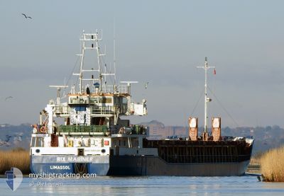
RIX MARINER
General Cargo
Current Trip
| Trip Time | 1 day |
|---|---|
| Trip Distance | 390.39 nm |
| AVG Speed | 7.1 Noeuds |
| MAX Speed | 11.3 Noeuds |
| Tirant d eau | 5.3 m |
| AVG Wind | 7.4 knots |
| MAX Wind | 23.8 knots |
| MIN Temp | -4.6°C / 23.72°F |
| MAX Temp | 3.6°C / 38.48°F |
| Position reçue | Maintenant |
Current Position
| Longitude | 6.82772° |
|---|---|
| Latitude | 53.45139° |
| Etat | Under way using engine |
| Vitesse | |
| Parcours | 104° |
| Zone | North Sea |
| Station | T-AIS |
| Position reçue | Maintenant |
Info
Information
The current position of RIX MARINER is in North Sea with coordinates 53.45139° / 6.82772° as reported on 2025-02-19 17:04 by AIS to our vessel tracker app. The vessel's current speed is 0 Noeuds and is currently inside the port of EEMSHAVEN.
The vessel RIX MARINER (IMO: 9197387, MMSI: 210552000) is a General Cargo that was built in 2001 ( 24 Age ). It's sailing under the flag of [CY] Cyprus.
In this page you can find informations about the vessels current position, last detected port calls, and current voyage information. If the vessels is not in coverage by AIS you will find the latest position.
The current position of RIX MARINER is detected by our AIS receivers and we are not responsible for the reliability of the data. The last position was recorded while the vessel was in Coverage by the Ais receivers of our vessel tracking app.
The current draught of RIX MARINER as reported by AIS is 5.3 meters
Weather
| Temperature | 2.2°C / 35.96°F |
|---|---|
| Wind Speed | 19 knots |
| Direction | 131° SE |
| Pressure | 1023 hPa |
| Humidity | 54.2 % |
| Cloud Coverage | 86 % |
Featured Company
Last Port Calls
| Port | Arrival | Departure | Time In Port |
|---|---|---|---|
| 2025-02-19 16:35 | |||
| 2025-02-14 18:21 | 2025-02-17 17:05 | 2 d | |
| 2025-02-13 05:06 | 2025-02-14 02:13 | 21 h | |
| 2025-02-12 07:16 | 2025-02-12 16:50 | 9 h | |
| 2025-02-06 05:04 | 2025-02-11 10:39 | 5 d | |
| 2025-02-03 17:49 | 2025-02-03 18:48 | 59 m | |
| 2025-01-29 22:57 | 2025-02-03 16:31 | 4 d | |
| 2025-01-26 17:37 | 2025-01-29 22:01 | 3 d | |
| 2025-01-22 22:50 | 2025-01-24 13:37 | 1 d | |
| 2025-01-20 09:39 | 2025-01-22 17:32 | 2 d |
Last Trips
| Origin | Departure | Destination | Arrival | Distance | |
|---|---|---|---|---|---|
| 2025-02-17 18:05 | 2025-02-19 17:35 | 390.39 nm | |||
| 2025-02-14 03:13 | 2025-02-14 19:21 | 126.40 nm | |||
| 2025-02-12 17:50 | 2025-02-13 06:06 | 110.21 nm | |||
| 2025-02-11 11:39 | 2025-02-12 08:16 | 200.49 nm | |||
| 2025-02-03 19:48 | 2025-02-06 06:04 | 519.86 nm | |||
| 2025-02-03 17:31 | 2025-02-03 18:49 | 9.90 nm | |||
| 2025-01-29 23:01 | 2025-01-29 23:57 | 9.16 nm | |||
| 2025-01-24 14:37 | 2025-01-26 18:37 | 417.31 nm | |||
| 2025-01-22 18:32 | 2025-01-22 23:50 | 45.70 nm | |||
| 2025-01-19 13:09 | 2025-01-20 10:39 | 153.15 nm |
Events
| Heure | Evenement | Détails | Position/ Destination | Info |
|---|---|---|---|---|
| 2025-02-19 16:57 | Arret |
53.45140 / 6.82770
[NL] EEMSHAVEN
|
Vitesse: 0.2 kn Parcours: 103° |
|
| 2025-02-19 16:35 | Port d'arrivée |
|
53.46120 / 6.83809
[NL] EEMSHAVEN
|
Vitesse: 6.2 kn Parcours: 173.9° |
| 2025-02-19 16:03 | Detecté en mer | Dutch part of the North Sea |
53.51326 / 6.77613
North Sea
NLEEM
|
Vitesse: 7.8 kn Parcours: 128° |
| 2025-02-19 15:47 | Etat Changé | Under way using engine Default |
53.53434 / 6.72638
NLEEM
|
Vitesse: 8.1 kn Parcours: 126° |
| 2025-02-19 15:37 | Etat Changé | Default Under way using engine |
53.54646 / 6.69746
NLEEM
|
Vitesse: 8.2 kn Parcours: 128.4° |
| 2025-02-19 15:20 | Etat Changé | Under way using engine Default |
53.57011 / 6.64465
NLEEM
|
Vitesse: 8.4 kn Parcours: 127° |
| 2025-02-19 15:17 | Etat Changé | Default Under way using engine |
53.57406 / 6.63559
NLEEM
|
Vitesse: 8.7 kn Parcours: 128.7° |
| 2025-02-19 15:11 | Changement de zone | German part of the North Sea Dutch part of the North Sea |
53.58275 / 6.61581
North Sea
NLEEM
|
Vitesse: 8.7 kn Parcours: 128.7° |
| 2025-02-19 15:03 | Etat Changé | Under way using engine Default |
53.59591 / 6.58835
NLEEM
|
Vitesse: 8.7 kn Parcours: 131° |
| 2025-02-19 14:18 | Etat Changé | Default Under way using engine |
53.61359 / 6.41506
NLEEM
|
Vitesse: 8.9 kn Parcours: 90.2° |