
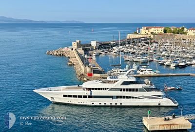
ROCK.IT
Pleasure Craft
Current Trip
ACKLIN ISLAND
| Time Travelled | 8 days |
|---|---|
| Remaining Time | --- |
| Distance Travelled | 185.72 nm |
| Remaining Distance | --- |
| AVG Speed | 9.3 Noeuds |
| MAX Speed | 13.1 Noeuds |
| AVG Wind | 7.6 knots |
| MAX Wind | 17 knots |
| MIN Temp | 20.2°C / 68.36°F |
| MAX Temp | 24.7°C / 76.46°F |
| Tirant d eau | 7.4 m |
| Position reçue | 3 d depuis |
Current Position
| Longitude | -75.48017° |
|---|---|
| Latitude | 23.74594° |
| Etat | Towing Astern |
| Vitesse | 9.9 Noeuds |
| Parcours | 87.7° |
| Zone | North Atlantic Ocean |
| Station | T-AIS |
| Position reçue | 3 d depuis |
Info
Information
The current position of ROCK.IT is in North Atlantic Ocean with coordinates 23.74594° / -75.48017° as reported on 2026-01-03 21:35 by AIS to our vessel tracker app. The vessel's current speed is 9.9 Noeuds
The vessel ROCK.IT (IMO: 1012347, MMSI: 319072900) is a Pleasure Craft It's sailing under the flag of [KY] Cayman Is.
In this page you can find informations about the vessels current position, last detected port calls, and current voyage information. If the vessels is not in coverage by AIS you will find the latest position.
The current position of ROCK.IT is detected by our AIS receivers and we are not responsible for the reliability of the data. The last position was recorded while the vessel was in Coverage by the Ais receivers of our vessel tracking app.
The current draught of ROCK.IT as reported by AIS is 7.4 meters
Weather
| Temperature | 22.5°C / 72.5°F |
|---|---|
| Wind Speed | 3 knots |
| Direction | 30° NNE |
| Pressure | 1014.8 hPa |
| Humidity | 56.9 % |
| Cloud Coverage | --- |
Featured Company
Last Port Calls
| Port | Arrival | Departure | Time In Port |
|---|---|---|---|
| 2025-12-22 09:00 | 2025-12-30 03:47 | 7 d | |
| 2025-12-05 08:21 | 2025-12-21 16:21 | 16 d | |
| 2025-11-27 08:29 | 2025-11-27 08:56 | 26 m |
Last Trips
| Origin | Departure | Destination | Arrival | Distance | |
|---|---|---|---|---|---|
| 2025-12-21 16:21 | 2025-12-22 09:00 | 182.03 nm | |||
| 2025-11-27 08:56 | 2025-12-05 08:21 | 229.65 nm | |||
| 2025-10-11 14:25 | 2025-11-27 08:29 | 3840.67 nm |
Events
| Heure | Evenement | Détails | Position/ Destination | Info |
|---|---|---|---|---|
| 2026-01-03 21:35 | Hors de la zone couverte |
23.74594 / -75.48017
North Atlantic Ocean
|
Vitesse: 9.9 kn Parcours: 87.7° |
|
| 2026-01-03 21:34 | Etat Changé | Towing Astern Under way using engine |
23.74586 / -75.48315
ACKLIN ISLAND
|
Vitesse: 9.9 kn Parcours: 88.4° |
| 2026-01-03 20:03 | Dans la zone couverte |
23.73536 / -75.75633
North Atlantic Ocean
|
Vitesse: 10 kn Parcours: 89.8° |
|
| 2026-01-03 18:59 | Hors de la zone couverte |
23.73312 / -75.91772
North Atlantic Ocean
|
Vitesse: 1.3 kn Parcours: 151° |
|
| 2026-01-03 13:29 | Changement de destination | ACKLIN ISLAND SANDY CAY |
24.19678 / -76.50993
ACKLIN ISLAND
|
Vitesse: 10.3 kn Parcours: 308.8° |
| 2026-01-03 13:24 | Démarrage |
24.18958 / -76.49908
SANDY CAY
|
Vitesse: 8 kn Parcours: 287° |
|
| 2026-01-03 13:22 | Etat Changé | Under way using engine At anchor |
24.18953 / -76.49674
SANDY CAY
|
Vitesse: 0.2 kn Parcours: 252° |
| 2026-01-01 14:05 | Etat Changé | At anchor Under way using engine |
24.18886 / -76.49695
SANDY CAY
|
Vitesse: 0.4 kn Parcours: 324° |
| 2026-01-01 14:05 | Arret |
24.18886 / -76.49699
SANDY CAY
|
Vitesse: 0.3 kn Parcours: 328° |
|
| 2026-01-01 13:52 | Démarrage |
24.20221 / -76.50573
SANDY CAY
|
Vitesse: 4.2 kn Parcours: 229° |