
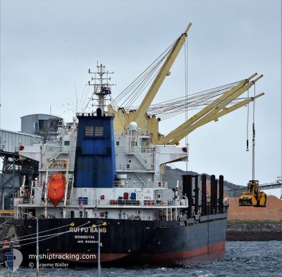
RUI FU BANG
Bulk Carrier
Current Trip
| Time Travelled | 1 day |
|---|---|
| Remaining Time | 1 day |
| Distance Travelled | 330.02 nm |
| Remaining Distance | 395.83 nm |
| AVG Speed | 11.8 Noeuds |
| MAX Speed | 12.7 Noeuds |
| AVG Wind | 11.5 knots |
| MAX Wind | 19.3 knots |
| MIN Temp | 13.8°C / 56.84°F |
| MAX Temp | 22.8°C / 73.04°F |
| Tirant d eau | 6.2 m |
| Position reçue | 18 d depuis |
Current Position
| Longitude | 34.45296° |
|---|---|
| Latitude | 27.88907° |
| Etat | Under way using engine |
| Vitesse | 12.5 Noeuds |
| Parcours | 9.4° |
| Zone | Gulf of Aqaba |
| Station | T-AIS |
| Position reçue | 18 d depuis |
Info
Information
The current position of RUI FU BANG is in Gulf of Aqaba with coordinates 27.88907° / 34.45296° as reported on 2025-01-15 14:28 by AIS to our vessel tracker app. The vessel's current speed is 12.5 Noeuds and is heading at the port of AQABA. The estimated time of arrival as calculated by MyShipTracking vessel tracking app is 2025-02-04 13:51 LT
The vessel RUI FU BANG (IMO: 9609847, MMSI: 636021928) is a Bulk Carrier that was built in 2011 ( 14 Age ). It's sailing under the flag of [LR] Liberia.
In this page you can find informations about the vessels current position, last detected port calls, and current voyage information. If the vessels is not in coverage by AIS you will find the latest position.
The current position of RUI FU BANG is detected by our AIS receivers and we are not responsible for the reliability of the data. The last position was recorded while the vessel was in Coverage by the Ais receivers of our vessel tracking app.
The current draught of RUI FU BANG as reported by AIS is 6.2 meters
Weather
| Temperature | 23.3°C / 73.94°F |
|---|---|
| Wind Speed | 11 knots |
| Direction | 355° N |
| Pressure | 1015.7 hPa |
| Humidity | 61.5 % |
| Cloud Coverage | 100 % |
Featured Company
Last Port Calls
| Port | Arrival | Departure | Time In Port |
|---|---|---|---|
| 2025-01-27 14:18 | 2025-02-01 20:15 | 5 d | |
| 2025-01-11 13:04 | 2025-01-15 07:22 | 3 d | |
| 2024-12-17 20:21 | 2024-12-31 10:58 | 13 d | |
| 2024-12-08 04:27 |
Most Visited Ports (Last year)
| Port | Arrivals | |
|---|---|---|
| 7 | ||
| 2 | ||
| 2 | ||
| 1 | ||
| 1 | ||
| 1 |
Last Trips
| Origin | Departure | Destination | Arrival | Distance | |
|---|---|---|---|---|---|
| 2025-01-15 09:22 | 2025-01-27 16:18 | 701.06 nm | |||
| 2024-12-31 13:58 | 2025-01-11 15:04 | 3022.02 nm | |||
| 2024-12-08 07:27 | 2024-12-17 23:21 | 1712.19 nm |
Events
| Heure | Evenement | Détails | Position/ Destination | Info |
|---|---|---|---|---|
| 2025-02-01 20:33 | Démarrage | 4 nm, South West of AQABA INDUSTRIAL |
29.33503 / 34.89972
AQABA
|
Vitesse: 12.2 kn Parcours: 212° |
| 2025-02-01 20:15 | PORT DE DEPART |
|
29.33503 / 34.89972
AQABA
|
Vitesse: 2.1 kn Parcours: 353° |
| 2025-01-27 14:18 | Arret |
29.36899 / 34.95954
[JO] AQABA INDUSTRIAL
|
Vitesse: Parcours: 51° |
|
| 2025-01-27 14:18 | Port d'arrivée |
|
29.36899 / 34.95954
[JO] AQABA INDUSTRIAL
|
Vitesse: 1.7 kn Parcours: 66° |
| 2025-01-24 15:36 | Démarrage | 1.74 nm, South West of MOTA BERTH |
29.45067 / 34.94733
AQABA
|
Vitesse: 4.4 kn Parcours: 206° |
| 2025-01-24 15:24 | Arret | 1.64 nm, South West of MOTA BERTH |
29.45556 / 34.94600
AQABA
|
Vitesse: 0.2 kn Parcours: 97° |