
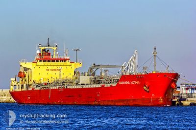
SAKHARA LOTUS
Oil/Chemical Tanker
Current Trip
| Time Travelled | 3 days |
|---|---|
| Remaining Time | 11 h, 11 mins |
| Distance Travelled | 680.89 nm |
| Remaining Distance | 292.53 nm |
| AVG Speed | 12.9 Noeuds |
| MAX Speed | 15.5 Noeuds |
| AVG Wind | 19.7 knots |
| MAX Wind | 26.7 knots |
| MIN Temp | 0.3°C / 32.54°F |
| MAX Temp | 12.9°C / 55.22°F |
| Tirant d eau | 7.2 m |
| Position reçue | 10 h, 15 m depuis |
Current Position
| Longitude | 28.23673° |
|---|---|
| Latitude | 35.23847° |
| Etat | Under way using engine |
| Vitesse | 13.5 Noeuds |
| Parcours | 138° |
| Zone | Mediterranean Sea - Eastern Basin |
| Station | T-AIS |
| Position reçue | 10 h, 15 m depuis |
Info
Information
The current position of SAKHARA LOTUS is in Mediterranean Sea - Eastern Basin with coordinates 35.23847° / 28.23673° as reported on 2025-02-11 23:46 by AIS to our vessel tracker app. The vessel's current speed is 13.5 Noeuds and is heading at the port of DAMIETTA. The estimated time of arrival as calculated by MyShipTracking vessel tracking app is 2025-02-12 23:13 LT
The vessel SAKHARA LOTUS (IMO: 9400382, MMSI: 372530000) is a Oil/Chemical Tanker that was built in 2009 ( 16 Age ). It's sailing under the flag of [PA] Panama.
In this page you can find informations about the vessels current position, last detected port calls, and current voyage information. If the vessels is not in coverage by AIS you will find the latest position.
The current position of SAKHARA LOTUS is detected by our AIS receivers and we are not responsible for the reliability of the data. The last position was recorded while the vessel was in Coverage by the Ais receivers of our vessel tracking app.
The current draught of SAKHARA LOTUS as reported by AIS is 7.2 meters
Weather
| Temperature | 12.9°C / 55.22°F |
|---|---|
| Wind Speed | 20 knots |
| Direction | 310° NW |
| Pressure | 1022.7 hPa |
| Humidity | 56.3 % |
| Cloud Coverage | 33 % |
Featured Company
Last Port Calls
| Port | Arrival | Departure | Time In Port |
|---|---|---|---|
| 2025-02-07 18:38 | 2025-02-08 14:11 | 19 h | |
| 2025-01-31 18:22 | 2025-02-01 20:10 | 1 d | |
| 2025-01-28 09:41 | 2025-01-30 13:59 | 2 d | |
| 2025-01-21 10:06 | 2025-01-22 15:08 | 1 d | |
| 2025-01-15 09:13 | 2025-01-16 09:39 | 1 d | |
| 2025-01-11 04:20 | 2025-01-11 17:12 | 12 h | |
| 2025-01-08 15:50 | 2025-01-11 04:02 | 2 d | |
| 2025-01-07 07:28 | 2025-01-08 15:24 | 1 d | |
| 2024-12-30 19:59 | 2025-01-01 01:37 | 1 d | |
| 2024-12-24 09:35 | 2024-12-26 08:47 | 1 d |
Last Trips
| Origin | Departure | Destination | Arrival | Distance | |
|---|---|---|---|---|---|
| 2025-02-01 20:10 | 2025-02-07 18:38 | 1617.40 nm | |||
| 2025-01-30 13:59 | 2025-01-31 18:22 | 6.41 nm | |||
| 2025-01-22 15:08 | 2025-01-28 09:41 | 1592.33 nm | |||
| 2025-01-16 09:39 | 2025-01-21 10:06 | 1441.05 nm | |||
| 2025-01-11 17:12 | 2025-01-15 09:13 | 367.23 nm | |||
| 2025-01-11 04:02 | 2025-01-11 04:20 | 2.68 nm | |||
| 2025-01-08 15:24 | 2025-01-08 15:50 | 2.55 nm | |||
| 2025-01-01 01:37 | 2025-01-07 07:28 | 1620.58 nm | |||
| 2024-12-26 08:47 | 2024-12-30 19:59 | 1442.66 nm | |||
| 2024-12-19 14:17 | 2024-12-24 09:35 | 591.39 nm |
Events
| Heure | Evenement | Détails | Position/ Destination | Info |
|---|---|---|---|---|
| 2025-02-11 23:57 | Etat Changé | Default Under way using engine |
35.20850 / 28.26812
EGDAM
|
Vitesse: 13.5 kn Parcours: 138° |
| 2025-02-11 23:46 | Hors de la zone couverte |
35.23847 / 28.23673
Mediterranean Sea - Eastern Basin
EGDAM
|
Vitesse: 13.5 kn Parcours: 138° |
|
| 2025-02-11 23:38 | Etat Changé | Under way using engine Default |
35.26243 / 28.21130
EGDAM
|
Vitesse: 13.8 kn Parcours: 139° |
| 2025-02-11 23:21 | Etat Changé | Default Under way using engine |
35.31052 / 28.16078
EGDAM
|
Vitesse: 13.7 kn Parcours: 138° |
| 2025-02-11 20:28 | Changement de zone | Greek part of the Mediterranean Sea - Eastern Basin Greek part of the Aegean Sea |
35.81177 / 27.64465
Mediterranean Sea - Eastern Basin
EGDAM
|
Vitesse: 13.9 kn Parcours: 140° |
| 2025-02-11 17:17 | Etat Changé | Under way using engine Default |
36.27982 / 26.98318
EGDAM
|
Vitesse: 13.1 kn Parcours: 129° |
| 2025-02-11 16:52 | Etat Changé | Default Under way using engine |
36.33718 / 26.89645
EGDAM
|
Vitesse: 13 kn Parcours: 146° |
| 2025-02-11 12:32 | Tirant d'eau modifié | 7.2 9.3 |
37.05967 / 26.15273
EGDAM
|
Vitesse: 13.2 kn Parcours: 158° |
| 2025-02-11 07:12 | Dans la zone couverte |
38.11395 / 25.51118
Aegean Sea
EGDAM
|
Vitesse: 13.8 kn Parcours: 161° |
|
| 2025-02-11 05:49 | Hors de la zone couverte |
38.41270 / 25.38257
Aegean Sea
EGDAM
|
Vitesse: 13.6 kn Parcours: 165° |