
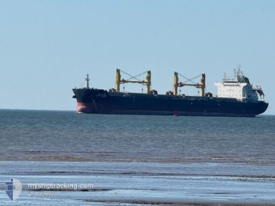
SAVITA NAREE
Cargo
Current Trip
| Time Travelled | 17 days |
|---|---|
| Remaining Time | 2 days |
| Distance Travelled | 4576.36 nm |
| Remaining Distance | 679.02 nm |
| AVG Speed | 10.9 Noeuds |
| MAX Speed | 14.5 Noeuds |
| AVG Wind | 12 knots |
| MAX Wind | 27.8 knots |
| MIN Temp | 7.8°C / 46.04°F |
| MAX Temp | 28.8°C / 83.84°F |
| Tirant d eau | 10 m |
| Position reçue | 21 h, 23 m depuis |
Current Position
| Longitude | -80.97478° |
|---|---|
| Latitude | 23.98185° |
| Etat | Under way using engine |
| Vitesse | 10.1 Noeuds |
| Parcours | 241.3° |
| Zone | North Atlantic Ocean |
| Station | T-AIS |
| Position reçue | 21 h, 23 m depuis |
Information
The current position of SAVITA NAREE is in North Atlantic Ocean with coordinates 23.98185° / -80.97478° as reported on 2025-06-08 04:23 by AIS to our vessel tracker app. The vessel's current speed is 10.1 Noeuds and is heading at the port of HOUSTON. The estimated time of arrival as calculated by MyShipTracking vessel tracking app is 2025-06-11 13:25 LT
The vessel SAVITA NAREE (MMSI: 566645000) is a Cargo It's sailing under the flag of [SG] Singapore.
In this page you can find informations about the vessels current position, last detected port calls, and current voyage information. If the vessels is not in coverage by AIS you will find the latest position.
The current position of SAVITA NAREE is detected by our AIS receivers and we are not responsible for the reliability of the data. The last position was recorded while the vessel was in Coverage by the Ais receivers of our vessel tracking app.
The current draught of SAVITA NAREE as reported by AIS is 10 meters
Weather
| Temperature | 28.5°C / 83.3°F |
|---|---|
| Wind Speed | 8 knots |
| Direction | 86° E |
| Pressure | 1015.1 hPa |
| Humidity | 77.1 % |
| Cloud Coverage | 10 % |
Featured Company
Last Port Calls
| Port | Arrival | Departure | Time In Port |
|---|---|---|---|
| 2025-05-13 09:59 | 2025-05-22 17:13 | 9 d | |
| 2025-05-08 03:20 | 2025-05-09 23:01 | 1 d | |
| 2025-05-08 02:53 | 2025-05-08 03:06 | 12 m | |
| 2025-05-04 21:03 | 2025-05-06 20:11 | 1 d | |
| 2025-04-19 00:21 | 2025-04-19 16:07 | 15 h | |
| 2025-04-12 21:19 | 2025-04-14 22:14 | 2 d | |
| 2025-04-06 16:03 | 2025-04-09 06:03 | 2 d | |
| 2025-04-06 04:12 | 2025-04-06 12:38 | 8 h | |
| 2025-04-01 22:58 | 2025-04-03 17:48 | 1 d |
Last Trips
| Origin | Departure | Destination | Arrival | Distance | |
|---|---|---|---|---|---|
| 2025-05-10 00:01 | 2025-05-13 11:59 | 403.28 nm | |||
| 2025-05-08 04:06 | 2025-05-08 04:20 | 0.02 nm | |||
| 2025-05-06 22:11 | 2025-05-08 03:53 | 214.90 nm | |||
| 2025-04-19 18:07 | 2025-05-04 23:03 | 1527.12 nm | |||
| 2025-04-15 00:14 | 2025-04-19 02:21 | 1073.21 nm | |||
| 2025-04-09 07:03 | 2025-04-12 23:19 | 1040.84 nm | |||
| 2025-04-03 19:48 | 2025-04-06 17:03 | 717.95 nm | |||
| 2025-04-03 19:48 | 2025-04-06 05:12 | 697.78 nm | |||
| 2025-02-11 19:54 | 2025-04-02 00:58 | 8562.74 nm |
Events
| Heure | Evenement | Détails | Position/ Destination | Info |
|---|---|---|---|---|
| 2025-06-08 04:34 | Etat Changé | Default Under way using engine |
23.96565 / -81.00531
HOUSTON
|
Vitesse: 10.1 kn Parcours: 241.3° |
| 2025-06-08 04:23 | Etat Changé | Under way using engine Default |
23.98185 / -80.97478
HOUSTON
|
Vitesse: 10.3 kn Parcours: 245° |
| 2025-06-08 04:23 | Hors de la zone couverte |
23.98185 / -80.97478
North Atlantic Ocean
|
Vitesse: 10.1 kn Parcours: 241.3° |
|
| 2025-06-08 03:54 | Etat Changé | Default Under way using engine |
24.01937 / -80.89302
HOUSTON
|
Vitesse: 10.9 kn Parcours: 242.8° |
| 2025-06-08 03:50 | Etat Changé | Under way using engine Default |
24.02537 / -80.88029
HOUSTON
|
Vitesse: 10.9 kn Parcours: 242° |
| 2025-06-08 03:34 | Etat Changé | Default Under way using engine |
24.04808 / -80.83449
HOUSTON
|
Vitesse: 10.8 kn Parcours: 241° |
| 2025-06-08 03:21 | Etat Changé | Under way using engine Default |
24.06656 / -80.79838
HOUSTON
|
Vitesse: 10.8 kn Parcours: 241° |
| 2025-06-08 03:21 | Dans la zone couverte |
24.06656 / -80.79838
North Atlantic Ocean
|
Vitesse: 10.8 kn Parcours: 241° |
|
| 2025-06-08 01:48 | Etat Changé | Default Under way using engine |
24.20317 / -80.53093
HOUSTON
|
Vitesse: 11 kn Parcours: 242° |
| 2025-06-08 01:47 | Hors de la zone couverte |
24.20455 / -80.52812
North Atlantic Ocean
|
Vitesse: 11 kn Parcours: 242° |