
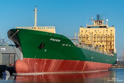
SC MARIGOT
Container Ship
Current Trip
PRSJU
| Time Travelled | 5 h, 27 mins |
|---|---|
| Remaining Time | --- |
| Distance Travelled | 10.29 nm |
| Remaining Distance | --- |
| AVG Speed | 12.9 Noeuds |
| MAX Speed | 13.7 Noeuds |
| AVG Wind | 11.1 knots |
| MAX Wind | 11.4 knots |
| MIN Temp | 26.7°C / 80.06°F |
| MAX Temp | 27°C / 80.6°F |
| Tirant d eau | 8.2 m |
| Position reçue | 4 h, 28 m depuis |
Current Position
| Longitude | -66.20672° |
|---|---|
| Latitude | 18.63057° |
| Etat | Under way using engine |
| Vitesse | 13.7 Noeuds |
| Parcours | 304.5° |
| Zone | North Atlantic Ocean |
| Station | T-AIS |
| Position reçue | 4 h, 28 m depuis |
Info
Information
The current position of SC MARIGOT is in North Atlantic Ocean with coordinates 18.63057° / -66.20672° as reported on 2025-02-20 15:36 by AIS to our vessel tracker app. The vessel's current speed is 13.7 Noeuds
The vessel SC MARIGOT (IMO: 9275115, MMSI: 636020666) is a Container Ship that was built in 2005 ( 20 Age ). It's sailing under the flag of [LR] Liberia.
In this page you can find informations about the vessels current position, last detected port calls, and current voyage information. If the vessels is not in coverage by AIS you will find the latest position.
The current position of SC MARIGOT is detected by our AIS receivers and we are not responsible for the reliability of the data. The last position was recorded while the vessel was in Coverage by the Ais receivers of our vessel tracking app.
The current draught of SC MARIGOT as reported by AIS is 8.2 meters
Weather
| Temperature | 25.8°C / 78.44°F |
|---|---|
| Wind Speed | 22 knots |
| Direction | 88° E |
| Pressure | 1015.9 hPa |
| Humidity | 78.2 % |
| Cloud Coverage | 60 % |
Featured Company
Last Port Calls
| Port | Arrival | Departure | Time In Port |
|---|---|---|---|
| 2025-02-19 18:14 | 2025-02-20 14:38 | 20 h | |
| 2025-02-18 02:15 | 2025-02-19 00:29 | 22 h | |
| 2025-02-15 20:35 | 2025-02-16 19:35 | 22 h | |
| 2025-02-13 10:35 | 2025-02-14 01:47 | 15 h | |
| 2025-02-07 23:15 | 2025-02-08 15:08 | 15 h | |
| 2025-02-05 16:36 | 2025-02-06 01:42 | 9 h | |
| 2025-02-01 01:39 | 2025-02-02 06:39 | 1 d | |
| 2025-01-28 10:30 | |||
| 2025-01-27 01:29 | 2025-01-27 12:58 | 11 h | |
| 2025-01-25 09:47 | 2025-01-26 05:51 | 20 h |
Most Visited Ports (Last year)
| Port | Arrivals | |
|---|---|---|
| 27 | ||
| 17 | ||
| 16 | ||
| 15 | ||
| 13 | ||
| 11 |
Last Trips
| Origin | Departure | Destination | Arrival | Distance | |
|---|---|---|---|---|---|
| 2025-02-18 20:29 | 2025-02-19 14:14 | 246.55 nm | |||
| 2025-02-16 14:35 | 2025-02-17 22:15 | 413.93 nm | |||
| 2025-02-13 20:47 | 2025-02-15 15:35 | 6.84 nm | |||
| 2025-02-08 09:08 | 2025-02-13 05:35 | 1215.57 nm | |||
| 2025-02-05 19:42 | 2025-02-07 17:15 | 249.74 nm | |||
| 2025-02-02 01:39 | 2025-02-05 10:36 | 1270.72 nm | |||
| 2025-01-27 08:58 | 2025-01-28 06:30 | 225.92 nm | |||
| 2025-01-26 01:51 | 2025-01-26 21:29 | 54.43 nm | |||
| 2025-01-23 01:19 | 2025-01-25 05:47 | 437.53 nm | |||
| 2025-01-19 01:31 | 2025-01-21 06:11 | 3.16 nm |
Events
| Heure | Evenement | Détails | Position/ Destination | Info |
|---|---|---|---|---|
| 2025-02-20 15:50 | Etat Changé | Default Under way using engine |
18.64477 / -66.25541
PRSJU
|
Vitesse: 13.7 kn Parcours: 304.5° |
| 2025-02-20 15:36 | Hors de la zone couverte |
18.63057 / -66.20672
North Atlantic Ocean
|
Vitesse: 13.7 kn Parcours: 304.5° |
|
| 2025-02-20 15:24 | Detecté en mer | Puerto Rican part of the North Atlantic Ocean |
18.60235 / -66.16664
North Atlantic Ocean
|
Vitesse: 13.5 kn Parcours: 305.6° |
| 2025-02-20 15:24 | Etat Changé | Under way using engine Default |
18.60235 / -66.16664
PRSJU
|
Vitesse: 13.5 kn Parcours: 346° |
| 2025-02-20 15:04 | Dans la zone couverte |
18.60235 / -66.16664
North Atlantic Ocean
|
Vitesse: 13.5 kn Parcours: 305.6° |
|
| 2025-02-20 14:38 | PORT DE DEPART |
|
18.48535 / -66.12851
PRSJU
|
Vitesse: 8.6 kn Parcours: 310° |
| 2025-02-20 14:34 | Démarrage |
18.45473 / -66.11452
[PR] SAN JUAN
|
Vitesse: 8.6 kn Parcours: 310° |
|
| 2025-02-19 19:08 | Arret |
18.43380 / -66.09758
[PR] SAN JUAN
|
Vitesse: Parcours: 58° |
|
| 2025-02-19 18:14 | Port d'arrivée |
|
18.46670 / -66.12695
[PR] SAN JUAN
|
Vitesse: 14 kn Parcours: 175° |
| 2025-02-19 01:49 | Hors de la zone couverte |
18.29085 / -69.73828
Caribbean Sea
PRSJU
|
Vitesse: 14 kn Parcours: 119.8° |