
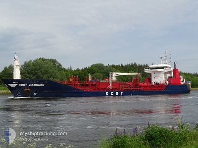
SCOT HAMBURG
Oil/Chemical Tanker
Current Trip
| Time Travelled | 11 days |
|---|---|
| Remaining Time | --- |
| Distance Travelled | 629.65 nm |
| Remaining Distance | --- |
| AVG Speed | 7.9 Noeuds |
| MAX Speed | 13.6 Noeuds |
| AVG Wind | 8.9 knots |
| MAX Wind | 21 knots |
| MIN Temp | 22.8°C / 73.04°F |
| MAX Temp | 29.3°C / 84.74°F |
| Tirant d eau | 7.6 m |
| Position reçue | 6 d depuis |
Current Position
| Longitude | -48.68382° |
|---|---|
| Latitude | -28.84923° |
| Etat | Under way using engine |
| Vitesse | 7.6 Noeuds |
| Parcours | 213.1° |
| Zone | South Atlantic Ocean |
| Station | T-AIS |
| Position reçue | 6 d depuis |
Info
Information
The current position of SCOT HAMBURG is in South Atlantic Ocean with coordinates -28.84923° / -48.68382° as reported on 2025-02-02 18:33 by AIS to our vessel tracker app. The vessel's current speed is 7.6 Noeuds
The vessel SCOT HAMBURG (IMO: 9255799, MMSI: 249081000) is a Oil/Chemical Tanker that was built in 2002 ( 23 Age ). It's sailing under the flag of [MT] Malta.
In this page you can find informations about the vessels current position, last detected port calls, and current voyage information. If the vessels is not in coverage by AIS you will find the latest position.
The current position of SCOT HAMBURG is detected by our AIS receivers and we are not responsible for the reliability of the data. The last position was recorded while the vessel was in Coverage by the Ais receivers of our vessel tracking app.
The current draught of SCOT HAMBURG as reported by AIS is 7.6 meters
Weather
| Temperature | 24.1°C / 75.38°F |
|---|---|
| Wind Speed | 6 knots |
| Direction | 19° NNE |
| Pressure | 1016.1 hPa |
| Humidity | 82.2 % |
| Cloud Coverage | --- |
Featured Company
Last Port Calls
| Port | Arrival | Departure | Time In Port |
|---|---|---|---|
| 2025-01-28 20:30 | 2025-01-28 21:27 | 56 m | |
| 2025-01-24 14:09 | 2025-01-25 17:04 | 1 d | |
| 2025-01-19 08:03 | 2025-01-19 09:04 | 1 h | |
| 2025-01-12 15:57 | 2025-01-14 16:36 | 2 d | |
| 2025-01-01 23:26 | 2025-01-02 00:32 | 1 h | |
| 2024-12-27 14:48 | 2024-12-28 16:40 | 1 d | |
| 2024-12-17 23:03 | 2024-12-18 00:01 | 58 m | |
| 2024-12-10 15:01 | 2024-12-11 16:13 | 1 d |
Most Visited Ports (Last year)
| Port | Arrivals | |
|---|---|---|
| 13 | ||
| 8 | ||
| 4 | ||
| 3 | ||
| 1 | ||
| 1 |
Last Trips
| Origin | Departure | Destination | Arrival | Distance | |
|---|---|---|---|---|---|
| 2025-01-25 14:04 | 2025-01-28 17:30 | 774.91 nm | |||
| 2025-01-19 06:04 | 2025-01-24 11:09 | 783.67 nm | |||
| 2025-01-14 13:36 | 2025-01-19 05:03 | 777.08 nm | |||
| 2025-01-01 21:32 | 2025-01-12 12:57 | 796.43 nm | |||
| 2024-12-28 13:40 | 2025-01-01 20:26 | 775.72 nm | |||
| 2024-12-17 21:01 | 2024-12-27 11:48 | 787.71 nm | |||
| 2024-12-11 13:13 | 2024-12-17 20:03 | 1302.68 nm | |||
| 2024-11-11 20:26 | 2024-12-10 12:01 | 1640.03 nm |
Events
| Heure | Evenement | Détails | Position/ Destination | Info |
|---|---|---|---|---|
| 2025-02-09 10:46 | Arret | 9.73 nm, South East of RIO GRANDE |
-32.14948 / -51.95855
BRRIG
|
Vitesse: 0.1 kn Parcours: 62° |
| 2025-02-09 09:18 | Démarrage | 2.92 nm, South of RIO GRANDE |
-32.07688 / -52.08884
BRRIG
|
Vitesse: 6.3 kn Parcours: 210° |
| 2025-02-07 09:04 | Arret | 2.54 nm, South of RIO GRANDE |
-32.07068 / -52.08643
BRRIG
|
Vitesse: Parcours: 42° |
| 2025-02-07 07:06 | Démarrage | 9.44 nm, South East of RIO GRANDE |
-32.09029 / -51.91541
BRRIG
|
Vitesse: 9 kn Parcours: 213° |
| 2025-02-04 01:45 | Arret | 9.48 nm, East of RIO GRANDE |
-32.08619 / -51.91258
BRRIG
|
Vitesse: 0.2 kn Parcours: 51° |
| 2025-02-02 18:37 | Etat Changé | Default Under way using engine |
-28.85616 / -48.68874
BRRIG
|
Vitesse: 7.6 kn Parcours: 213.1° |
| 2025-02-02 18:33 | Hors de la zone couverte |
-28.84923 / -48.68382
South Atlantic Ocean
BRRIG
|
Vitesse: 7.6 kn Parcours: 213.1° |
|
| 2025-02-02 18:28 | Etat Changé | Under way using engine Default |
-28.84060 / -48.67768
BRRIG
|
Vitesse: 7.6 kn Parcours: 211° |
| 2025-02-02 18:20 | Etat Changé | Default Under way using engine |
-28.82552 / -48.66718
BRRIG
|
Vitesse: 7.5 kn Parcours: 210.5° |
| 2025-02-02 18:17 | Etat Changé | Under way using engine Default |
-28.82018 / -48.66341
BRRIG
|
Vitesse: 7.5 kn Parcours: 211° |