
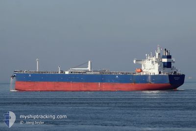
SEACALM
Tanker A
Current Trip
| Time Travelled | 1 day |
|---|---|
| Remaining Time | 1 day |
| Distance Travelled | 438.16 nm |
| Remaining Distance | 408.86 nm |
| AVG Speed | 10.9 Noeuds |
| MAX Speed | 12.8 Noeuds |
| AVG Wind | 5.9 knots |
| MAX Wind | 9 knots |
| MIN Temp | 11.2°C / 52.16°F |
| MAX Temp | 14.9°C / 58.82°F |
| Tirant d eau | 8.3 m |
| Position reçue | 1 h, 28 m depuis |
Current Position
| Longitude | 18.75865° |
|---|---|
| Latitude | 39.66204° |
| Etat | Under way using engine |
| Vitesse | 10.8 Noeuds |
| Parcours | 218.8° |
| Zone | Ionian Sea |
| Station | T-AIS |
| Position reçue | 1 h, 28 m depuis |
Info
Information
The current position of SEACALM is in Ionian Sea with coordinates 39.66204° / 18.75865° as reported on 2025-03-06 06:14 by AIS to our vessel tracker app. The vessel's current speed is 10.8 Noeuds and is heading at the port of PIRAEUS. The estimated time of arrival as calculated by MyShipTracking vessel tracking app is 2025-03-07 21:32 LT
The vessel SEACALM (IMO: 9773753, MMSI: 538007376) is a Tanker A It's sailing under the flag of [MH] Marshall Is.
In this page you can find informations about the vessels current position, last detected port calls, and current voyage information. If the vessels is not in coverage by AIS you will find the latest position.
The current position of SEACALM is detected by our AIS receivers and we are not responsible for the reliability of the data. The last position was recorded while the vessel was in Coverage by the Ais receivers of our vessel tracking app.
The current draught of SEACALM as reported by AIS is 8.3 meters
Weather
| Temperature | 14.7°C / 58.46°F |
|---|---|
| Wind Speed | 4 knots |
| Direction | 50° NE |
| Pressure | 1027.5 hPa |
| Humidity | 66.8 % |
| Cloud Coverage | --- |
Featured Company
Events
| Heure | Evenement | Détails | Position/ Destination | Info |
|---|---|---|---|---|
| 2025-03-06 06:32 | Etat Changé | Default Under way using engine |
39.61805 / 18.71062
PIRAEUS FOR ORDERS
|
Vitesse: 10.8 kn Parcours: 218.8° |
| 2025-03-06 06:14 | Hors de la zone couverte |
39.66204 / 18.75865
Ionian Sea
PIRAEUS FOR ORDERS
|
Vitesse: 10.8 kn Parcours: 218.8° |
|
| 2025-03-06 05:55 | Changement de zone | Italian part of the Ionian Sea Italian part of the Adriatic Sea |
39.71640 / 18.77636
Ionian Sea
PIRAEUS FOR ORDERS
|
Vitesse: 11.1 kn Parcours: 188.9° |
| 2025-03-06 05:55 | Etat Changé | Under way using engine Default |
39.71640 / 18.77636
PIRAEUS FOR ORDERS
|
Vitesse: 10.9 kn Parcours: 189° |
| 2025-03-06 05:55 | Dans la zone couverte |
39.71640 / 18.77636
Ionian Sea
PIRAEUS FOR ORDERS
|
Vitesse: 11.1 kn Parcours: 188.9° |
|
| 2025-03-06 04:21 | Etat Changé | Default Under way using engine |
39.99325 / 18.83300
PIRAEUS FOR ORDERS
|
Vitesse: 10.4 kn Parcours: 187.3° |
| 2025-03-06 04:16 | Hors de la zone couverte |
40.00853 / 18.83564
Adriatic Sea
PIRAEUS FOR ORDERS
|
Vitesse: 10.4 kn Parcours: 187.3° |
|
| 2025-03-06 04:16 | Etat Changé | Under way using engine Default |
40.00944 / 18.83580
PIRAEUS FOR ORDERS
|
Vitesse: 10.4 kn Parcours: 188° |
| 2025-03-06 03:58 | Etat Changé | Default Under way using engine |
40.06042 / 18.84485
PIRAEUS FOR ORDERS
|
Vitesse: 10.3 kn Parcours: 173.5° |
| 2025-03-06 03:22 | Etat Changé | Under way using engine Default |
40.15964 / 18.83092
PIRAEUS FOR ORDERS
|
Vitesse: 10.5 kn Parcours: 170° |