
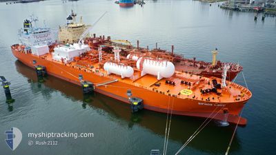
SIFNOS LADY
Tanker
Current Trip
| Time Travelled | 12 days |
|---|---|
| Remaining Time | --- |
| Distance Travelled | 3426.26 nm |
| Remaining Distance | --- |
| AVG Speed | 11.4 Noeuds |
| MAX Speed | 15.6 Noeuds |
| AVG Wind | 15.6 knots |
| MAX Wind | 27.8 knots |
| MIN Temp | 0.3°C / 32.54°F |
| MAX Temp | 20.9°C / 69.62°F |
| Tirant d eau | 7.6 m |
| Position reçue | 6 d depuis |
Current Position
| Longitude | -29.66675° |
|---|---|
| Latitude | 37.39082° |
| Etat | Under way using engine |
| Vitesse | 11.3 Noeuds |
| Parcours | 258.8° |
| Zone | North Atlantic Ocean |
| Station | T-AIS |
| Position reçue | 6 d depuis |
Info
Information
The current position of SIFNOS LADY is in North Atlantic Ocean with coordinates 37.39082° / -29.66675° as reported on 2025-12-31 13:28 by AIS to our vessel tracker app. The vessel's current speed is 11.3 Noeuds and is heading at the port of MARCUS HOOK. The estimated time of arrival as calculated by MyShipTracking vessel tracking app is 2026-01-07 13:00 LT
The vessel SIFNOS LADY (IMO: 9903073, MMSI: 563137100) is a Tanker It's sailing under the flag of [SG] Singapore.
In this page you can find informations about the vessels current position, last detected port calls, and current voyage information. If the vessels is not in coverage by AIS you will find the latest position.
The current position of SIFNOS LADY is detected by our AIS receivers and we are not responsible for the reliability of the data. The last position was recorded while the vessel was in Coverage by the Ais receivers of our vessel tracking app.
The current draught of SIFNOS LADY as reported by AIS is 7.6 meters
Weather
| Temperature | 16.9°C / 62.42°F |
|---|---|
| Wind Speed | 10 knots |
| Direction | 54° NE |
| Pressure | 1024 hPa |
| Humidity | 67.6 % |
| Cloud Coverage | 100 % |
Featured Company
Last Port Calls
| Port | Arrival | Departure | Time In Port |
|---|---|---|---|
| 2025-12-22 17:33 | 2025-12-25 13:49 | 2 d | |
| 2025-12-06 07:01 | 2025-12-07 09:59 | 1 d | |
| 2025-11-20 01:25 | 2025-11-22 10:21 | 2 d | |
| 2025-11-04 19:18 | 2025-11-05 21:38 | 1 d |
Last Trips
| Origin | Departure | Destination | Arrival | Distance | |
|---|---|---|---|---|---|
| 2025-12-07 09:59 | 2025-12-22 17:33 | 4327.15 nm | |||
| 2025-11-22 10:21 | 2025-12-06 07:01 | 3901.12 nm | |||
| 2025-11-05 21:38 | 2025-11-20 01:25 | 3584.20 nm | |||
| 2025-10-22 02:18 | 2025-11-04 19:18 | 3880.78 nm |
Events
| Heure | Evenement | Détails | Position/ Destination | Info |
|---|---|---|---|---|
| 2025-12-31 13:33 | Etat Changé | Default Under way using engine |
37.38667 / -29.68667
US MAH
|
Vitesse: 11.3 kn Parcours: 258.8° |
| 2025-12-31 13:28 | Hors de la zone couverte |
37.39082 / -29.66675
North Atlantic Ocean
US MAH
|
Vitesse: 11.3 kn Parcours: 258.8° |
|
| 2025-12-31 12:27 | Etat Changé | Under way using engine Default |
37.42456 / -29.43877
US MAH
|
Vitesse: 10.9 kn Parcours: 259° |
| 2025-12-31 12:25 | Etat Changé | Default Under way using engine |
37.42560 / -29.43090
US MAH
|
Vitesse: 10.7 kn Parcours: 260.2° |
| 2025-12-31 02:09 | Changement de zone | Portuguese (Azores) part of the North Atlantic Ocean United Kingdom part of the English Channel |
37.82709 / -27.14161
North Atlantic Ocean
US MAH
|
Vitesse: 11.1 kn Parcours: 245° |
| 2025-12-31 02:06 | Etat Changé | Under way using engine Default |
37.83101 / -27.13125
US MAH
|
Vitesse: 11.2 kn Parcours: 247° |
| 2025-12-31 02:06 | Dans la zone couverte |
37.82709 / -27.14161
North Atlantic Ocean
US MAH
|
Vitesse: 11.1 kn Parcours: 245° |
|
| 2025-12-31 01:05 | Etat Changé | Default Under way using engine |
37.91356 / -26.90401
US MAH
|
Vitesse: 11.3 kn Parcours: 245.9° |
| 2025-12-31 01:03 | Etat Changé | Under way using engine Default |
37.91583 / -26.89785
US MAH
|
Vitesse: 11 kn Parcours: 244° |
| 2025-12-31 01:03 | Hors de la zone couverte |
37.91583 / -26.89785
English Channel
US MAH
|
Vitesse: 11.3 kn Parcours: 245.9° |