

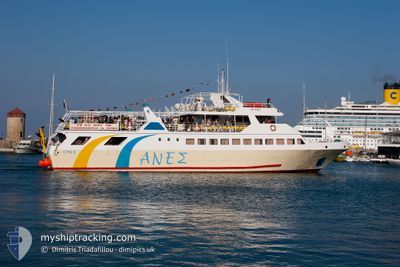
SIMI II
Ro-Ro/Passenger Ship

Current Trip
| Trip Time | 8 h, 42 mins |
|---|---|
| Trip Distance | 42.99 nm |
| AVG Speed | 11.6 Noeuds |
| MAX Speed | 12.8 Noeuds |
| Tirant d eau | 2.5 m |
| AVG Wind | 8.8 knots |
| MAX Wind | 12.3 knots |
| MIN Temp | 18.6°C / 65.48°F |
| MAX Temp | 19.9°C / 67.82°F |
| Position reçue | 8 h, 55 m depuis |
Current Position
| Longitude | 28.22617° |
|---|---|
| Latitude | 36.44908° |
| Etat | Under way using engine |
| Vitesse | |
| Parcours | --- |
| Zone | Mediterranean Sea - Eastern Basin |
| Station | T-AIS |
| Position reçue | 8 h, 55 m depuis |
Information
The current position of SIMI II is in Mediterranean Sea - Eastern Basin with coordinates 36.44908° / 28.22617° as reported on 2025-05-31 15:06 by AIS to our vessel tracker app. The vessel's current speed is 0 Noeuds and is currently inside the port of RHODES.
The vessel SIMI II (IMO: 8900220, MMSI: 241677000) is a Ro-Ro/Passenger Ship that was built in 1990 ( 35 Age ). It's sailing under the flag of [GR] Greece.
In this page you can find informations about the vessels current position, last detected port calls, and current voyage information. If the vessels is not in coverage by AIS you will find the latest position.
The current position of SIMI II is detected by our AIS receivers and we are not responsible for the reliability of the data. The last position was recorded while the vessel was in Coverage by the Ais receivers of our vessel tracking app.
The current draught of SIMI II as reported by AIS is 2.5 meters
Weather
| Temperature | 19.6°C / 67.28°F |
|---|---|
| Wind Speed | 11 knots |
| Direction | 137° SE |
| Pressure | 1012.6 hPa |
| Humidity | 73.1 % |
| Cloud Coverage | 100 % |


Featured Company
Last Port Calls
| Port | Arrival | Departure | Time In Port |
|---|---|---|---|
| 2025-05-31 17:45 | |||
| 2025-05-30 17:48 | 2025-05-31 09:03 | 15 h | |
| 2025-05-30 15:00 | 2025-05-30 16:02 | 1 h | |
| 2025-05-29 17:47 | 2025-05-30 09:02 | 15 h | |
| 2025-05-29 15:03 | 2025-05-29 15:58 | 55 m | |
| 2025-05-29 11:05 | 2025-05-29 14:11 | 3 h | |
| 2025-05-28 17:48 | 2025-05-29 09:04 | 15 h | |
| 2025-05-28 15:05 | 2025-05-28 16:00 | 55 m | |
| 2025-05-28 11:08 | 2025-05-28 14:08 | 2 h | |
| 2025-05-26 17:44 | 2025-05-28 09:13 | 1 d |
Most Visited Ports (Last year)
| Port | Arrivals | |
|---|---|---|
| 162 | ||
| 70 | ||
| 39 | ||
| 1 |
Last Trips
| Origin | Departure | Destination | Arrival | Distance | |
|---|---|---|---|---|---|
| 2025-05-31 09:03 | 2025-05-31 17:45 | 42.99 nm | |||
| 2025-05-30 16:02 | 2025-05-30 17:48 | 21.28 nm | |||
| 2025-05-30 09:02 | 2025-05-30 15:00 | 31.04 nm | |||
| 2025-05-29 15:58 | 2025-05-29 17:47 | 21.48 nm | |||
| 2025-05-29 14:11 | 2025-05-29 15:03 | 7.85 nm | |||
| 2025-05-29 09:04 | 2025-05-29 11:05 | 23.72 nm | |||
| 2025-05-28 16:00 | 2025-05-28 17:48 | 21.44 nm | |||
| 2025-05-28 14:08 | 2025-05-28 15:05 | 11.40 nm | |||
| 2025-05-28 09:13 | 2025-05-28 11:08 | 21.89 nm | |||
| 2025-05-26 15:56 | 2025-05-26 17:44 | 21.53 nm |
Events
| Heure | Evenement | Détails | Position/ Destination | Info |
|---|---|---|---|---|
| 2025-05-31 15:06 | Hors de la zone couverte |
36.44908 / 28.22617
Mediterranean Sea - Eastern Basin
[GR] RHODES
|
Vitesse: Parcours: 241.3° |
|
| 2025-05-31 14:51 | Arret |
36.44927 / 28.22626
[GR] RHODES
|
Vitesse: 0.2 kn Parcours: 511° |
|
| 2025-05-31 14:45 | Port d'arrivée |
|
36.45190 / 28.22666
[GR] RHODES
|
Vitesse: 7.1 kn Parcours: 207.1° |
| 2025-05-31 14:42 | Changement de zone | Greek part of the Mediterranean Sea - Eastern Basin Greek part of the Aegean Sea |
36.45793 / 28.22535
Mediterranean Sea - Eastern Basin
|
Vitesse: 11.7 kn Parcours: 122.7° |
| 2025-05-31 14:34 | Dans la zone couverte |
36.46586 / 28.19407
Aegean Sea
|
Vitesse: 11.9 kn Parcours: 104.7° |
|
| 2025-05-31 14:33 | Etat Changé | Under way using engine Default |
36.46708 / 28.18872
RHO-SYM-PAN-RHO
|
Vitesse: 12.1 kn Parcours: 107° |
| 2025-05-31 06:20 | Etat Changé | Default Under way using engine |
36.48020 / 28.16601
RHO-SYM-PAN-RHO
|
Vitesse: 12.6 kn Parcours: 293.3° |
| 2025-05-31 06:16 | Hors de la zone couverte |
36.47545 / 28.17899
Aegean Sea
|
Vitesse: 12.6 kn Parcours: 293.3° |
|
| 2025-05-31 06:10 | Changement de zone | Greek part of the Aegean Sea Greek part of the Mediterranean Sea - Eastern Basin |
36.46701 / 28.20297
Aegean Sea
|
Vitesse: 12.9 kn Parcours: 292° |
| 2025-05-31 06:03 | PORT DE DEPART |
|
36.45530 / 28.22913
RHO-SYM-PAN-RHO
|
Vitesse: 9 kn Parcours: 58.8° |