

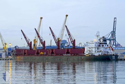
SIRIUS
Bulk Carrier
Current Trip
JM KIN
| Time Travelled | 11 days |
|---|---|
| Remaining Time | --- |
| Distance Travelled | 2720.56 nm |
| Remaining Distance | --- |
| AVG Speed | 9.8 Noeuds |
| MAX Speed | 12.7 Noeuds |
| AVG Wind | 15.2 knots |
| MAX Wind | 20 knots |
| MIN Temp | 22.5°C / 72.5°F |
| MAX Temp | 28°C / 82.4°F |
| Tirant d eau | 7.5 m |
| Position reçue | 7 d depuis |
Current Position
| Longitude | -61.73146° |
|---|---|
| Latitude | 16.64898° |
| Etat | Under way using engine |
| Vitesse | 10.3 Noeuds |
| Parcours | 65.9° |
| Zone | Caribbean Sea |
| Station | T-AIS |
| Position reçue | 7 d depuis |
Information
The current position of SIRIUS is in Caribbean Sea with coordinates 16.64898° / -61.73146° as reported on 2025-05-22 12:09 by AIS to our vessel tracker app. The vessel's current speed is 10.3 Noeuds
The vessel SIRIUS (IMO: 9541887, MMSI: 538008996) is a Bulk Carrier that was built in 2011 ( 14 Age ). It's sailing under the flag of [MH] Marshall Is.
In this page you can find informations about the vessels current position, last detected port calls, and current voyage information. If the vessels is not in coverage by AIS you will find the latest position.
The current position of SIRIUS is detected by our AIS receivers and we are not responsible for the reliability of the data. The last position was recorded while the vessel was in Coverage by the Ais receivers of our vessel tracking app.
The current draught of SIRIUS as reported by AIS is 7.5 meters
Weather
| Temperature | 22.9°C / 73.22°F |
|---|---|
| Wind Speed | 16 knots |
| Direction | 50° NE |
| Pressure | 1017.7 hPa |
| Humidity | 81.9 % |
| Cloud Coverage | 82 % |
Featured Company
Last Port Calls
| Port | Arrival | Departure | Time In Port |
|---|---|---|---|
| 2025-05-18 18:16 | 2025-05-18 18:24 | 8 m | |
| 2025-05-18 01:56 | 2025-05-18 02:04 | 8 m | |
| 2025-05-11 15:39 | 2025-05-12 17:37 | 1 d | |
| 2025-05-08 07:33 | 2025-05-09 19:52 | 1 d | |
| 2025-04-24 00:08 | 2025-04-28 01:37 | 4 d | |
| 2025-04-01 20:35 | 2025-04-05 20:40 | 4 d | |
| 2025-03-03 01:33 | 2025-03-08 16:51 | 5 d |
Most Visited Ports (Last year)
| Port | Arrivals | |
|---|---|---|
| 2 | ||
| 2 | ||
| 2 | ||
| 2 | ||
| 2 | ||
| 1 |
Last Trips
| Origin | Departure | Destination | Arrival | Distance | |
|---|---|---|---|---|---|
| 2025-05-18 02:04 | 2025-05-18 18:16 | 6.59 nm | |||
| 2025-05-12 17:37 | 2025-05-18 01:56 | 1134.84 nm | |||
| 2025-05-09 19:52 | 2025-05-11 15:39 | 35.58 nm | |||
| 2025-04-28 01:37 | 2025-05-08 07:33 | 1102.35 nm | |||
| 2025-04-05 20:40 | 2025-04-24 00:08 | 4434.33 nm | |||
| 2025-03-08 16:51 | 2025-04-01 20:35 | 726.70 nm | |||
| 2025-02-08 01:36 | 2025-03-03 01:33 | 3180.67 nm |
Events
| Heure | Evenement | Détails | Position/ Destination | Info |
|---|---|---|---|---|
| 2025-05-22 12:16 | Etat Changé | Default Under way using engine |
16.65673 / -61.71201
JM KIN
|
Vitesse: 10.3 kn Parcours: 65.9° |
| 2025-05-22 12:09 | Hors de la zone couverte |
16.64898 / -61.73146
Caribbean Sea
|
Vitesse: 10.3 kn Parcours: 65.9° |
|
| 2025-05-22 12:06 | Etat Changé | Under way using engine Default |
16.64561 / -61.73978
JM KIN
|
Vitesse: 10.4 kn Parcours: 67° |
| 2025-05-22 12:04 | Etat Changé | Default Under way using engine |
16.64365 / -61.74497
JM KIN
|
Vitesse: 10.4 kn Parcours: 66.3° |
| 2025-05-22 12:04 | Etat Changé | Under way using engine Default |
16.64269 / -61.74730
JM KIN
|
Vitesse: 10.5 kn Parcours: 68° |
| 2025-05-22 11:56 | Etat Changé | Default Under way using engine |
16.63471 / -61.76771
JM KIN
|
Vitesse: 10.6 kn Parcours: 66° |
| 2025-05-22 11:49 | Etat Changé | Under way using engine Default |
16.62632 / -61.78869
JM KIN
|
Vitesse: 10.5 kn Parcours: 65° |
| 2025-05-22 11:16 | Etat Changé | Default Under way using engine |
16.58885 / -61.88229
JM KIN
|
Vitesse: 10.6 kn Parcours: 69.1° |
| 2025-05-22 11:10 | Etat Changé | Under way using engine Default |
16.58159 / -61.90035
JM KIN
|
Vitesse: 10.6 kn Parcours: 69° |
| 2025-05-22 11:08 | Etat Changé | Default Under way using engine |
16.57979 / -61.90527
JM KIN
|
Vitesse: 10.6 kn Parcours: 69.8° |