
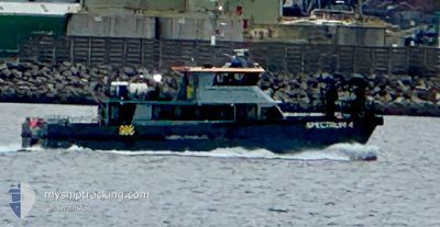
SPECTRUM 4
High speed craft
Current Trip
| Time Travelled | 9 h, 16 mins |
|---|---|
| Remaining Time | 1 h, 3 mins |
| Distance Travelled | 34.55 nm |
| Remaining Distance | --- |
| AVG Speed | 12.4 Noeuds |
| MAX Speed | 21.5 Noeuds |
| AVG Wind | 12.7 knots |
| MAX Wind | 14.9 knots |
| MIN Temp | 3.4°C / 38.12°F |
| MAX Temp | 4.3°C / 39.74°F |
| Tirant d eau | 1.8 m |
| Position reçue | 1 m depuis |
Current Position
| Longitude | -3.25038° |
|---|---|
| Latitude | 53.47452° |
| Etat | Under way using engine |
| Vitesse | 6.3 Noeuds |
| Parcours | 280.8° |
| Zone | Irish Sea and St. George's Channel |
| Station | T-AIS |
| Position reçue | 1 m depuis |
Info
Information
The current position of SPECTRUM 4 is in Irish Sea and St. George's Channel with coordinates 53.47452° / -3.25038° as reported on 2025-02-15 16:42 by AIS to our vessel tracker app. The vessel's current speed is 6.3 Noeuds and is heading at the port of LIVERPOOL. The estimated time of arrival as calculated by MyShipTracking vessel tracking app is 2025-02-15 17:46 LT
The vessel SPECTRUM 4 (IMO: 960959800, MMSI: 235080287) is a High speed craft It's sailing under the flag of [GB] United Kingdom.
In this page you can find informations about the vessels current position, last detected port calls, and current voyage information. If the vessels is not in coverage by AIS you will find the latest position.
The current position of SPECTRUM 4 is detected by our AIS receivers and we are not responsible for the reliability of the data. The last position was recorded while the vessel was in Coverage by the Ais receivers of our vessel tracking app.
The current draught of SPECTRUM 4 as reported by AIS is 1.8 meters
Weather
| Temperature | 4.3°C / 39.74°F |
|---|---|
| Wind Speed | 14 knots |
| Direction | 114° ESE |
| Pressure | 1016.9 hPa |
| Humidity | 86.8 % |
| Cloud Coverage | 100 % |
Featured Company
Last Port Calls
| Port | Arrival | Departure | Time In Port |
|---|---|---|---|
| 2025-02-15 07:01 | 2025-02-15 07:27 | 26 m | |
| 2025-02-15 04:48 | 2025-02-15 06:42 | 1 h | |
| 2025-02-14 18:03 | 2025-02-15 04:40 | 10 h | |
| 2025-02-14 17:14 | 2025-02-14 17:52 | 37 m | |
| 2025-02-14 07:09 | 2025-02-14 07:42 | 33 m | |
| 2025-02-14 05:20 | 2025-02-14 06:35 | 1 h | |
| 2025-02-13 16:39 | 2025-02-14 05:13 | 12 h | |
| 2025-02-13 16:03 | 2025-02-13 16:36 | 33 m | |
| 2025-02-13 07:18 | 2025-02-13 08:00 | 42 m | |
| 2025-02-13 04:52 | 2025-02-13 07:00 | 2 h |
Most Visited Ports (Last year)
| Port | Arrivals | |
|---|---|---|
| 560 | ||
| 205 | ||
| 21 | ||
| 2 | ||
| 2 | ||
| 1 |
Last Trips
| Origin | Departure | Destination | Arrival | Distance | |
|---|---|---|---|---|---|
| 2025-02-15 06:42 | 2025-02-15 07:01 | 0.82 nm | |||
| 2025-02-15 04:40 | 2025-02-15 04:48 | 1.54 nm | |||
| 2025-02-14 17:52 | 2025-02-14 18:03 | 1.54 nm | |||
| 2025-02-14 07:42 | 2025-02-14 17:14 | 75.07 nm | |||
| 2025-02-14 06:35 | 2025-02-14 07:09 | 1.80 nm | |||
| 2025-02-14 05:13 | 2025-02-14 05:20 | 1.54 nm | |||
| 2025-02-13 16:36 | 2025-02-13 16:39 | 2.03 nm | |||
| 2025-02-13 08:00 | 2025-02-13 16:03 | 55.07 nm | |||
| 2025-02-13 07:00 | 2025-02-13 07:18 | 0.28 nm | |||
| 2025-02-13 04:44 | 2025-02-13 04:52 | 1.47 nm |
Events
| Heure | Evenement | Détails | Position/ Destination | Info |
|---|---|---|---|---|
| 2025-02-15 16:36 | Arret | 5.31 nm, East of LIVERPOOL ANCH |
53.47477 / -3.24945
LIVERPOOL> |
Vitesse: 0.2 kn Parcours: 259° |
| 2025-02-15 16:13 | Démarrage | 2.23 nm, North East of LIVERPOOL ANCH |
53.50075 / -3.35578
LIVERPOOL> |
Vitesse: 16.6 kn Parcours: 217.2° |
| 2025-02-15 16:07 | Arret | 2.34 nm, North East of LIVERPOOL ANCH |
53.50155 / -3.35285
LIVERPOOL> |
Vitesse: 0.2 kn Parcours: 279° |
| 2025-02-15 15:58 | Démarrage | 2 nm, North East of LIVERPOOL ANCH |
53.50168 / -3.36885
LIVERPOOL> |
Vitesse: 4.6 kn Parcours: 355° |
| 2025-02-15 15:18 | Arret | 2.34 nm, North East of LIVERPOOL ANCH |
53.50153 / -3.35288
LIVERPOOL> |
Vitesse: 0.2 kn Parcours: 300° |
| 2025-02-15 15:11 | Démarrage | 2.75 nm, East of LIVERPOOL ANCH |
53.47140 / -3.32072
LIVERPOOL> |
Vitesse: 19.1 kn Parcours: 300.9° |
| 2025-02-15 15:04 | Arret | 2.87 nm, East of LIVERPOOL ANCH |
53.47127 / -3.31748
LIVERPOOL> |
Vitesse: 0.3 kn Parcours: 303° |
| 2025-02-15 14:46 | Démarrage | 2.01 nm, East of LIVERPOOL ANCH |
53.47505 / -3.34143
LIVERPOOL> |
Vitesse: 3.1 kn Parcours: 189° |
| 2025-02-15 13:10 | Arret | 2.87 nm, East of LIVERPOOL ANCH |
53.47125 / -3.31747
LIVERPOOL> |
Vitesse: 0.3 kn Parcours: 295° |
| 2025-02-15 12:43 | Démarrage | 2.29 nm, North East of LIVERPOOL ANCH |
53.49973 / -3.35175
LIVERPOOL> |
Vitesse: 5.2 kn Parcours: 166.4° |