
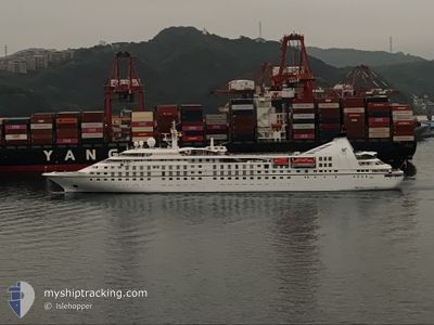
STAR BREEZE
Passengers Ship
Current Trip
PF RFP
| Time Travelled | 22 days |
|---|---|
| Remaining Time | --- |
| Distance Travelled | 4879.65 nm |
| Remaining Distance | --- |
| AVG Speed | 11.3 Noeuds |
| MAX Speed | 15.1 Noeuds |
| AVG Wind | 10.8 knots |
| MAX Wind | 26.2 knots |
| MIN Temp | 23.4°C / 74.12°F |
| MAX Temp | 28.6°C / 83.48°F |
| Tirant d eau | 5.2 m |
| Position reçue | 13 m depuis |
Current Position
| Longitude | -150.22017° |
|---|---|
| Latitude | -17.28600° |
| Etat | Under way using engine |
| Vitesse | 7.6 Noeuds |
| Parcours | 293.1° |
| Zone | South Pacific Ocean |
| Station | T-AIS |
| Position reçue | 13 m depuis |
Info
Information
The current position of STAR BREEZE is in South Pacific Ocean with coordinates -17.28600° / -150.22017° as reported on 2025-02-25 06:32 by AIS to our vessel tracker app. The vessel's current speed is 7.6 Noeuds
The vessel STAR BREEZE (IMO: 8807997, MMSI: 311083000) is a Passengers Ship that was built in 1989 ( 36 Age ). It's sailing under the flag of [BS] Bahamas.
In this page you can find informations about the vessels current position, last detected port calls, and current voyage information. If the vessels is not in coverage by AIS you will find the latest position.
The current position of STAR BREEZE is detected by our AIS receivers and we are not responsible for the reliability of the data. The last position was recorded while the vessel was in Coverage by the Ais receivers of our vessel tracking app.
The current draught of STAR BREEZE as reported by AIS is 5.2 meters
Weather
| Temperature | 28.3°C / 82.94°F |
|---|---|
| Wind Speed | 12 knots |
| Direction | 99° E |
| Pressure | 1015.6 hPa |
| Humidity | 78 % |
| Cloud Coverage | 3 % |
Featured Company
Last Port Calls
| Port | Arrival | Departure | Time In Port |
|---|---|---|---|
| 2025-02-02 12:51 | 2025-02-03 01:19 | 12 h | |
| 2025-01-18 13:07 | 2025-01-29 22:55 | 11 d | |
| 2025-01-16 14:52 | 2025-01-16 22:42 | 7 h |
Most Visited Ports (Last year)
| Port | Arrivals | |
|---|---|---|
| 2 | ||
| 1 |
Last Trips
| Origin | Departure | Destination | Arrival | Distance | |
|---|---|---|---|---|---|
| 2025-01-29 17:55 | 2025-02-02 06:51 | 545.85 nm | |||
| 2025-01-16 16:42 | 2025-01-18 08:07 | 509.16 nm |
Events
| Heure | Evenement | Détails | Position/ Destination | Info |
|---|---|---|---|---|
| 2025-02-25 06:36 | Etat Changé | Default Under way using engine |
-17.28217 / -150.22867
PF RFP
|
Vitesse: 7.6 kn Parcours: 293.1° |
| 2025-02-25 06:32 | Etat Changé | Under way using engine Default |
-17.28600 / -150.22017
PF RFP
|
Vitesse: 7.5 kn Parcours: 294° |
| 2025-02-25 06:02 | Etat Changé | Default Under way using engine |
-17.31233 / -150.15883
PF RFP
|
Vitesse: 7.6 kn Parcours: 295.8° |
| 2025-02-25 05:57 | Etat Changé | Under way using engine Default |
-17.31716 / -150.14733
PF RFP
|
Vitesse: 7.8 kn Parcours: 296° |
| 2025-02-25 05:54 | Etat Changé | Default Under way using engine |
-17.31917 / -150.14250
PF RFP
|
Vitesse: 8 kn Parcours: 295.5° |
| 2025-02-25 05:46 | Etat Changé | Under way using engine Default |
-17.32683 / -150.12517
PF RFP
|
Vitesse: 8.1 kn Parcours: 294° |
| 2025-02-25 05:38 | Dans la zone couverte |
-17.32683 / -150.12517
South Pacific Ocean
PF RFP
|
Vitesse: 8 kn Parcours: 295.5° |
|
| 2025-02-25 04:44 | Etat Changé | Default Under way using engine |
-17.38300 / -149.99716
PF RFP
|
Vitesse: 8.1 kn Parcours: 294° |
| 2025-02-25 04:39 | Hors de la zone couverte |
-17.38700 / -149.98717
South Pacific Ocean
PF RFP
|
Vitesse: 8.1 kn Parcours: 294° |
|
| 2025-02-25 04:38 | Etat Changé | Under way using engine Default |
-17.38817 / -149.98433
PF RFP
|
Vitesse: 8.3 kn Parcours: 295° |