
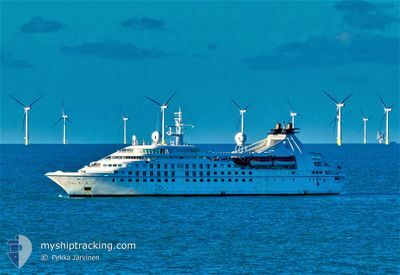
STAR PRIDE
Passengers Ship
Current Trip
AW ORJ
| Time Travelled | 1 day |
|---|---|
| Remaining Time | --- |
| Distance Travelled | 381.46 nm |
| Remaining Distance | --- |
| AVG Speed | 12.3 Noeuds |
| MAX Speed | 14 Noeuds |
| AVG Wind | 18.5 knots |
| MAX Wind | 29 knots |
| MIN Temp | 24.4°C / 75.92°F |
| MAX Temp | 26.9°C / 80.42°F |
| Tirant d eau | 5.5 m |
| Position reçue | 2 h, 13 m depuis |
Current Position
| Longitude | -70.11250° |
|---|---|
| Latitude | 12.54275° |
| Etat | Under way using engine |
| Vitesse | 13.7 Noeuds |
| Parcours | 104° |
| Zone | Caribbean Sea |
| Station | T-AIS |
| Position reçue | 2 h, 13 m depuis |
Info
Information
The current position of STAR PRIDE is in Caribbean Sea with coordinates 12.54275° / -70.11250° as reported on 2025-02-14 16:28 by AIS to our vessel tracker app. The vessel's current speed is 13.7 Noeuds
The vessel STAR PRIDE (IMO: 8707343, MMSI: 311084000) is a Passengers Ship that was built in 1988 ( 37 Age ). It's sailing under the flag of [BS] Bahamas.
In this page you can find informations about the vessels current position, last detected port calls, and current voyage information. If the vessels is not in coverage by AIS you will find the latest position.
The current position of STAR PRIDE is detected by our AIS receivers and we are not responsible for the reliability of the data. The last position was recorded while the vessel was in Coverage by the Ais receivers of our vessel tracking app.
The current draught of STAR PRIDE as reported by AIS is 5.5 meters
Weather
| Temperature | 26.2°C / 79.16°F |
|---|---|
| Wind Speed | 16 knots |
| Direction | 81° E |
| Pressure | 1014.6 hPa |
| Humidity | 78.1 % |
| Cloud Coverage | 63 % |
Featured Company
Last Port Calls
| Port | Arrival | Departure | Time In Port |
|---|---|---|---|
| 2025-02-12 09:46 | 2025-02-13 05:12 | 19 h | |
| 2025-02-02 23:07 | 2025-02-04 15:33 | 1 d | |
| 2025-01-29 09:38 | 2025-01-30 07:49 | 22 h | |
| 2025-01-20 06:46 | 2025-01-21 16:04 | 1 d | |
| 2025-01-16 06:11 | 2025-01-16 21:15 | 15 h | |
| 2025-01-11 04:12 | 2025-01-11 20:02 | 15 h | |
| 2025-01-07 08:17 | 2025-01-07 21:13 | 12 h | |
| 2025-01-07 07:22 | 2025-01-07 07:53 | 31 m | |
| 2025-01-05 07:10 | 2025-01-05 21:15 | 14 h | |
| 2025-01-01 09:47 | 2025-01-02 17:25 | 1 d |
Most Visited Ports (Last year)
| Port | Arrivals | |
|---|---|---|
| 11 | ||
| 11 | ||
| 9 | ||
| 8 | ||
| 8 | ||
| 6 |
Last Trips
| Origin | Departure | Destination | Arrival | Distance | |
|---|---|---|---|---|---|
| 2025-02-04 15:33 | 2025-02-12 09:46 | 1341.78 nm | |||
| 2025-01-30 07:49 | 2025-02-02 23:07 | 779.32 nm | |||
| 2025-01-21 16:04 | 2025-01-29 09:38 | 1344.62 nm | |||
| 2025-01-16 21:15 | 2025-01-20 06:46 | 572.09 nm | |||
| 2025-01-11 20:02 | 2025-01-16 06:11 | 814.08 nm | |||
| 2025-01-07 21:13 | 2025-01-11 04:12 | 425.44 nm | |||
| 2025-01-07 07:53 | 2025-01-07 08:17 | 1.32 nm | |||
| 2025-01-05 21:15 | 2025-01-07 07:22 | 432.91 nm | |||
| 2025-01-02 17:25 | 2025-01-05 07:10 | 468.68 nm | |||
| 2024-12-24 16:21 | 2025-01-01 09:47 | 1075.72 nm |
Events
| Heure | Evenement | Détails | Position/ Destination | Info |
|---|---|---|---|---|
| 2025-02-14 17:25 | Arret |
12.51723 / -70.04029
AW ORJ
|
Vitesse: Parcours: 131° |
|
| 2025-02-14 16:35 | Etat Changé | Default Under way using engine |
12.53701 / -70.08899
AW ORJ
|
Vitesse: 13.7 kn Parcours: 104° |
| 2025-02-14 16:28 | Hors de la zone couverte |
12.54275 / -70.11250
Caribbean Sea
AW ORJ
|
Vitesse: 13.7 kn Parcours: 104° |
|
| 2025-02-14 15:41 | Etat Changé | Under way using engine Default |
12.56100 / -70.27727
AW ORJ
|
Vitesse: 11.6 kn Parcours: 96° |
| 2025-02-14 15:39 | Etat Changé | Default Under way using engine |
12.56160 / -70.28290
AW ORJ
|
Vitesse: 11.7 kn Parcours: 96.4° |
| 2025-02-14 15:39 | Etat Changé | Under way using engine Default |
12.56162 / -70.28317
AW ORJ
|
Vitesse: 12 kn Parcours: 96° |
| 2025-02-14 15:39 | Dans la zone couverte |
12.56162 / -70.28317
Caribbean Sea
AW ORJ
|
Vitesse: 11.7 kn Parcours: 96.4° |
|
| 2025-02-14 15:39 | Changement de zone | Aruban part of the Caribbean Sea Colombian part of the Caribbean Sea |
12.56162 / -70.28317
Caribbean Sea
AW ORJ
|
Vitesse: 11.7 kn Parcours: 96.4° |
| 2025-02-13 17:28 | Etat Changé | Default Under way using engine |
11.27431 / -74.71948
AW ORJ
|
Vitesse: 12.4 kn Parcours: 67.8° |
| 2025-02-13 17:25 | Hors de la zone couverte |
11.27054 / -74.72865
Caribbean Sea
AW ORJ
|
Vitesse: 12.4 kn Parcours: 67.8° |