
SUSTAINABLE EARTH
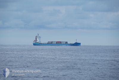
Cargo A
Current Trip
| Time Travelled | 7 days |
|---|---|
| Remaining Time | 4 h, 12 mins |
| Distance Travelled | 1094.84 nm |
| Remaining Distance | 126.24 nm |
| AVG Speed | 13 Noeuds |
| MAX Speed | 16.5 Noeuds |
| AVG Wind | 13.4 knots |
| MAX Wind | 29.3 knots |
| MIN Temp | 2.1°C / 35.78°F |
| MAX Temp | 11.7°C / 53.06°F |
| Tirant d eau | 7.7 m |
| Position reçue | 13 h, 33 m depuis |
Current Position
| Longitude | 138.19015° |
|---|---|
| Latitude | 37.57669° |
| Etat | Under way using engine |
| Vitesse | 14 Noeuds |
| Parcours | 49.4° |
| Zone | Japan Sea |
| Station | T-AIS |
| Position reçue | 13 h, 33 m depuis |
Info
Information
The current position of SUSTAINABLE EARTH is in Japan Sea with coordinates 37.57669° / 138.19015° as reported on 2025-02-01 16:08 by AIS to our vessel tracker app. The vessel's current speed is 14 Noeuds and is heading at the port of TOYAMASHIN. The estimated time of arrival as calculated by MyShipTracking vessel tracking app is 2025-02-02 09:53 LT
The vessel SUSTAINABLE EARTH (IMO: 9929235, MMSI: 636021093) is a Cargo A It's sailing under the flag of [LR] Liberia.
In this page you can find informations about the vessels current position, last detected port calls, and current voyage information. If the vessels is not in coverage by AIS you will find the latest position.
The current position of SUSTAINABLE EARTH is detected by our AIS receivers and we are not responsible for the reliability of the data. The last position was recorded while the vessel was in Coverage by the Ais receivers of our vessel tracking app.
The current draught of SUSTAINABLE EARTH as reported by AIS is 7.7 meters
Weather
| Temperature | 4.4°C / 39.92°F |
|---|---|
| Wind Speed | 7 knots |
| Direction | 12° NNE |
| Pressure | 1016.5 hPa |
| Humidity | 59.3 % |
| Cloud Coverage | 66 % |
Featured Company
Last Port Calls
| Port | Arrival | Departure | Time In Port |
|---|---|---|---|
| 2025-01-25 01:09 | 2025-01-25 16:21 | 15 h | |
| 2025-01-19 22:05 | 2025-01-20 08:04 | 9 h | |
| 2025-01-15 22:09 | 2025-01-16 07:05 | 8 h | |
| 2025-01-12 11:31 | 2025-01-12 22:33 | 11 h | |
| 2025-01-09 14:05 | 2025-01-09 22:45 | 8 h | |
| 2024-12-29 22:00 | 2024-12-30 09:13 | 11 h | |
| 2024-12-25 23:05 | 2024-12-26 07:17 | 8 h | |
| 2024-12-22 20:54 | 2024-12-23 04:37 | 7 h | |
| 2024-12-20 18:48 | 2024-12-21 05:41 | 10 h | |
| 2024-12-13 22:05 | 2024-12-14 04:28 | 6 h |
Most Visited Ports (Last year)
| Port | Arrivals | |
|---|---|---|
| 27 | ||
| 17 | ||
| 16 | ||
| 15 |
Last Trips
| Origin | Departure | Destination | Arrival | Distance | |
|---|---|---|---|---|---|
| 2025-01-20 17:04 | 2025-01-25 09:09 | 1245.93 nm | |||
| 2025-01-16 16:05 | 2025-01-20 07:05 | 541.23 nm | |||
| 2025-01-13 06:33 | 2025-01-16 07:09 | 963.45 nm | |||
| 2025-01-10 06:45 | 2025-01-12 19:31 | 393.51 nm | |||
| 2024-12-30 18:13 | 2025-01-09 22:05 | 1639.28 nm | |||
| 2024-12-26 16:17 | 2024-12-30 07:00 | 523.95 nm | |||
| 2024-12-23 12:37 | 2024-12-26 08:05 | 957.54 nm | |||
| 2024-12-21 13:41 | 2024-12-23 04:54 | 380.52 nm | |||
| 2024-12-14 13:28 | 2024-12-21 02:48 | 1697.28 nm | |||
| 2024-12-11 20:52 | 2024-12-14 07:05 | 510.21 nm |
Events
| Heure | Evenement | Détails | Position/ Destination | Info |
|---|---|---|---|---|
| 2025-02-01 23:57 | Arret | 2.94 nm, East of NIIGATA |
37.97538 / 139.23193
KIJ JP
|
Vitesse: 0.3 kn Parcours: 65° |
| 2025-02-01 22:05 | Démarrage | 8.4 nm, West of NIIGATA |
38.00776 / 138.99734
KIJ JP
|
Vitesse: 3.9 kn Parcours: 80° |
| 2025-02-01 20:05 | Arret | 8.07 nm, West of NIIGATA |
38.00332 / 139.00325
KIJ JP
|
Vitesse: 0.3 kn Parcours: 53° |
| 2025-02-01 16:30 | Etat Changé | Default Under way using engine |
37.63440 / 138.27469
KIJ JP
|
Vitesse: 14 kn Parcours: 49.4° |
| 2025-02-01 16:08 | Hors de la zone couverte |
37.57669 / 138.19015
Japan Sea
KIJ JP
|
Vitesse: 14 kn Parcours: 49.4° |
|
| 2025-02-01 12:29 | Changement d'ETA | 2025/02/02 08:10 2025/02/02 06:00 |
37.04231 / 137.38779
KIJ JP
|
Vitesse: 13.8 kn Parcours: 46.8° |
| 2025-02-01 12:22 | Etat Changé | Under way using engine Default |
37.02409 / 137.36251
KIJ JP
|
Vitesse: 13.5 kn Parcours: 49° |
| 2025-02-01 12:17 | Etat Changé | Default Under way using engine |
37.01173 / 137.34531
KIJ JP
|
Vitesse: 13.4 kn Parcours: 49.3° |
| 2025-02-01 12:12 | Etat Changé | Under way using engine Default |
36.99939 / 137.32675
KIJ JP
|
Vitesse: 13.5 kn Parcours: 53° |
| 2025-02-01 12:09 | Etat Changé | Default Under way using engine |
36.99307 / 137.31677
KIJ JP
|
Vitesse: 13.1 kn Parcours: 53.4° |