

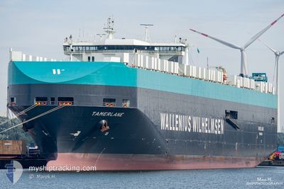
TAMERLANE
Vehicles Carrier

Current Trip
| Time Travelled | 3 days |
|---|---|
| Remaining Time | --- |
| Distance Travelled | 1732.38 nm |
| Remaining Distance | --- |
| AVG Speed | 19.1 Noeuds |
| MAX Speed | 22.6 Noeuds |
| AVG Wind | 17.2 knots |
| MAX Wind | 23.8 knots |
| MIN Temp | 5.4°C / 41.72°F |
| MAX Temp | 19.5°C / 67.1°F |
| Tirant d eau | 10.5 m |
| Position reçue | 4 d depuis |
Current Position
| Longitude | 141.04891° |
|---|---|
| Latitude | 36.41029° |
| Etat | Under way using engine |
| Vitesse | 13.3 Noeuds |
| Parcours | 17.2° |
| Zone | North Pacific Ocean |
| Station | T-AIS |
| Position reçue | 4 d depuis |
Information
The current position of TAMERLANE is in North Pacific Ocean with coordinates 36.41029° / 141.04891° as reported on 2025-06-02 02:07 by AIS to our vessel tracker app. The vessel's current speed is 13.3 Noeuds and is heading at the port of HITACHI. The estimated time of arrival as calculated by MyShipTracking vessel tracking app is 2025-06-02 17:00 LT
The vessel TAMERLANE (IMO: 9218648, MMSI: 257758000) is a Vehicles Carrier that was built in 2001 ( 24 Age ). It's sailing under the flag of [NO] Norway.
In this page you can find informations about the vessels current position, last detected port calls, and current voyage information. If the vessels is not in coverage by AIS you will find the latest position.
The current position of TAMERLANE is detected by our AIS receivers and we are not responsible for the reliability of the data. The last position was recorded while the vessel was in Coverage by the Ais receivers of our vessel tracking app.
The current draught of TAMERLANE as reported by AIS is 10.5 meters
Weather
| Temperature | 5.7°C / 42.26°F |
|---|---|
| Wind Speed | 13 knots |
| Direction | 162° SSE |
| Pressure | 1024.4 hPa |
| Humidity | 94.2 % |
| Cloud Coverage | 100 % |


Featured Company
Last Port Calls
| Port | Arrival | Departure | Time In Port |
|---|---|---|---|
| 2025-06-02 17:14 | 2025-06-03 04:26 | 11 h | |
| 2025-05-30 07:17 | 2025-05-31 00:35 | 17 h | |
| 2025-05-28 07:14 | 2025-05-29 08:02 | 1 d | |
| 2025-05-26 06:34 | 2025-05-27 15:58 | 1 d | |
| 2025-05-24 05:59 | 2025-05-24 17:07 | 11 h | |
| 2025-04-27 08:28 | 2025-04-28 15:24 | 1 d | |
| 2025-04-23 03:02 | 2025-04-25 11:27 | 2 d | |
| 2025-04-20 04:35 | 2025-04-22 17:09 | 2 d | |
| 2025-04-13 18:57 | 2025-04-14 19:11 | 1 d |
Last Trips
| Origin | Departure | Destination | Arrival | Distance | |
|---|---|---|---|---|---|
| 2025-05-31 00:35 | 2025-06-02 17:14 | 262.69 nm | |||
| 2025-05-29 08:02 | 2025-05-30 07:17 | 238.18 nm | |||
| 2025-05-27 15:58 | 2025-05-28 07:14 | 253.56 nm | |||
| 2025-05-24 17:07 | 2025-05-26 06:34 | 501.57 nm | |||
| 2025-04-28 15:24 | 2025-05-24 05:59 | 9882.29 nm | |||
| 2025-04-25 11:27 | 2025-04-27 08:28 | 692.69 nm | |||
| 2025-04-22 17:09 | 2025-04-23 03:02 | 162.78 nm | |||
| 2025-04-14 19:11 | 2025-04-20 04:35 | 1775.77 nm | |||
| 2025-03-22 05:26 | 2025-04-13 18:57 | 7674.98 nm |
Events
| Heure | Evenement | Détails | Position/ Destination | Info |
|---|---|---|---|---|
| 2025-06-02 19:26 | PORT DE DEPART |
|
36.40110 / 140.63356
JP HTC
|
Vitesse: 8.6 kn Parcours: 180° |
| 2025-06-02 19:15 | Démarrage |
36.42652 / 140.63115
[JP] HITACHINAKA
|
Vitesse: 4.4 kn Parcours: 165° |
|
| 2025-06-02 08:35 | Arret |
36.43103 / 140.62451
[JP] HITACHINAKA
|
Vitesse: 0.2 kn Parcours: 271° |
|
| 2025-06-02 08:14 | Port d'arrivée |
|
36.42865 / 140.63051
[JP] HITACHINAKA
|
Vitesse: 11.8 kn Parcours: 336° |
| 2025-06-02 06:23 | Démarrage | 17.06 nm, South East of KAWAJIRI |
36.48267 / 140.98589
JP HTC
|
Vitesse: 4.5 kn Parcours: 346° |
| 2025-06-02 04:38 | Arret | 19.21 nm, East of HITACHI |
36.45714 / 141.02167
JP HTC
|
Vitesse: 0.3 kn Parcours: 158° |
| 2025-06-02 02:15 | Etat Changé | Default Under way using engine |
36.43433 / 141.06192
JP HTC
|
Vitesse: 13.3 kn Parcours: 17.2° |
| 2025-06-02 02:07 | Hors de la zone couverte |
36.41029 / 141.04891
North Pacific Ocean
JP HTC
|
Vitesse: 13.3 kn Parcours: 17.2° |
|
| 2025-06-02 01:48 | Etat Changé | Under way using engine Default |
36.35414 / 141.02745
JP HTC
|
Vitesse: 5.7 kn Parcours: 3° |
| 2025-06-02 01:47 | Démarrage | 20.02 nm, East of HITACHINAKA |
36.35100 / 141.02672
JP HTC
|
Vitesse: 5.7 kn Parcours: 3° |