

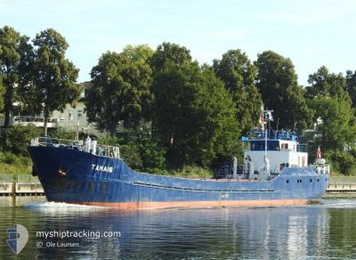
TANAIS
Cargo

Current Trip
| Trip Time | 6 days |
|---|---|
| Trip Distance | 416.29 nm |
| AVG Speed | 6.1 Noeuds |
| MAX Speed | 7.4 Noeuds |
| Tirant d eau | 2 m |
| AVG Wind | 10.4 knots |
| MAX Wind | 17.7 knots |
| MIN Temp | -0.2°C / 31.64°F |
| MAX Temp | 6.9°C / 44.42°F |
| Position reçue | 3 h, 0 m depuis |
Current Position
| Longitude | 19.38666° |
|---|---|
| Latitude | 54.17643° |
| Etat | Moored |
| Vitesse | |
| Parcours | --- |
| Zone | Baltic Sea |
| Station | T-AIS |
| Position reçue | 3 h, 0 m depuis |
Information
The current position of TANAIS is in Baltic Sea with coordinates 54.17643° / 19.38666° as reported on 2025-03-30 20:15 by AIS to our vessel tracker app. The vessel's current speed is 0 Noeuds and is currently inside the port of ELBLAG.
The vessel TANAIS (IMO: 6721008, MMSI: 261006820) is a Cargo It's sailing under the flag of [PL] Poland.
In this page you can find informations about the vessels current position, last detected port calls, and current voyage information. If the vessels is not in coverage by AIS you will find the latest position.
The current position of TANAIS is detected by our AIS receivers and we are not responsible for the reliability of the data. The last position was recorded while the vessel was in Coverage by the Ais receivers of our vessel tracking app.
The current draught of TANAIS as reported by AIS is 2 meters
Weather
| Temperature | 4.8°C / 40.64°F |
|---|---|
| Wind Speed | 4 knots |
| Direction | 247° WSW |
| Pressure | 1007.6 hPa |
| Humidity | 90.5 % |
| Cloud Coverage | 80 % |


Featured Company
Last Port Calls
| Port | Arrival | Departure | Time In Port |
|---|---|---|---|
| 2025-02-05 11:30 | |||
| 2025-01-29 12:17 | 2025-01-30 06:25 | 18 h | |
| 2025-01-25 17:59 | 2025-01-28 11:56 | 2 d | |
| 2025-01-21 19:04 | 2025-01-22 13:05 | 18 h | |
| 2025-01-13 10:51 |
Most Visited Ports (Last year)
| Port | Arrivals | |
|---|---|---|
| 7 | ||
| 6 | ||
| 4 | ||
| 3 | ||
| 2 | ||
| 1 |
Last Trips
| Origin | Departure | Destination | Arrival | Distance | |
|---|---|---|---|---|---|
| 2025-01-30 07:25 | 2025-02-05 12:30 | 416.29 nm | |||
| 2025-01-28 12:56 | 2025-01-29 13:17 | 72.77 nm | |||
| 2025-01-22 14:05 | 2025-01-25 18:59 | 108.07 nm | |||
| 2025-01-13 11:51 | 2025-01-21 20:04 | 452.54 nm |
Events
| Heure | Evenement | Détails | Position/ Destination | Info |
|---|---|---|---|---|
| 2025-03-30 20:27 | Etat Changé | Default Moored |
54.17645 / 19.38666
[PL] ELBLAG
|
Vitesse: Parcours: 511° |
| 2025-03-30 20:15 | Etat Changé | Moored Default |
54.17643 / 19.38666
[PL] ELBLAG
|
Vitesse: Parcours: -1° |
| 2025-03-30 20:15 | Dans la zone couverte |
54.17643 / 19.38666
Baltic Sea
[PL] ELBLAG
|
Vitesse: Parcours: 511° |
|
| 2025-03-30 20:15 | Hors de la zone couverte |
54.17643 / 19.38666
Baltic Sea
[PL] ELBLAG
|
Vitesse: Parcours: 511° |
|
| 2025-03-30 18:12 | Etat Changé | Default Moored |
54.17643 / 19.38669
[PL] ELBLAG
|
Vitesse: Parcours: 511° |
| 2025-03-30 18:09 | Hors de la zone couverte |
54.17643 / 19.38668
Baltic Sea
[PL] ELBLAG
|
Vitesse: Parcours: 511° |
|
| 2025-03-30 18:00 | Etat Changé | Moored Default |
54.17642 / 19.38667
[PL] ELBLAG
|
Vitesse: Parcours: -1° |
| 2025-03-30 18:00 | Dans la zone couverte |
54.17643 / 19.38667
Baltic Sea
[PL] ELBLAG
|
Vitesse: Parcours: 511° |
|
| 2025-03-30 16:48 | Etat Changé | Default Moored |
54.17644 / 19.38668
[PL] ELBLAG
|
Vitesse: Parcours: 511° |
| 2025-03-30 16:45 | Hors de la zone couverte |
54.17644 / 19.38669
Baltic Sea
[PL] ELBLAG
|
Vitesse: Parcours: 511° |