
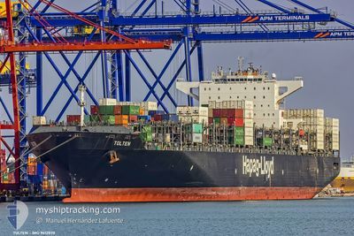
TOLTEN
Container Ship
Current Trip
| Time Travelled | 1 day |
|---|---|
| Remaining Time | 12 h, 11 mins |
| Distance Travelled | 437.23 nm |
| Remaining Distance | 247.51 nm |
| AVG Speed | 17 Noeuds |
| MAX Speed | 20.6 Noeuds |
| AVG Wind | 11.2 knots |
| MAX Wind | 18.2 knots |
| MIN Temp | 18°C / 64.4°F |
| MAX Temp | 24.7°C / 76.46°F |
| Tirant d eau | 11.8 m |
| Position reçue | 6 d depuis |
Current Position
| Longitude | 66.47539° |
|---|---|
| Latitude | 23.00211° |
| Etat | Under way using engine |
| Vitesse | 13.5 Noeuds |
| Parcours | 16.7° |
| Zone | Arabian Sea |
| Station | T-AIS |
| Position reçue | 6 d depuis |
Info
Information
The current position of TOLTEN is in Arabian Sea with coordinates 23.00211° / 66.47539° as reported on 2025-01-29 17:53 by AIS to our vessel tracker app. The vessel's current speed is 13.5 Noeuds and is heading at the port of PORT QASIM. The estimated time of arrival as calculated by MyShipTracking vessel tracking app is 2025-02-05 10:55 LT
The vessel TOLTEN (IMO: 9612870, MMSI: 636092678) is a Container Ship that was built in 2012 ( 13 Age ). It's sailing under the flag of [LR] Liberia.
In this page you can find informations about the vessels current position, last detected port calls, and current voyage information. If the vessels is not in coverage by AIS you will find the latest position.
The current position of TOLTEN is detected by our AIS receivers and we are not responsible for the reliability of the data. The last position was recorded while the vessel was in Coverage by the Ais receivers of our vessel tracking app.
The current draught of TOLTEN as reported by AIS is 11.8 meters
Weather
| Temperature | 18.1°C / 64.58°F |
|---|---|
| Wind Speed | 9 knots |
| Direction | 318° NW |
| Pressure | 1014.6 hPa |
| Humidity | 60.9 % |
| Cloud Coverage | --- |
Featured Company
Last Port Calls
| Port | Arrival | Departure | Time In Port |
|---|---|---|---|
| 2025-02-02 09:25 | 2025-02-03 21:13 | 1 d | |
| 2025-01-30 03:52 | 2025-01-31 04:45 | 1 d | |
| 2024-12-27 23:08 | 2024-12-28 19:08 | 20 h | |
| 2024-12-26 05:51 | 2024-12-27 14:05 | 1 d | |
| 2024-12-21 08:21 | 2024-12-22 12:59 | 1 d | |
| 2024-12-18 09:37 | 2024-12-20 08:50 | 1 d |
Most Visited Ports (Last year)
| Port | Arrivals | |
|---|---|---|
| 6 | ||
| 5 | ||
| 4 | ||
| 4 | ||
| 4 | ||
| 4 |
Last Trips
| Origin | Departure | Destination | Arrival | Distance | |
|---|---|---|---|---|---|
| 2025-01-31 09:45 | 2025-02-02 14:55 | 584.25 nm | |||
| 2024-12-28 14:08 | 2025-01-30 08:52 | 11634.46 nm | |||
| 2024-12-27 09:05 | 2024-12-27 18:08 | 124.52 nm | |||
| 2024-12-22 07:59 | 2024-12-26 00:51 | 582.86 nm | |||
| 2024-12-20 03:50 | 2024-12-21 03:21 | 309.05 nm | |||
| 2024-11-22 04:03 | 2024-12-18 04:37 | 11506.97 nm |
Events
| Heure | Evenement | Détails | Position/ Destination | Info |
|---|---|---|---|---|
| 2025-02-03 21:25 | Démarrage | 0.35 nm, North of NHAVA SHEVA |
18.96242 / 72.94641
PKBQM
|
Vitesse: 5.8 kn Parcours: 206° |
| 2025-02-03 21:13 | PORT DE DEPART |
|
18.96534 / 72.94774
PKBQM
|
Vitesse: 0.7 kn Parcours: 26° |
| 2025-02-02 09:33 | Arret |
18.96371 / 72.95046
[IN] NHAVA SHEVA
|
Vitesse: Parcours: 26° |
|
| 2025-02-02 09:25 | Port d'arrivée |
|
18.96349 / 72.94902
[IN] NHAVA SHEVA
|
Vitesse: 5.9 kn Parcours: 39° |
| 2025-02-01 16:15 | Démarrage |
19.87020 / 71.16792
PKBQM
|
Vitesse: 9.8 kn Parcours: 76° |
|
| 2025-02-01 15:16 | Arret |
19.87692 / 71.13796
PKBQM
|
Vitesse: 0.3 kn Parcours: 36° |
|
| 2025-01-31 04:45 | PORT DE DEPART |
|
24.77876 / 67.29400
PKBQM
|
Vitesse: 7.3 kn Parcours: 305° |
| 2025-01-31 04:30 | Démarrage |
24.76216 / 67.32336
[PK] PORT QASIM
|
Vitesse: 3.1 kn Parcours: 287° |
|
| 2025-01-30 04:26 | Arret |
24.76380 / 67.32455
[PK] PORT QASIM
|
Vitesse: 0.1 kn Parcours: 269° |
|
| 2025-01-30 03:52 | Port d'arrivée |
|
24.76890 / 67.31084
[PK] PORT QASIM
|
Vitesse: 7.8 kn Parcours: 119° |