

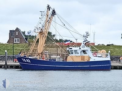
TX42 RES NOVA
Fishing

Current Trip
| Trip Time | 6 h, 19 mins |
|---|---|
| Trip Distance | 41.99 nm |
| AVG Speed | 7.2 Noeuds |
| MAX Speed | 8.4 Noeuds |
| Tirant d eau | 2.5 m |
| AVG Wind | 21.6 knots |
| MAX Wind | 23.9 knots |
| MIN Temp | 13.1°C / 55.58°F |
| MAX Temp | 17.7°C / 63.86°F |
| Position reçue | 4 m depuis |
Current Position
| Longitude | 5.07543° |
|---|---|
| Latitude | 52.49297° |
| Etat | Moored |
| Vitesse | |
| Parcours | 41° |
| Zone | North Sea |
| Station | T-AIS |
| Position reçue | 4 m depuis |
Information
The current position of TX42 RES NOVA is in North Sea with coordinates 52.49297° / 5.07543° as reported on 2025-06-07 09:03 by AIS to our vessel tracker app. The vessel's current speed is 0 Noeuds and is currently inside the port of VOLENDAM.
The vessel TX42 RES NOVA (MMSI: 246226000) is a Fishing It's sailing under the flag of [NL] Netherlands.
In this page you can find informations about the vessels current position, last detected port calls, and current voyage information. If the vessels is not in coverage by AIS you will find the latest position.
The current position of TX42 RES NOVA is detected by our AIS receivers and we are not responsible for the reliability of the data. The last position was recorded while the vessel was in Coverage by the Ais receivers of our vessel tracking app.
The current draught of TX42 RES NOVA as reported by AIS is 2.5 meters
Weather
| Temperature | 11.4°C / 52.52°F |
|---|---|
| Wind Speed | 7 knots |
| Direction | 181° S |
| Pressure | 1005.8 hPa |
| Humidity | 93.8 % |
| Cloud Coverage | 100 % |


Featured Company
Last Port Calls
| Port | Arrival | Departure | Time In Port |
|---|---|---|---|
| 2025-06-06 14:42 | |||
| 2025-06-06 08:23 | |||
| 2025-05-30 07:19 | 2025-06-01 23:59 | 2 d | |
| 2025-05-26 21:21 | 2025-05-28 05:23 | 1 d | |
| 2025-05-21 23:52 | 2025-05-25 23:52 | 4 d | |
| 2025-05-14 23:46 | 2025-05-18 23:57 | 4 d | |
| 2025-05-08 06:02 | 2025-05-11 23:54 | 3 d | |
| 2025-05-05 06:51 | |||
| 2025-04-24 18:31 | 2025-04-28 00:02 | 3 d | |
| 2025-04-22 12:23 |
Most Visited Ports (Last year)
| Port | Arrivals | |
|---|---|---|
| 43 | ||
| 14 | ||
| 3 | ||
| 3 | ||
| 2 | ||
| 1 |
Last Trips
| Origin | Departure | Destination | Arrival | Distance | |
|---|---|---|---|---|---|
| 2025-06-06 08:23 | 2025-06-06 14:42 | 41.99 nm | |||
| 2025-05-28 05:23 | 2025-05-30 07:19 | 148.10 nm | |||
| 2025-05-25 23:52 | 2025-05-26 21:21 | 66.76 nm | |||
| 2025-05-18 23:57 | 2025-05-21 23:52 | 220.30 nm | |||
| 2025-05-11 23:54 | 2025-05-14 23:46 | 161.53 nm | |||
| 2025-05-05 06:51 | 2025-05-08 06:02 | 210.35 nm | |||
| 2025-04-22 12:23 | 2025-04-24 18:31 | 130.76 nm | |||
| 2025-04-02 18:09 | 2025-04-03 08:22 | 46.17 nm | |||
| 2025-03-27 12:30 | 2025-04-02 12:23 | 35.43 nm |
Events
| Heure | Evenement | Détails | Position/ Destination | Info |
|---|---|---|---|---|
| 2025-06-06 12:44 | Arret |
52.49322 / 5.07638
[NL] VOLENDAM
|
Vitesse: 0.2 kn Parcours: 36° |
|
| 2025-06-06 12:42 | Port d'arrivée |
|
52.49270 / 5.07652
[NL] VOLENDAM
|
Vitesse: 2.8 kn Parcours: 316° |
| 2025-06-06 11:40 | Tirant d'eau modifié | 2.5 2 |
52.59083 / 5.18286
OUDESCHILD - TEXEL
|
Vitesse: 7.4 kn Parcours: 208.3° |
| 2025-06-06 11:22 | Tirant d'eau modifié | 2 2.5 |
52.62372 / 5.21063
OUDESCHILD - TEXEL
|
Vitesse: 7.4 kn Parcours: 206.2° |
| 2025-06-06 10:41 | Démarrage | 0.68 nm, South of ENKHUIZEN |
52.68920 / 5.29491
OUDESCHILD - TEXEL
|
Vitesse: 7.3 kn Parcours: 206.1° |
| 2025-06-06 10:31 | Arret | 0.57 nm, South of ENKHUIZEN |
52.69096 / 5.29567
OUDESCHILD - TEXEL
|
Vitesse: 0.3 kn Parcours: 185° |
| 2025-06-06 08:08 | Démarrage | 0.35 nm, North of MARINA DEN OEVER |
52.92921 / 5.04895
OUDESCHILD - TEXEL
|
Vitesse: 6.6 kn Parcours: 144.7° |
| 2025-06-06 08:01 | Arret | 0.42 nm, North of MARINA DEN OEVER |
52.93071 / 5.04704
OUDESCHILD - TEXEL
|
Vitesse: 0.2 kn Parcours: 146° |
| 2025-06-06 06:48 | Dans la zone couverte |
52.99488 / 4.85894
North Sea
|
Vitesse: 7.1 kn Parcours: 153.4° |
|
| 2025-06-06 06:23 | PORT DE DEPART |
|
52.99488 / 4.85894
OUDESCHILD - TEXEL
|
Vitesse: Parcours: 263° |