
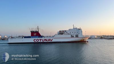
ULYSSE
Ro-Ro/Passenger Ship
Current Trip
| Time Travelled | 1 day |
|---|---|
| Remaining Time | 1 h, 26 mins |
| Distance Travelled | 456.06 nm |
| Remaining Distance | --- |
| AVG Speed | 14.5 Noeuds |
| MAX Speed | 16.3 Noeuds |
| AVG Wind | 15.4 knots |
| MAX Wind | 29 knots |
| MIN Temp | 10.9°C / 51.62°F |
| MAX Temp | 15.1°C / 59.18°F |
| Tirant d eau | 6 m |
| Position reçue | 3 m depuis |
Current Position
| Longitude | 5.22174° |
|---|---|
| Latitude | 43.09580° |
| Etat | Under way using engine |
| Vitesse | 13 Noeuds |
| Parcours | 326.8° |
| Zone | Tyrrhenian Sea |
| Station | T-AIS |
| Position reçue | 3 m depuis |
Info
Information
The current position of ULYSSE is in Tyrrhenian Sea with coordinates 43.09580° / 5.22174° as reported on 2025-02-02 03:50 by AIS to our vessel tracker app. The vessel's current speed is 13 Noeuds and is heading at the port of MARSEILLE. The estimated time of arrival as calculated by MyShipTracking vessel tracking app is 2025-02-02 05:20 LT
The vessel ULYSSE (IMO: 9142459, MMSI: 672248000) is a Ro-Ro/Passenger Ship that was built in 1997 ( 28 Age ). It's sailing under the flag of [TN] Tunisia.
In this page you can find informations about the vessels current position, last detected port calls, and current voyage information. If the vessels is not in coverage by AIS you will find the latest position.
The current position of ULYSSE is detected by our AIS receivers and we are not responsible for the reliability of the data. The last position was recorded while the vessel was in Coverage by the Ais receivers of our vessel tracking app.
The current draught of ULYSSE as reported by AIS is 6 meters
Weather
| Temperature | 11.7°C / 53.06°F |
|---|---|
| Wind Speed | 21 knots |
| Direction | 72° ENE |
| Pressure | 1018.1 hPa |
| Humidity | 78.8 % |
| Cloud Coverage | 100 % |
Featured Company
Last Port Calls
| Port | Arrival | Departure | Time In Port |
|---|---|---|---|
| 2025-01-31 05:05 | 2025-01-31 21:02 | 15 h | |
| 2025-01-29 08:15 | 2025-01-29 21:51 | 13 h | |
| 2025-01-27 10:36 | 2025-01-27 22:14 | 11 h | |
| 2025-01-26 05:22 | 2025-01-26 11:48 | 6 h | |
| 2025-01-24 18:41 | 2025-01-25 01:37 | 6 h | |
| 2025-01-23 07:31 | 2025-01-23 17:55 | 10 h | |
| 2025-01-21 07:41 | 2025-01-21 23:17 | 15 h | |
| 2025-01-18 05:43 | 2025-01-19 17:40 | 1 d | |
| 2025-01-16 05:57 | 2025-01-16 19:07 | 13 h | |
| 2025-01-14 11:58 | 2025-01-14 21:29 | 9 h |
Last Trips
| Origin | Departure | Destination | Arrival | Distance | |
|---|---|---|---|---|---|
| 2025-01-29 22:51 | 2025-01-31 06:05 | 424.14 nm | |||
| 2025-01-27 23:14 | 2025-01-29 09:15 | 422.87 nm | |||
| 2025-01-26 12:48 | 2025-01-27 11:36 | 415.95 nm | |||
| 2025-01-25 02:37 | 2025-01-26 06:22 | 411.28 nm | |||
| 2025-01-23 18:55 | 2025-01-24 19:41 | 477.69 nm | |||
| 2025-01-22 00:17 | 2025-01-23 08:31 | 476.93 nm | |||
| 2025-01-19 18:40 | 2025-01-21 08:41 | 669.15 nm | |||
| 2025-01-16 20:07 | 2025-01-18 06:43 | 600.65 nm | |||
| 2025-01-14 22:29 | 2025-01-16 06:57 | 596.95 nm | |||
| 2025-01-13 01:09 | 2025-01-14 12:58 | 588.34 nm |
Events
| Heure | Evenement | Détails | Position/ Destination | Info |
|---|---|---|---|---|
| 2025-02-02 03:49 | Changement de zone | French part of the Mediterranean Sea - Western Basin French part of the Tyrrhenian Sea |
43.09123 / 5.22591
Mediterranean Sea - Western Basin
|
Vitesse: 13 kn Parcours: 326° |
| 2025-02-02 03:48 | Etat Changé | Under way using engine Default |
43.08917 / 5.22776
TNRDS
|
Vitesse: 13 kn Parcours: 327° |
| 2025-02-02 03:48 | Dans la zone couverte |
43.09123 / 5.22591
Mediterranean Sea - Western Basin
|
Vitesse: 13 kn Parcours: 326° |
|
| 2025-01-31 21:02 | PORT DE DEPART |
|
36.80154 / 10.32303
TNRDS
|
Vitesse: 4.4 kn Parcours: 57° |
| 2025-01-31 06:04 | Arret |
36.80553 / 10.27010
[TN] RADES
|
Vitesse: Parcours: 78° |
|
| 2025-01-31 05:05 | Port d'arrivée |
|
36.80727 / 10.27328
[TN] RADES
|
Vitesse: 15.7 kn Parcours: 181° |
| 2025-01-30 05:57 | Hors de la zone couverte |
41.79217 / 9.76504
Tyrrhenian Sea
TNRDS
|
Vitesse: 13.2 kn Parcours: 177.7° |
|
| 2025-01-30 02:59 | Changement d'ETA | 2025/01/31 06:00 2025/01/31 05:00 |
42.44408 / 9.68424
TNRDS
|
Vitesse: 13.2 kn Parcours: 175.8° |
| 2025-01-30 01:45 | Changement de destination | TNRDS ITLIV |
42.71562 / 9.64744
TNRDS
|
Vitesse: 12.8 kn Parcours: 176° |
| 2025-01-30 01:45 | Changement d'ETA | 2025/01/31 05:00 2025/01/30 23:00 |
42.71562 / 9.64744
TNRDS
|
Vitesse: 12.8 kn Parcours: 176° |